
Near Williamsburg in James City County, Virginia — The American South (Mid-Atlantic)
Eastern State Hospital
Williamsburg, Virginia
| — | 1768 - 1925 | — |
Photographed by Bernard Fisher, July 20, 2013
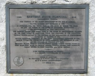
1. Eastern State Hospital Marker
The Assembly placed this great work in the hands of distinguished citizens as the first Court of Directors, which was composed of the following: Thomas Nelson, Jr., one of the signers of the Declaration of Independence, Governor of Virginia in 1781, Peyton Randolph, President of the First Continental Congress in 1774, George Wythe, the preceptor of both Marshall and Jefferson in law, at the College of William and Mary, Benjamin Waller, Thomas Everard, Robert Carter, Robert Carter Nicholas, John Blair, John Blair, Jr., Thomas Nelson, William Nelson, John Randolph, Dudley Digges, Jr., John Tazewell and Lewis Burwell.
E. Lee Trinkle, Governor of Virginia
C.A. Osborne, Commissioner of Hospitals
Board of Directors
Ed. Whitlock, W.M. Cease, Mrs. T.S.D. Covington
Dr. C.W. Brown, Superintendent
Erected 1925.
Topics. This historical marker is listed
this page online
Location. 37° 17.485′ N, 76° 44.056′ W. Marker is near Williamsburg, Virginia, in James City County. It is on Foster Road 0.2 miles north of Galt Drive, on the left when traveling north. Touch for map. Marker is in this post office area: Williamsburg VA 23188, United States of America. Touch for directions.

Regionally, this marker is on Virginia’s Peninsula, in Coastal Virginia, and in the Hampton Roads Metropolitan Area. It is also in the American South, specifically in the Upper South, in the Tidewater, and on the Eastern Seaboard. Globally, it is in the North Atlantic Region, North America, the Western Hemisphere, the Western World, and the Anglosphere. Historically, it finds itself in what was once the territory of the Mississippian Culture, one of the original Thirteen Colonies, one of the Confederate States of America, and the Antebellum South.
Other nearby markers. At least 8 other markers are within 2 miles of this marker, measured as the crow flies: A different marker also named Eastern State Hospital
Photographed by Bernard Fisher, July 20, 2013
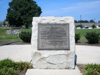
2. Eastern State Hospital Marker
Photographed by Bernard Fisher, July 20, 2013
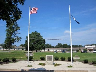
3. Eastern State Hospital Marker
Credits. This page was last revised on January 13, 2025. It was originally submitted on July 21, 2013, by Bernard Fisher of Richmond, Virginia. This page has been viewed 904 times since then and 33 times this year. Photos: 1, 2, 3. submitted on July 21, 2013, by Bernard Fisher of Richmond, Virginia.
