
Montgomery in Montgomery County, Alabama — The American South (East South Central)
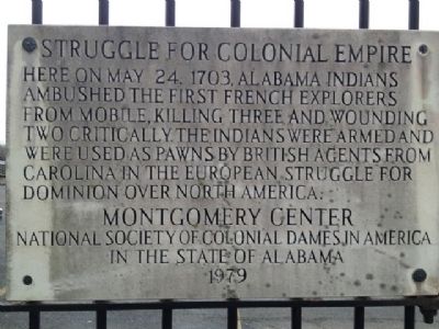
Struggle For Colonial Empire
Photographed by Mark Hilton, February 23, 2013
1. Struggle For Colonial Empire Marker
Erected 1979 by Montgomery Center - National Society of Colonial Dames in America in the State of Alabama.
Topics and series. This historical marker is listed in these topic lists: Colonial Era • Exploration • Indigenous Peoples and Communities. In addition, it is included in the The Colonial Dames of America, National Society of series list. A significant historical month for this entry is May 1792.
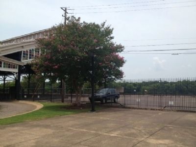
Location. 32° 22.88′ N, 86° 18.79′ W. Marker is in Montgomery, Alabama, in Montgomery County. It can be reached from the intersection of Water Streer and Commerce Street, on the right when traveling west. Located next to the old Union Train Station and Riverfront Park. Touch for map. Marker is at or near this postal address: 210 Water Streer, Montgomery AL 36104, United States of America. Touch for directions.

Regionally, this marker is in Alabama’s
this page online
Other nearby markers. At least 8 other markers are within walking distance of this marker: The Domestic Slave Trade / Slave Transportation to Montgomery (a few steps from this marker); Encanchata (within shouting distance of this marker); Montgomery (about 300 feet away, measured in a direct line); High Red Bluff (about 300 feet away); Rainbow Soldier (about 300 feet away); Transportation and Commerce (about 300 feet away); Major Charles W. Davis, Infantry United States Army / "Above and Beyond" (about 300 feet away); Montgomery's Panel Project (about 300 feet away). Touch for a list and map of all markers in Montgomery.
Another marker is no longer nearby. Union Station & Riverfront Park / Lower Commerce Street (was about
Photographed by Mark Hilton, February 23, 2013
2. Marker on fence near train station.
Credits. This page was last revised on June 16, 2016. It was originally submitted on August 22, 2013, by Mark Hilton of Montgomery, Alabama. This page has been viewed 1,097 times since then and 21 times this year. Photos: 1, 2. submitted on August 22, 2013, by Mark Hilton of Montgomery, Alabama. • Bernard Fisher was the editor who published this page.
