San Marcos in Hays County, Texas — The American South (West South Central)
San Marcos Springs
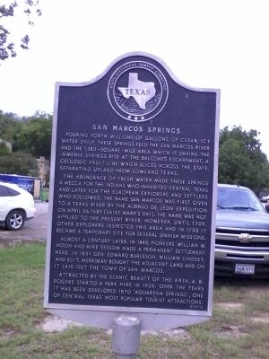
Pouring forth millions of gallons of clear, icy water daily, these springs feed the San Marcos River and the 1,380-square-mile area which it drains. The immense springs rise at the Balcones Escarpment, a geologic fault line which slices across the state, separating upland from lowland Texas.
The abundance of fresh water made these springs a mecca for the Indians who inhabited Central Texas and later for the European explorers and settlers who followed. The name San Marcos was first given to a Texas river by the Alonso de Leon Expedition on April 26, 1689 (Saint Mark's Day). The name was not applied to the present river, however, until 1709. Other explorers inspected this area and in 1755 it became a temporary site for several Spanish missions.
Almost a century later, in 1845, pioneers William W. Moon and Mike Sessom made a permanent settlement here. In 1851 Gen. Edward Burleson, William Lindsey, and Eli T. Merriman bought the adjacent land and on it laid out the town of San Marcos.
Attracted by the scenic beauty of the area, A. B. Rogers started a park here in 1926. Over the years it has been developed into “Aquarena Springs”, one of Central Texas' most popular tourist attractions.
Erected 1971 by State Historical Survey Committee. (Marker Number 10325.)
Topics and series. This historical marker is listed in these topic lists: Hispanic Americans • Native Americans • Settlements & Settlers • Waterways & Vessels. In addition, it is included in the El Camino Real de los Tejas National Historic Trail series list. A significant historical month for this entry is April 1830.
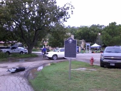
Location. 29° 53.637′ N, 97° 55.739′ W. Marker is in San Marcos, Texas, in Hays County. Marker is at the intersection of Spring Lake and West Laurel Street, on the right when traveling west on Spring Lake. Touch for map. Marker is at or near this postal address: 951 Aquarena Springs Drive, San Marcos TX 78666, United States of America. Touch for directions.
Other nearby markers. At least 8 other markers are within walking distance of this marker. Texas Water Safari (within shouting distance of this marker); Post San Marcos (about 600 feet away, measured in a direct line); The Old Lime Kiln (approx. 0.4 miles away); Riverhead Farm (approx. 0.4 miles away); San Marcos Mill Tract (approx. 0.4 miles away); Spring Lake Dam (approx. 0.4 miles away); "Old Main" (approx. 0.7 miles away); Sink Springs (approx. 0.7 miles away). Touch for a list and map of all markers in San Marcos.
Also see . . .
1. The Meadows Center for Water and the Environment, Texas State University. (Submitted on September 22, 2013, by Richard Denney of Austin, Texas.)
2. Historical Overview of San Marcos Springs. Overview of the springs, including a video, starting from earliest times (many archaeologists believe San Marcos Springs to be one of the oldest continually inhabited sites in North America) to the present. The "River Center" referenced on this site was renamed The Meadows Center for Water and the Environment (Submitted on September 22, 2013, by Richard Denney of Austin, Texas.)
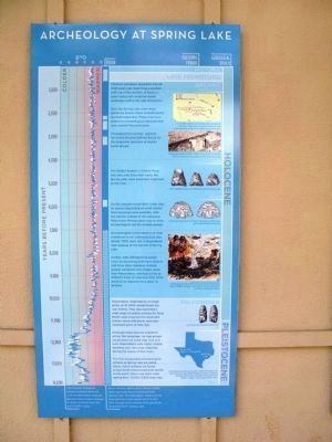
3. National Geographic video on archaeological research at Spring Lake. Researchers are exploring freshwater springs in Texas that date back to the end of the last ice age. Spring Lake, near San Marcos, Texas, is unique because it was dammed 150 years ago, creating an underwater archaeological preserve. (Submitted on September 22, 2013, by Richard Denney of Austin, Texas.)
Photographed By Richard Denney, September 21, 2013
3. Spring Lake
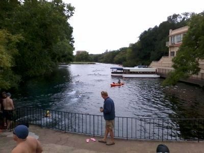
In 1849 a dam was built across the San Marcos River to operate a gristmill. The dam created Spring Lake, pictured here. Spring Lake is closed to the public for swimming except on very rare occasions, The Rotary Club of Greater San Marcos' Aquarena Springs TRI (triathlon) being one such exception. Shown is the swimming portion of the 2nd annual triathlon, 9/21/2013.
Photographed By Richard Denney, October 5, 2013
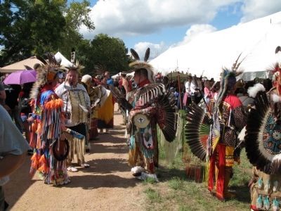
4. Sacred Springs Powwow
San Marcos Springs continues to be recognized by Native Americans as a special space, important to their history. San Marcos Springs is home to the Sacred Springs Powwow, sponsored by the Indigenous Cultures Institute of San Marcos, Texas. Photo is from the 2013 Powwow.
Credits. This page was last revised on November 22, 2020. It was originally submitted on September 22, 2013, by Richard Denney of Austin, Texas. This page has been viewed 978 times since then and 45 times this year. Photos: 1, 2, 3. submitted on September 22, 2013, by Richard Denney of Austin, Texas. 4, 5. submitted on October 6, 2013, by Richard Denney of Austin, Texas. • Bernard Fisher was the editor who published this page.
