Allison Hill in Harrisburg in Dauphin County, Pennsylvania — The American Northeast (Mid-Atlantic)
Parson John Elder House
Photographed by William Pfingsten, March 30, 2008
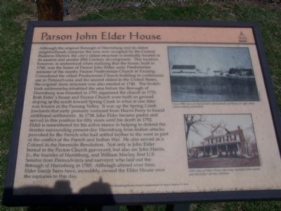
1. Parson John Elder House Marker
this page online
Top Photo
Circa 1900 view of original barn (demolished) and house at right when a farm looking northward.
Bottom Photo
1960 view of Elder House showing expanded front porch and third floor dormer addition.
Erected by The Harrisburg History Project Commissioned by Mayor Stephen R. Reed.
Topics and series. This historical marker is listed in these topic lists: Cemeteries & Burial Sites • Colonial Era • Indigenous Peoples and Communities • Religion & Religious Structures • War, US Revolutionary.
Photographed by William Pfingsten, March 30, 2008
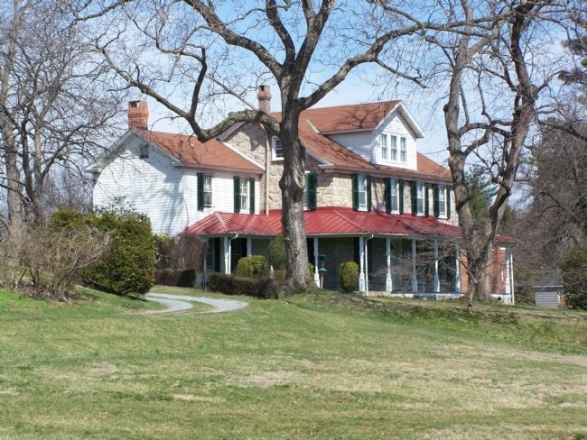
2. John Elder House
Location. 40° 15.639′ N, 76° 50.746′ W. Marker is in Harrisburg, Pennsylvania, in Dauphin County. It is in Allison Hill. It is at the intersection of Ellerslie Street and S. 24th Street, on the left when traveling east on Ellerslie Street. Touch for map. Marker is at or near this postal address: 705 S 24th St, Harrisburg PA 17104, United States of America. Touch for directions.

Regionally, this marker is in South-Central Pennsylvania, specifically in Pennsylvania Dutch Country, and in the Susquehanna Valley. It is also in the American Northeast and in the Mid-Atlantic. Globally, it is in North America, the Western Hemisphere, the Western World, and the Anglosphere. Historically, it finds itself in what was once the Haudenosaunee (Iroquois) Confederacy and also one of the original Thirteen Colonies.
Other nearby markers. At least 8 other markers are within walking distance of this marker: Harrisburg (approx. half a mile away); a different marker also named Harrisburg (approx. 0.6 miles away); Bellevue Park (approx. 0.7 miles away); Breeze Hill (approx. 0.7 miles away); Paxton Presbyterian Church (approx. 0.8 miles away); Harrisburg High School and Former John Harris High School (approx. 0.8 miles away); Paxton Church (approx. 0.8 miles away); Bishop McDevitt High School (approx. 0.8 miles away). Touch for a list and map of all markers in Harrisburg.
Credits. This page was last revised on June 24, 2024. It was originally submitted on April 4, 2008, by Bill Pfingsten of Bel Air, Maryland. This page has been viewed 5,454 times since then and 279 times this year. Photos: 1, 2. submitted on April 4, 2008, by Bill Pfingsten of Bel Air, Maryland.
