Amherstburg in Essex County, Ontario — Central Canada (North America)
Shoreline Breakwall
Photographed by Dale K. Benington, June 15, 2013
1. Shoreline Breakwall Marker
Shoreline Breakwall
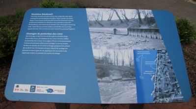
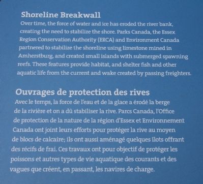
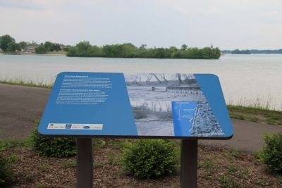
Over time, the force of water and ice has eroded the river bank, creating the need to stabilize the shore. Parks Canada, the Essex Region Conservation Authority (ERCA) and Environment Canada partnered to stabilize the shoreline using limestone mined in Amherstburg, and created small islands with submerged spawning reefs. These features provide habitat, and shelter fish and other aquatic life from the current and wake created by passing freighters.
Ouvrages de protection des rives
Avec le temps, la force de l'eau et de la glace a érodé la berge de la rivière et on a dû stabiliser la rive. Parcs Canada, l'Office de protection de la nature de la région d'Essex et Environnement Canada ont joint leurs efforts pour protéger la rive au moyen de blocs de calcaire; ils ont aussi aménagé quelques îlots offrant des récifs de frai. Ces travaux ont pour objectif de protéger les poissons et autres types de vie aquatique des courants et des vagues que créent, en passant, les navires de charge.
Erected by Parks Canada.
Topics. This historical marker is listed in these topic lists: Environment •
this page online
Location. 42° 6.471′ N, 83° 6.835′ W. Marker is in Amherstburg, Ontario, in Essex County. It can be reached from Laird Avenue South just south of Elm Avenue, on the right when traveling south. This historical marker is located in a cluster of three markers, situated a short distance behind the Fort Malden National Historic Site Visitor Centre, slightly downstream, very near the Detroit River. Touch for map. Marker is in this post office area: Amherstburg ON N9V 1X5, Canada. Touch for directions.

Regionally, this marker is in the Southwest Ontario Area and in Southwestern Ontario. It is also in Central Canada. Globally, it is in North America, on the Great Lakes, in the Western Hemisphere, in the Western World, and in the Anglosphere. Historically, it finds itself in what was once a British colony, the Viceroyalty of New France, the Haudenosaunee (Iroquois) Confederacy, and Rupert’s Land.
Other nearby markers. At least 8 other markers are within walking distance of this marker: Indian Council House (here, next to this marker); Detroit River Heritage
Photographed by Dale K. Benington, June 15, 2013
2. Shoreline Breakwall Marker
Close-up view of the large text section displayed on the historical marker.
Photographed by Dale K. Benington, June 15, 2013
3. Shoreline Breakwall Marker
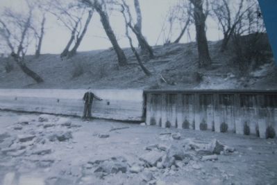
A close-up view of the top picture displayed on the historical marker, which shows a view of the Detroit River shoreline at the base of Fort Malden.
Photographed by Dale K. Benington, June 15, 2013
4. Shoreline Breakwall Marker
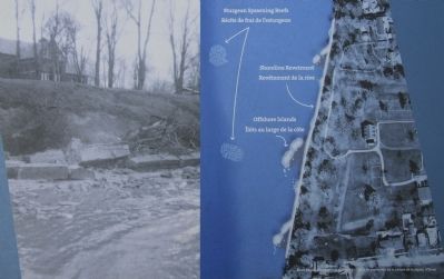
A close-up view of the bottom pictures (including aerial photograph) displayed on the historical marker.
Photographed by Dale K. Benington, June 15, 2013
5. Shoreline Breakwall Marker
View of the historical marker situated on a National Park walkway, that runs along the Detroit River, with a view of the river in the background of the picture.
Photographed by Dale K. Benington, June 15, 2013
6. Shoreline Breakwall Marker
A distant view of the historical marker, situated in a cluster of three markers, located between the northwest outer corner of the Fort Malden fortification earthworks and the Detroit River.
Photographed by Dale K. Benington, June 15, 2013
7. Shoreline Breakwall Marker
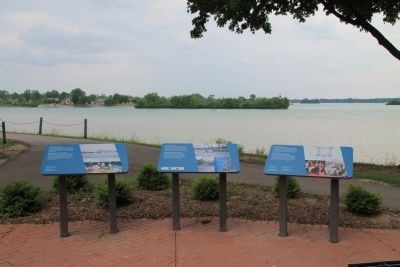
View of the featured historical marker, situated in the center of a cluster of three markers, with a view of the Detroit River in the background.
Photographed by Dale K. Benington, June 15, 2013
8. Shoreline Breakwall Marker
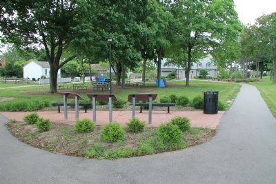
View of the backside of the featured historical marker, situated in the center of a cluster of three markers, with a distant view of the Fort Malden National Historic Site Visitor Centre at the end of the right walkway, and a distant view of the pensioner's cottage at the end of the left walkway.
Credits. This page was last revised on June 16, 2016. It was originally submitted on January 7, 2014, by Dale K. Benington of Toledo, Ohio. This page has been viewed 632 times since then and 11 times this year. Photos: 1, 2, 3, 4, 5, 6, 7, 8. submitted on January 7, 2014, by Dale K. Benington of Toledo, Ohio.
