Larimer in Pittsburgh in Allegheny County, Pennsylvania — The American Northeast (Mid-Atlantic)
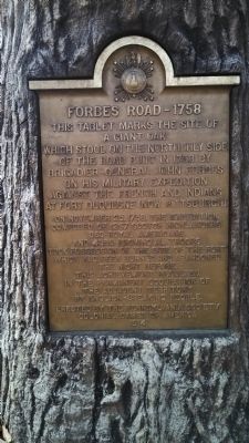
Forbes Road, 1758
On November 25, 1758, the expedition, composed of 1267 Scotch Highlanders 363 Loyal Americans and 4350 Provincial Troops took possession of the site of the fort which had been burned and abandoned the night before. This achievement resulted in the permanent occupation of the adjacent territory by English-speaking people.
Erected 1914 by The Pennsylvania Society Colonial Dames of America.
Topics and series. This historical marker is listed in these topic lists: Forts and Castles • Native Americans • Roads & Vehicles • War, French and Indian. In addition, it is included in the The Colonial Dames of America, National Society of series list. A significant historical date for this entry is November 25, 1758.
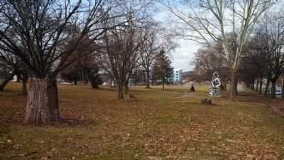
Location. 40° 27.269′ N, 79° 54.808′ W. Marker is in Pittsburgh, Pennsylvania, in Allegheny County. It is in Larimer. Marker can be reached from the intersection of Penn Avenue (Pennsylvania Route 380) and Fifth Avenue, on the right when traveling east. Located in the northeast corner of Mellon Park. Touch for map . Marker is in this post office area: Pittsburgh PA 15206, United States of America. Touch for directions.
Other nearby markers. At least 8 other markers are within walking distance of this marker. Linwood Apartments (approx. 0.3 miles away); Mellon Park (approx. 0.4 miles away); Mary Lou Williams (approx. 0.4 miles away); Calvary Episcopal Church (approx. half a mile away); Westinghouse Gas Wells (approx. half a mile away); Sacred Heart Church (approx. half a mile away); Veterans Memorial (approx. half a mile away); The Sidney W. Singer Veterans Service Center (approx. 0.6 miles away). Touch for a list and map of all markers in Pittsburgh.
Also see . . . National Society of the Colonial Dames of America. (Submitted on February 23, 2014, by Mike Wintermantel of Pittsburgh, Pennsylvania.)

Photographed By Mike Wintermantel, February 23, 2014
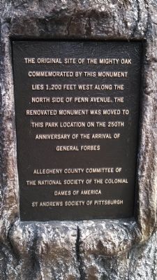
3. Forbes Road Oak plaque
Mounted to the back of the oak stump:
The original site of the mighty oak commemorated by this monument lies 1,200 feet west along the north side of Penn Avenue. The renovated monument was moved to this park location on the 250th anniversary of the arrival of General Forbes.
Allegheny County Committee of the National Society of the Colonial Dames of America
St Andrews Society of Pittsburgh
Credits. This page was last revised on February 2, 2023. It was originally submitted on February 23, 2014, by Mike Wintermantel of Pittsburgh, Pennsylvania. This page has been viewed 803 times since then and 15 times this year. Photos: 1, 2, 3. submitted on February 23, 2014, by Mike Wintermantel of Pittsburgh, Pennsylvania.

