Anacortes in Skagit County, Washington — The American West (Northwest)
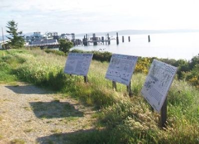
Ship Harbor
THE NATURAL DYNAMIC
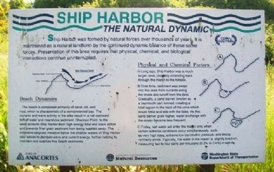
Ship Harbor was formed by natural forces over thousands of years. It is maintained as a natural landform by the continued dynamic balance of these same forces. Preservation of this area requires that physical, chemical, and biological interactions continue uninterrupted.
Beach Dynamics
The beach is composed primarily of sand, silt, and mud, which is characteristic of a semiprotected bay. The currents and wave activity in the area result in a net eastward drift of water and nearshore sediment. Shannon Point, to the west, protects Ship Harbor from high energy tidal and wave action and prevents finer grain sediment from being washed away. The extensive eelgrass meadow below the shallow waters of Ship Harbor also serves to dampen wave and current energy, further helping to maintain and stabilize fine beach sediments.
Physical and Chemical Factors
A. Long ago, Ship Harbor was a much larger cove, probably extending back through the marsh to the hillside.
B. Over time, sediment was swept into this area from currents along the shore and runoff from the land. Gradually, a sand barrier (known as a baymouth bar) formed, creating a tidal lagoon in the back of the cove which would flood and ebb with the tides. As this sand barrier grew higher, water exchange with the ocean became less frequent.
C. Today, salt water will enter the marsh only when certain extreme conditions occur simultaneously, such as very high tides, extreme low barometric pressure, and strong northerly winds. Typically, the water in the marsh is slightly brackish, measuring two to four parts per thousand (0.2% to 0.4%) in salinity.
THE LIVING SYSTEM
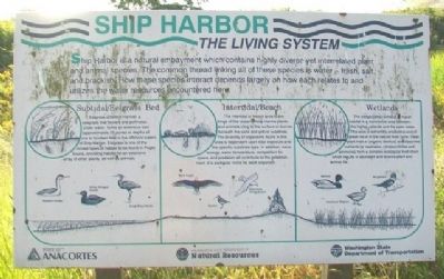
Ship Harbor is a natural embayment which contains highly diverse yet interrelated plant and animal species. The common thread linking all of these species is water - fresh, salt, and brackish. How these species interact depends largely on how each relates to and utilizes the water resources encountered here.
Subtidal/Eelgrass Bed
Eelgrass (Zostera marina), a seegrass that flowers and pollinates under water, forms an extensive bed (approximately 23 acres) at depths of one to fourteen feet in the offshore waters of Ship Harbor. Eelgrass is one of the richest types of habitat to be found in Puget Sound, providing habitat for an extensive array of other plants, as well as animals.
Intertidal/Beach
The intertidal or beach area is the fringe of the ocean where marine plants and animals cling to the surface or burrow beneath the sand and gravel substrate. The diversity of organisms found in this area is dependent upon tidal exposure and the specific substrate type. In addition, wave energy, water temperature, competition for space, and predation all contribute to the establishment of a particular niche for each organism.
Wetlands
The sedge/cattail wetland, or marsh habitat is a transitional area between the higher uplands and the open water. This area is extremely productive and of great value in the natural food cycle. Dead plant matter (organic detritus) and dissolved nutrients (phosphates, nitrates/nitrites and ammonia) form a complex ecological food chain which results in abundant and diverse plant and animal life.
THE HUMAN DYNAMIC
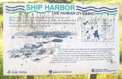
Ship Harbor is a unique economic resource. Once, this was the site of salmon canning operations. Today, we recognize the economic benefits of preserving wetlands and eelgrass beds to help maintain local commercial fish populations.
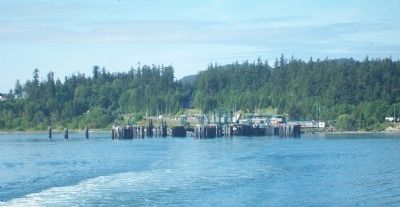
The pilings throughout the tidal areas once supported dock loading operations for a large salmon cannery. The rows of posts still found throughout the marsh were used as racks for drying and tarring cotton web used for fish traps. Old cannery "tin piles" may be found throughout the area. The Fidalgo Island Packing Company began operations in 1894. The plant employed as many as 1000 workers, including many local Scandinavians, Indians, Chinese, and some Greeks. The plant closed in 1925 for economic reasons.
[Diagram showing] Ship Harbor circa 1917
Erected by Port of Anacortes, Washington Dept of Natural Resources, and Washington Dept of Transportation.
Topics. This historical marker is listed in these topic lists: Environment • Man-Made Features • Waterways & Vessels. A significant historical year for this entry is 1894.
Location. 48° 30.304′ N, 122° 40.691′ W. Marker is in Anacortes, Washington, in Skagit County. Markers are at the San Juan Islands/Sidney B.C. ferry terminal at the end of westbound Oakes Avenue (WA Highway 20). Touch for map. Marker is in this post office area: Anacortes WA 98221, United States of America. Touch for directions.
Other nearby markers. At least 8 other markers are within 3 miles of this marker, measured as the crow flies. Andrew Carnegie (approx. 2.9 miles away); Mrs. Luella Howard (approx. 2.9 miles away); Miss Carrie M. White (approx. 2.9 miles away); War Memorial (approx. 2.9 miles away); Causland Park (approx. 3 miles away); Causland Memorial Park (approx. 3 miles away); Island Flyer (approx. 3 miles away); "Anne Curtis Bowman" (approx. 3.1 miles away). Touch for a list and map of all markers in Anacortes.
More about this marker. Access to the markers is limited to ticketed ferry passengers who have passed through security.
Credits. This page was last revised on October 14, 2020. It was originally submitted on June 1, 2014, by William Fischer, Jr. of Scranton, Pennsylvania. This page has been viewed 575 times since then and 9 times this year. Photos: 1, 2, 3, 4, 5, 6. submitted on June 1, 2014, by William Fischer, Jr. of Scranton, Pennsylvania.
