Near Winchester in Clark County, Kentucky — The American South (East South Central)
Defending the Kentucky River
Bridges, Fords and Ferries
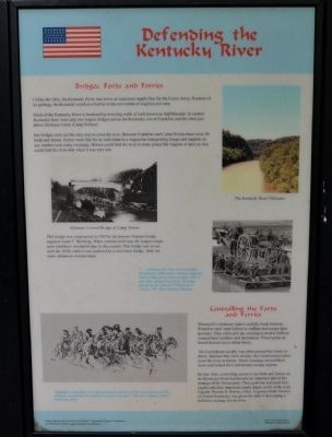
Unlike the Ohio, the Kentucky River was never an important supply line for the Union Army. Because of its geology, the Kentucky acted as a barrier to the movement of supplies and men.
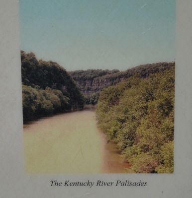
Much of the Kentucky River is bordered by towering walls of rock known as the Palisades. In central Kentucky there were only two wagon bridges across the Kentucky, one at Frankfort and the other just above Hickman Creek (Camp Nelson).
But bridges were not the only way to cross the river. Between Frankfort and Camp Nelson there were 50 fords and ferries. Ferries were fine for an individual or a wagon but transporting troops and supplies in any number took many crossings. Horses could ford the river in some places but wagons or men on foot could ford the river only when it was very low.
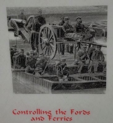
Controlling the Fords and Ferries
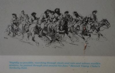
Mounted Confederate raiders used the fords between Frankfort and Camp Nelson to confuse and escape their pursuers. They often split up, crossing at several fords to conceal their numbers and destination. These tactics allowed them to move about freely.
The Confederate cavalry was often pursued by Union infantry. Because they were on foot, the Union troops had to cross the river on ferries. These crossings slowed them down and helped the Confederates escape capture.
By late 1862, controlling access to the fords and ferries on the Kentucky River had become an important part of the strategy of the Union army. Their goal was to protect Lexington and other important supply depots north of the river. Captain Thomas B. Brooks, Chief Engineer of the District of Central Kentucky, was given the task of developing a defensive strategy for the river.
Erected by The Winchester/Clark County Tourism Commission.
Topics. This historical marker is listed in these topic lists: War, US Civil • Waterways & Vessels. A significant historical year for this entry is 1862.
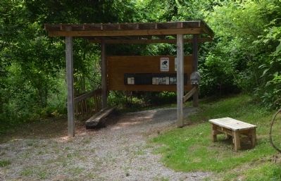
Location. 37° 53.411′ N, 84° 15.627′ W. Marker is near Winchester, Kentucky, in Clark County. Marker can be reached from Ford Road/4 Mile Road (Kentucky Route 1924) 1.2 miles south of Boonesboro Road (Kentucky Route 627), on the left when traveling south. The exhibit can be reached from the parking area on KY Route 1924. The trailhead is at the edge of the parking area here. This wayside exhibit can be found partway up the trail that leads to the fort at the top of the hill. Touch for map. Marker is at or near this postal address: 1250 Ford Road, Winchester KY 40391, United States of America. Touch for directions.
Other nearby markers. At least 8 other markers are within walking distance of this marker. Three Confederate Raids (here, next to this marker); Roads in the Wilderness (a few steps from this marker); A Long, Steep Road (a few steps from this marker); The Quest for Land (within shouting distance of this marker); The Eye of the Rich Land (within shouting distance of this marker); Rock and Man (within shouting distance of this marker); Common Cliffside Plants (within shouting distance of this marker); Thomas B. Brooks, Army Engineer (about 400 feet away, measured in a direct line). Touch for a list and map of all markers in Winchester.
More about this marker. This marker is part of the historic site known as the "Civil War Fort at Boonesboro." CAUTION: The climb up the hill is VERY steep.
Also see . . . Civil War Fort at Boonesboro. (Submitted on June 22, 2014.)
Photographed By Karl Stelly, June 1, 2014
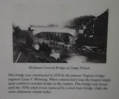
3. Hickman Covered Bridge at Camp Nelson
This bridge was constructed in 1838 by the famous Virginia bridge engineer Louis V. Wernwag. When constructed it was the longest single span cantilever wooden bridge in the country. This bridge was in use until the 1930s when it was replaced by a steel truss bridge. Only the stone abutments remain today.
Credits. This page was last revised on June 16, 2016. It was originally submitted on June 21, 2014, by Karl Stelly of Gettysburg, Pennsylvania. This page has been viewed 727 times since then and 17 times this year. Photos: 1, 2, 3, 4, 5, 6. submitted on June 21, 2014, by Karl Stelly of Gettysburg, Pennsylvania. • Bernard Fisher was the editor who published this page.
