Near Winchester in Clark County, Kentucky — The American South (East South Central)
A Long, Steep Road
Hauling Supplies
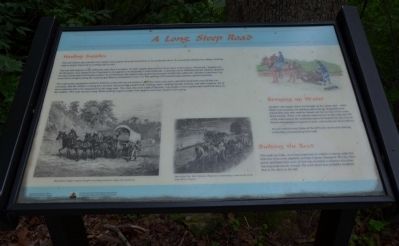
This trail follows the road that took soldiers and supplies from the road below to the earthwork above. It is uncertain whether the military built the road or simply improved an existing trail or road.
The men and supplies at the earthwork came from Lexington, the main supply depot for the Union army in this region of Kentucky. Supplies for the Bluegrass were shipped from Cincinnati to Lexington on the Kentucky Central Railroad. A spur line ran to Nicholasville but supplies destined for other points had to be hauled overland. In all likelihood, the supplies and equipment necessary to build the earthwork, and then to garrison it, came from Lexington along the road through Athens to Boonesboro (the Civil War spelling of Boonesborough) and then up this steep road.
The construction equipment needed to build the earthwork was not extensive. Shovels, picks, axes, saws, and other hand tools were all that was necessary. But the soldiers working here and later stationed here needed food, clothing, tents, cooking utensils, lanterns, and other supplies. All of these materials had to be transported up this steep road. This road, like most roads of the time, was muddy in wet weather and rutted and dusty in dry weather. This road was also steep. Mules pulling wagons loaded with supplies must have found it slow going.
Bringing up Water
Another vital supply had to be brought up this steep road -- water. Water was necessary for drinking and cooking. Regulations required that each man wash his hands and face at least twice a day, before meals. There is no natural water source on the ridge top. All of the water used at the earthwork had to be hauled from the river in barrels transported on wagons or sleds, such as the one shown above.
As you walk this trail, think of the difficulty involved in hauling everything you needed up this road.
Building the Road
This road was built, or at least improved, by soldiers working under the direction of an army engineer, perhaps Captain Thomas B. Brooks. Manpower and hand tools were all that was available to improve this short but important stretch of road. The work detail here probably resembled that in the photo to the left.
Erected by The Winchester/Clark County Tourism Commission.
Topics. This historical marker is listed in these topic lists: Forts and Castles • Roads & Vehicles • War, US Civil.
Location. 37° 53.403′ N, 84° 15.615′ W. Marker is near Winchester, Kentucky, in Clark County. Marker can be reached from Ford Road/4
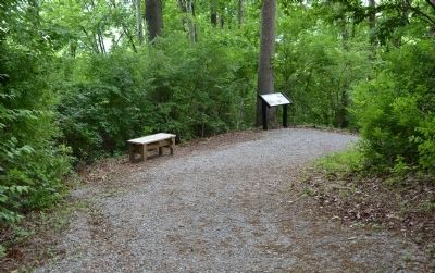
Mile Road (Kentucky Route 1924) 1.2 miles south of Boonesboro Road (Kentucky Route 627), on the left when traveling south. The exhibit can be reached from the parking area on KY Route 1924. The trailhead is at the edge of the parking area here. This wayside exhibit can be found partway up the trail that leads to the fort at the top of the hill. Touch for map. Marker is at or near this postal address: 1250 Ford Road, Winchester KY 40391, United States of America. Touch for directions.
Other nearby markers. At least 8 other markers are within walking distance of this marker. Roads in the Wilderness (here, next to this marker); The Quest for Land (a few steps from this marker); The Eye of the Rich Land (a few steps from this marker); Defending the Kentucky River (a few steps from this marker); Three Confederate Raids (a few steps from this marker); Rock and Man (within shouting distance of this marker); Common Cliffside Plants (within shouting distance of this marker); Thomas B. Brooks, Army Engineer (about 300 feet away, measured in a direct line). Touch for a list and map of all markers in Winchester.
More about this marker. This marker is part of the historic site known as the "Civil War Fort at Boonesboro." CAUTION: The climb up the hill is VERY steep.
Also see . . . Civil War Fort at Boonesboro. (Submitted on June 23, 2014.)
Credits. This page was last revised on July 14, 2022. It was originally submitted on June 23, 2014, by Karl Stelly of Gettysburg, Pennsylvania. This page has been viewed 734 times since then and 28 times this year. Photos: 1, 2. submitted on June 23, 2014, by Karl Stelly of Gettysburg, Pennsylvania. • Bernard Fisher was the editor who published this page.

