Near Winchester in Clark County, Kentucky — The American South (East South Central)
Roads in the Wilderness
Opening the Wilderness
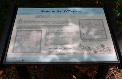
We take paved roads, highway maps, bridges and directional signs for granted. But when Clark County was formed in 1792, there were no maps or roads as we think of them, just two well-worn pack horse trails and a network of ill-defined paths. The lack of roads was one of the first issues faced by the new county commissioners. Roads were vital. Farmers needed roads to get their produce and livestock to market. They were needed to access iron works, saw mills, grist mills, ferries and fords. Communication depended on roads. It is no wonder that road building was the county court's highest priority.
Laws requiring men between the ages of 15 and 50 to spend a prescribed number of days building or maintaining roads in their precinct went some way toward rectifying the dismal state of roads in the county. In 1834, a new era of road building began when the first private turnpike company was chartered in Clark County. By the time of the Civil War, there were as many as a half dozen privately owned turnpike roads in the county, including the important Boonesboro Road connecting the ferry landing opposite Boonesborough (often spelled Boonesboro) with Winchester.
An Explosion of Roads
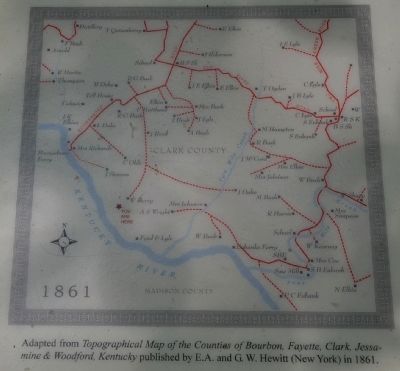
In the first half century of Clark County's existence, there was an explosion in road construction. The county Order Books bristle with notations of road building and improvement, and a map published in 1861 shows an extensive network of turnpikes and lesser roads.
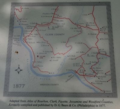
Two roads recorded in Clark County Order Book No. 14 for 1860 probably provided at least partial access to the Civil War earthwork. The first ran over the ridgetop, connecting the property of M.B. Berry to the Boonesborough Turnpike. The 1861 map, left, shows a W. Berry owning land at or near the site where the earthwork was constructed in 1863. The second road, built "from opposite mouth of Otter Creek down Ky. River to Boonesborough," ran from the present location of Ford to the Boonesborough Ferry landing. It is shown on the 1877 map, right (on the map, Boonesborough is spelled Boonesboro).
Men, Mules, and Hard Labor
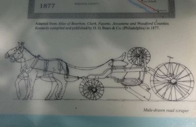
Road building in the 18th and early 19th century was a tremendous undertaking. Topographic barriers—watercourses, hills and ravines—had to be overcome. Landowners had to be placated. Money had to
be raised to fund construction, which required laborers, equipment, horses and mules in large numbers.
Erected by The Winchester/Clark County Tourism Commission.
Topics. This historical marker is listed in these topic lists: Roads & Vehicles • Settlements & Settlers • War, US Civil. A significant historical year for this entry is 1924.
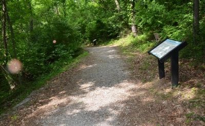
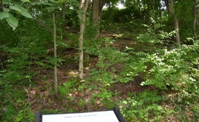
Location. 37° 53.404′ N, 84° 15.62′ W. Marker is near Winchester, Kentucky, in Clark County. Marker can be reached from Ford Road/4 Mile Road (Kentucky Route 1924) 1.2 miles south of Boonesboro Road (Kentucky Route 627), on the left when traveling south. The exhibit can be reached from the parking area on KY Route 1924. The trailhead is at the edge of the parking area here. This wayside exhibit can be found partway up the trail that leads to the fort at the top of the hill. Touch for map. Marker is at or near this postal address: 1250 Ford Road, Winchester KY 40391, United States of America. Touch for directions.
Other nearby markers. At least 8 other markers are within walking distance of this marker. A Long, Steep Road (here, next to this marker); Defending the Kentucky River (a few steps from this marker); Three Confederate Raids (a few steps from this marker); The Quest for Land (a few steps from this marker); The Eye of the Rich Land (within shouting distance of this marker); Rock and Man
(within shouting distance of this marker); Common Cliffside Plants (within shouting distance of this marker); Thomas B. Brooks, Army Engineer (about 300 feet away, measured in a direct line). Touch for a list and map of all markers in Winchester.
More about this marker. This marker is part of the historic site known as the "Civil War Fort at Boonesboro." CAUTION: The climb up the hill is VERY steep.
Also see . . . Civil War Fort at Boonesboro. (Submitted on June 24, 2014.)
Credits. This page was last revised on June 16, 2016. It was originally submitted on June 23, 2014, by Karl Stelly of Gettysburg, Pennsylvania. This page has been viewed 742 times since then and 21 times this year. Photos: 1, 2, 3, 4, 5, 6. submitted on June 23, 2014, by Karl Stelly of Gettysburg, Pennsylvania. • Bernard Fisher was the editor who published this page.
