Near Stafford in Stafford County, Virginia — The American South (Mid-Atlantic)
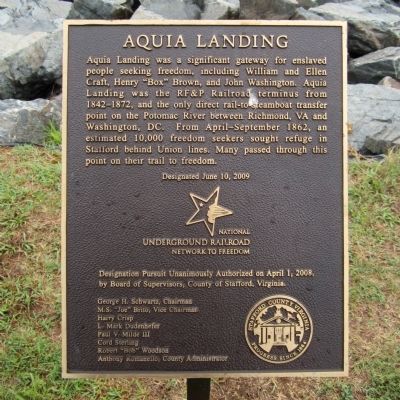
Aquia Landing
National Underground Railroad Network to Freedom
Erected 2009 by Stafford County.
Topics and series. This historical marker is listed in these topic lists: Abolition & Underground RR • African Americans • War, US Civil • Waterways & Vessels. In addition, it is included in the National Underground Railroad Network to Freedom series list. A significant historical date for this entry is June 10, 1854.
Location. 38° 23.375′ N, 77° 18.947′ W. Marker is near Stafford, Virginia, in Stafford County. Marker is on Brooke Road (County Route 608) half a mile north of Thorny Point Road (County Route 685), on the right when traveling north. Located in Aquia Landing Beach Park. Touch for map. Marker is at or near this postal address: 2846 Brooke Road, Stafford VA 22554, United States of America. Touch for directions.
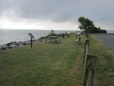
Other nearby markers. At least 8 other markers are within walking distance of this marker. Steamships, Stages and Slave Trade (here, next to this marker); Early Escape Route (here, next to this marker); Gateway to Freedom (here, next to this marker); a different marker also named Aquia Landing (within shouting distance of this marker); Patawomeck Tribe Village (approx. ¼ mile away); a different marker also named Aquia Landing (approx. half a mile away); History of the Patawomeck Indians (approx. half a mile away); a different marker also named Aquia Landing (approx. 0.6 miles away). Touch for a list and map of all markers in Stafford.
Also see . . .
1. Aquia Landing Park. (Submitted on August 3, 2014.)
2. Aquia Landing. Virginia Department of Wildlife Resources (Submitted on November 14, 2021.)
Credits. This page was last revised on June 22, 2022. It was originally submitted on August 3, 2014, by Bernard Fisher of Richmond, Virginia. This page has been viewed 1,004 times since then and 179 times this year. Photos: 1, 2. submitted on August 3, 2014, by Bernard Fisher of Richmond, Virginia. 3. submitted on May 23, 2022, by Shane Oliver of Richmond, Virginia.


