Cincinnati in Hamilton County, Ohio — The American Midwest (Great Lakes)
Tucker's Station
Outpost on the Ohio Frontier
— Anthony Wayne campsite —
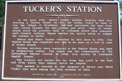
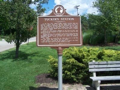
Henry and Mary Tucker returned to this farm in 1794. The Station House was completed and was to be used as a fort in case of Indian attack.
Worship services were conducted in the Station House and later in neighboring cabins. The result was the organization of The Springfield Baptist Church in 1798, now known as Landmark Baptist Temple.
The Tuckers were buried not far from this point in the rich soil from which they helped carve an empire.
This marker is erected to the memory of Henry and Mary Turker whowere among the first settlers in Ohio.
Erected 1966 by Historical Committee - - Landmark Baptist Temple.
Topics. This historical marker is listed in these topic lists: Churches & Religion • Forts and Castles • Native Americans • Roads & Vehicles • Settlements & Settlers • Wars, US Indian. A significant historical year for this entry is 1792.
Location. 39° 15.737′ N, 84° 27.039′ W. Marker is in Cincinnati, Ohio, in Hamilton County. Marker is at the intersection of Chester Road and Oak Road, on the left when traveling south on Chester Road. Sharon Road west from exit 15 on I-75, then south on Chester Road. Marker is on left about 1/2 mile south, in front of a ball field. Touch for map. Marker is at or near this postal address: 1099 Oak Road, Cincinnati OH 45215, United States of America. Touch for directions.
Other nearby markers. At least 8 other markers are within 2 miles of this marker, measured as the crow flies. The Eliza House (a few steps from this marker); Village of Glendale (approx. ¾ mile away); Glendale (approx. 0.8 miles away); First Children's International Summer Village (approx. 0.8 miles away); The Cincinnati Hamilton Turnpike (approx. one mile away); Taken for Granite? (approx. 1.2 miles away); Welcome to the Cotswald Overlook (approx. 1.2 miles away); Eckstein School (approx. 1.4 miles away). Touch for a list and map of all markers in Cincinnati.
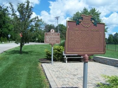
More about this marker. there are two markers at this site
Additional keywords. General Anthony Wayne
Credits. This page was last revised on January 8, 2020. It was originally submitted on August 16, 2014, by Rev. Ronald Irick of West Liberty, Ohio. This page has been viewed 985 times since then and 52 times this year. Photos: 1, 2, 3. submitted on August 16, 2014, by Rev. Ronald Irick of West Liberty, Ohio. • Al Wolf was the editor who published this page.


