Near Pleasanton in Linn County, Kansas — The American Midwest (Upper Plains)
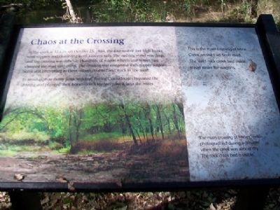
Chaos at the Crossing
At the creek at 11 a.m. on October 25, 1864, the four-to-five feet high banks were slippery and crumbling from a recent rain. The rushing water was deep, and the crossing was difficult. Hundreds of wagon wheels and horses had churned the mud into mires. The crossing was congested with supply wagons - some still attempting to cross, others disabled and stuck in the mud.
To avoid capture many panic-stricken, fleeing Confederates bypassed the crossing and plunged their horses down the steep bank into the water.
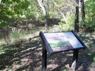
This is the main crossing of Mine Creek on the Fort Scott road. The solid rock creek bed made travel easier for wagons.
[Photo caption reads] The main crossing of Mine Creek - photographed during a drought when the creek was almost dry. The rock creek bed is visible.
Erected 2012 by Kansas State Historical Society.
Topics. This historical marker is listed in these topic lists: Roads & Vehicles • War, US Civil • Waterways & Vessels. A significant historical date for this entry is October 25, 1864.
Location. 38° 8.179′ N, 94° 43.476′ W. Marker is near Pleasanton, Kansas, in Linn County. Touch for map. Marker is at or near this postal address: 20485 Kansas Highway 52, Pleasanton KS 66075, United States of America. Touch for directions.
Other nearby markers. At least 8 other markers are within walking distance of this marker . "Hurra for Kansas!" (about 400 feet away, measured in a direct line); Cavalry Horses (about 700 feet away); Lieutenant Colonel Frederick W. Benteen Memorial Bridge (about 700 feet away); Battle of Mine Creek (about 700 feet away); Cavalry (approx. ¼ mile away); Nursing the Wounded (approx. 0.4 miles away); Conclusion of Price Campaign (approx. 0.4 miles away); Union Charge (approx. half a mile away). Touch for a list and map of all markers in Pleasanton.
Also see . . .
1. Mine Creek Battle. Wikipedia entry (Submitted on November 3, 2014, by William Fischer, Jr. of Scranton, Pennsylvania.)
2. Mine Creek Civil War Battlefield. Kansas Historical Society website entry (Submitted on January 16, 2022, by Larry Gertner of New York, New York.)
Credits. This page was last revised on January 16, 2022. It was originally submitted on November 3, 2014, by William Fischer, Jr. of Scranton, Pennsylvania. This page has been viewed 510 times since then and 11 times this year. Photos: 1, 2, 3. submitted on November 3, 2014, by William Fischer, Jr. of Scranton, Pennsylvania.


