Marker Logo
THE HISTORICAL
MARKER DATABASE
“Bite-Size Bits of Local, National, and Global History”
Near Salem in Mahoning County, Ohio — The American Midwest (Great Lakes)
 

Maple-Dell

Built 1848
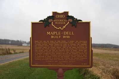
 
 
Maple-Dell Marker image. Click for full size.
Photographed by Mike Wintermantel, November 16, 2014
1. Maple-Dell Marker
Inscription. Maple-Dell was the home of John Butler, a Quaker who expressed his religious faith by working for humanitarian causes. An early Goshen Township teacher, Butler opened his home to orphans, the homeless, and runaway slaves, and devoted 20 years of his life to support the Freedman's Camps for former slaves. One of the many individuals he sheltered was Edwin Coppock who was hung along with abolitionist, John Brown, after the raid on Harper's Ferry in 1859. Butler met with President Lincoln and Secretary of War, Edwin Stanton in 1862 to request exemption from military service for Quakers during the Civil War. In 1868, President Grant petitioned the churches to assist in organizing a peace policy for the Indians. Butler prepared and presented to Congress a proposal for treating the Indians humanely including providing them with scientific and industrial education.
 
Erected 1992 by Damascus Area Historical Society and The Ohio Historical Society. (Marker Number 3-50.)
 
Topics and series. This historical marker is listed in these topic lists: Abolition & Underground RRAfrican AmericansAgriculture
Paid Advertisement
Click or scan to see
this page online
War, US Civil. In addition, it is included in the Former U.S. Presidents: #16 Abraham Lincoln, the Former U.S. Presidents: #18 Ulysses S. Grant, the Ohio Historical Society / The Ohio History Connection, and the Quakerism series lists. A significant historical year for this entry is 1859.
 
Location. 40° 54.897′ N, 80° 55.787′ W. Marker is near Salem, Ohio, in Mahoning County. It can be reached from West Garfield Road (County Route 8) 0.3 miles east of Seacrist Road (County Route 45). Touch for map. Marker is at or near this postal address: 14737 W Garfield Rd, Salem OH 44460, United States of America. Touch for directions.

Regionally, this marker is in Ohio’s Western Reserve and in the Mahoning Valley. It is also in the American Midwest. Globally, it is in North America, the Western Hemisphere, the Western World, and the Anglosphere. Historically, it finds itself in what was once the Haudenosaunee (Iroquois) Confederacy, the territory of the Mississippian Culture, and the Northwest Territory.

Other nearby markers. At least 8 other markers are within 6 miles of this marker, measured as the crow flies: Lot 17, Friends Burying Grounds
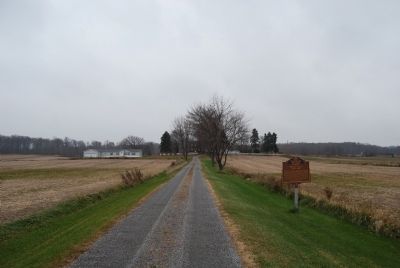
Maple-Dell Marker image. Click for full size.
Photographed by Mike Wintermantel, November 16, 2014
2. Maple-Dell Marker
(approx. 1.6 miles away); Tract of the City of Alliance (approx. 1.6 miles away); Damascus Grade School Museum (approx. 1.6 miles away); Ervin George Bailey (approx. 1.6 miles away); Friends Burying Grounds (approx. 1.7 miles away); Unserheim (approx. 4.8 miles away); Salem (approx. 4.9 miles away); Stage Coach Inn (approx. 5.8 miles away). Touch for a list and map of all markers in Salem.
 
 
Credits. This page was last revised on March 23, 2021. It was originally submitted on November 16, 2014, by Mike Wintermantel of Pittsburgh, Pennsylvania. This page has been viewed 1,193 times since then and 55 times this year. Photos:   1, 2. submitted on November 16, 2014, by Mike Wintermantel of Pittsburgh, Pennsylvania.

m=78944

CeraNet Cloud Computing sponsors the Historical Marker Database.
This website earns income from purchases you make after using our links to Amazon.com. We appreciate your support.
Paid Advertisement
Jul. 21, 2026