Crescent Spring and Trail
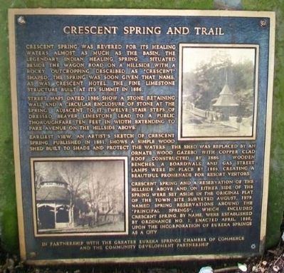
Crescent Spring was revered for its healing waters almost as much as the basin, the legendary Indian Healing Spring. Situated beside the Wagon Road on a hillside with a rocky outcropping described as "crescent" shaped, the spring was soon given that name, as was Crescent Hotel, the fine limestone structure built at its summit in 1886.
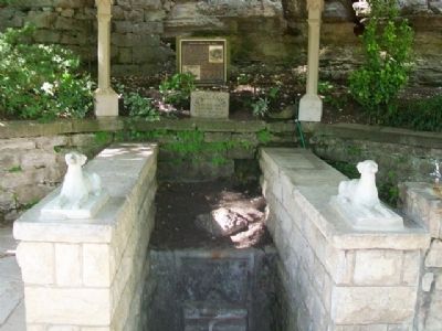
Street maps dated 1886 show a stone retaining wall and a circular enclosure of stone at the spring. Adjacent to it, twelve stair steps of dressed Beaver limestone lead to a public thoroughfare ten feet in width extending to Park Avenue on the hillside above.
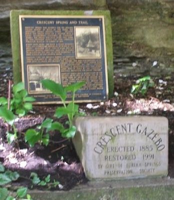
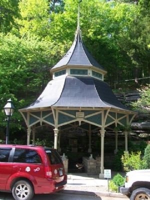
Earliest view, an artist's sketch of Crescent Spring, published in 1881, shows a simple wood shed built to shade and protect the waters. The shed was replaced by an ornate wood gazebo with copper clad roof constructed by 1886. Wooden benches, a boardwalk and gas street lamps were in place by 1886, creating a beautiful promenade for resort visitors.
Crescent Spring and a reservation of the hillside above and on either side of the spring were set aside in the original plat of the town site surveyed August, 1979 [sic - 1879]. Named spring reservations around the "principal springs", which included Crescent Spring, by name, were established by Ordinance No. 1, enacted April, 1880, upon the incorporation of Eureka Springs as a city.
Erected by
Topics. This historical marker is listed in these topic lists: Native Americans • Roads & Vehicles • Settlements & Settlers • Waterways & Vessels. A significant historical year for this entry is 1886.
Location. 36° 24.464′ N, 93° 44.168′ W. Marker is in Eureka Springs, Arkansas, in Carroll County. Marker is at the intersection of Spring Street and Hillside Avenue, on the right when traveling west on Spring Street. Touch for map. Marker is at or near this postal address: 209 Spring Street, Eureka Springs AR 72632, United States of America. Touch for directions.
Other nearby markers. At least 8 other markers are within walking distance of this marker. Clayton-Becker House (within shouting distance of this marker); Carnegie Library (within shouting distance of this marker); A Timeless Place (within shouting distance of this marker); The Crescent Hotel & Spa (about 500 feet away, measured in a direct line); Few Things But Staples … (approx. 0.2 miles away); Avarana (approx. 0.2 miles away); Harding Spring (approx. 0.2 miles away); The Lay of the Land (approx. 0.2 miles away). Touch for a list and map of all markers in Eureka Springs.
Also see . . .
1. The Historic Springs of Eureka Springs, Arkansas. (Submitted on January 5, 2015, by William Fischer, Jr. of Scranton, Pennsylvania.)
2. Eureka Springs History
Credits. This page was last revised on September 3, 2020. It was originally submitted on January 5, 2015, by William Fischer, Jr. of Scranton, Pennsylvania. This page has been viewed 739 times since then and 88 times this year. Photos: 1, 2, 3, 4. submitted on January 5, 2015, by William Fischer, Jr. of Scranton, Pennsylvania.


