Land's Legacy
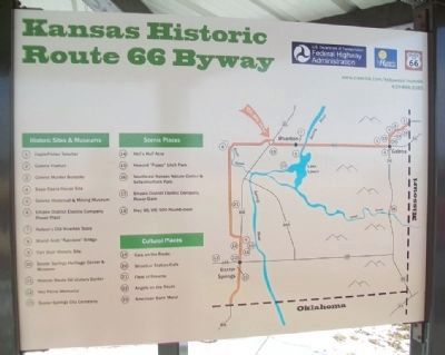
Kansas Historic Route 66 Byway
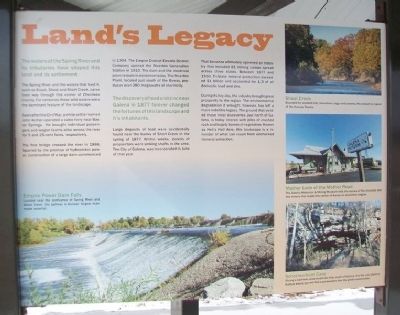
The waters of the Spring River and its tributaries have shaped this land and its settlement.
The Spring River and the waters that feed it, such as Brush, Shoal and Short Creek, carve their way through this corner of Cherokee County. For centuries these wild waters were the dominant feature of the landscape.
Soon after the Civil War, a white settler named John Archer operated a cable ferry near Baxter Springs. He brought individual passengers and wagon teams alike across the river for 5 and 25 cent fares, respectively.
The first bridge crossed the river in 1886. Spurred by the promise of hydroelectric power, construction of a large dam commenced in 1904. The Empire District Electric District [sic] Company opened the Riverton Generation Station in 1910. The dam and the electrical plant remain in existence today. The Riverton Plant, located just south of the Byway, produces over 280 megawatts of electricity.
The discovery of lead and zinc near Galena in 1877 forever changed the fortunes of this landscape and it's inhabitants.
Large deposits of lead were accidentally found near the banks of Short Creek in the spring
this page online
That bonanza ultimately spawned an industry that included 81 mining camps spread across three states. Between 1877 and 1950, Tri-State mineral production exceeded $1 billion and accounted for 1/2 of all domestic lead and zinc.
During its hey-day, the industry brought great prosperity to the region. The environmental degradation it wrought, however, has left a more indelible legacy. The ground that yielded those in[i]tial discoveries, just north of Galena, is today littered with piles of crushed rock and largely barren of vegetation. Known as Hell's Half Acre, this landscape is a reminder of what can result from unchecked mineral extraction.
[Photo captions read]
Empire Power Dam Falls
Located near the confluence of Spring River and Shoal Creek, this spillway is Kansas' largest man-made waterfall.
Shoal Creek
Bounded by wooded hills, limestone crags and caverns, this stream is typical of the Kansas Ozarks.
Mother Lode of the Mother Road
The Galena Historical & Mining Museum tells the stories
Schermerhorn Cave
Slicing a half-mile underneath the hills south of Galena, it is the only place in Kansas where you will find cave-dwellers like the grotto salamander.
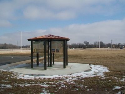
Erected by USDOT Federal Highway Administration and the State of Kansas.
Topics and series. This historical marker is listed in these topic lists: Environment • Industry & Commerce • Roads & Vehicles • Waterways & Vessels. In addition, it is included in the U.S. Route 66 series list. A significant historical year for this entry is 1886.
Location. 37° 4.54′ N, 94° 43.039′ W. Marker is in Riverton, Kansas, in Cherokee County. It is at the intersection of U.S. 400 and State Highway 66, on the right when traveling south on U.S. 400. Marker kiosk is about 300 feet west of the roundabout. Touch for map. Marker is in this post office area: Riverton KS 66770, United States of America. Touch for directions.
Regionally, this marker is in Eastern Kansas and specifically in Bleeding Kansas Border War Country. It is also in the American Midwest, in the Corn Belt, on the
Other nearby markers. At least 8 other markers are within walking distance of this marker: Bridging the American Divide (here, next to this marker); Boom Towns (here, next to this marker); Cosmopolitan Corner (here, next to this marker); Crossroads of Kansas (here, next to this marker); Baxter Springs Massacre and Today (a few steps from this marker); Fort Blair (a few steps from this marker); Where Two Roads Converge (a few steps from this marker); Baxter Springs Massacre (approx. 0.8 miles away). Touch for a list and map of all markers in Riverton.
Also see . . .
1. Kansas' Historic Route 66 Byway. (Submitted on February 26, 2015, by William Fischer, Jr. of Reynoldsburg, Ohio.)
2. Kansas Route 66 Historic Byway on Facebook. (Submitted on February 26, 2015, by William Fischer, Jr. of Reynoldsburg, Ohio.)
3. National Historic Route 66 Federation. (Submitted on February 26, 2015, by William Fischer, Jr. of Reynoldsburg, Ohio.)
Credits. This page was last revised on June 20, 2023. It was originally submitted on February 26, 2015, by William Fischer, Jr. of Reynoldsburg, Ohio. This page has been viewed 710 times since then and 103 times this year. Photos: 1, 2, 3. submitted on February 26, 2015, by William Fischer, Jr. of Reynoldsburg, Ohio.
