Harpers Ferry in Jefferson County, West Virginia — The American South (Appalachia)
Harpers Ferry / John Brown’s Fort
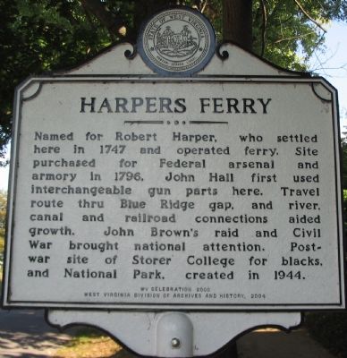
Harpers Ferry. Named for Robert Harper, who settled here in 1747 and operated ferry. Site purchased for Federal arsenal and armory in 1796. John Hall first used interchangeable gun parts here. Travel route thru Blue Ridge gap, and river, canal, and railroad connections added growth. John Brown's raid and Civil War brought national attention. Post-war site of Storer College for blacks, and National Park, created in 1944.
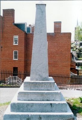
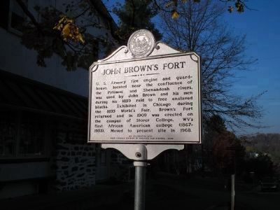
John Brown's Fort. U.S. Armory fire engine and guard-house located near the confluence of the Potomac and Shenandoah rivers, was used by John Brown and his men during his 1859 raid to free enslaved blacks. Exhibited in Chicago during the 1893 World’s Fair, Brown’s Fort returned and in 1909 was erected on the campus of Storer College. WV’s first African American college (1867-1955). Moved to present site in 1968.
Erected 2004 by WV Celebration 2000 / West Virginia Division of Archives and History.
Topics and series. This historical marker is listed in these topic lists: Abolition & Underground RR • African Americans • Civil Rights • War, US Civil. In addition, it is included in the Historically Black Colleges and Universities, and the West Virginia Archives and History series lists. A significant historical year for this entry is 1747.
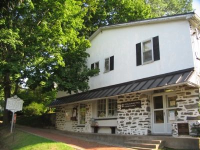
Location. 39° 19.537′ N, 77° 44.433′ W. Marker is in Harpers Ferry, West Virginia, in Jefferson County. Marker is at the intersection of Washington Street (Alternate U.S. 340) and Storer College Place on Washington Street. Located in front of the Appalachian Trail Conservancy Headquarters. Touch for map. Marker is at or near this postal address: 799 Washington Street, Harpers Ferry WV 25425, United States of America. Touch for directions.
Other nearby markers. At least 8 other markers are within walking distance of this marker. The Appalachian Trail and Benton MacKaye (here, next to this marker); The Black Americans (within shouting distance of this marker); Virginia Lodge No. 1 (about 300 feet away, measured in a direct line); Camp Hill (about 300 feet away); Storer College Veterans Memorial Gate (about 400 feet away); The Niagara Movement (about 400 feet away); Foundations of Freedom (about 400 feet away); A Land Divided (about 500 feet away). Touch for a list and map of all markers in Harpers Ferry.
More about this marker. The East facing inscription as listed in "Marking Our Past: West Virginia's Historical Highway Markers," published in 2002, which denotes this as a "missing" marker, is as follows:
"The United States building in which John Brown and his companions were captured was exhibited at the Chicago World's Fair in 1893, and now is on campus of Storer College above the town. This school, established,
Photographed By Bill Coughlin, November 10, 2006
2. East Side of Marker
U. S. Armory fire engine and guardhouse, located near the confluence of the Potomac and Shenandoah rivers, was used by John Brown and his men during the 1859 raid to free enslaved blacks. Exhibited in Chicago during the 1893 World’s Fair, Brown’s Fort returned and in 1909 was erected on the campus of Storer College, WV’s first African American college (1867-1955). Moved to present site in 1968.
Also see . . .
1. Harpers Ferry, West Virginia. Wikipedia entry. (Submitted on October 13, 2007, by Craig Swain of Leesburg, Virginia.)
2. Harpers Ferry Town Website. (Submitted on October 13, 2007, by Craig Swain of Leesburg, Virginia.)
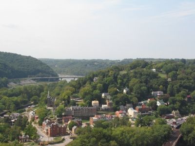
Photographed By Craig Swain, September 22, 2007
4. Lower Town Harpers Ferry
Situated at the confluence of the Potomac and Shenandoah Rivers, along side the Chesapeake and Ohio Canal, and astride the path of the Baltimore and Ohio Railroad with spur lines extending south into the Shenandoah Valley, Harpers Ferry was a transportation hub during the first century of the United States. The city is truly one of the crossroads of American history.
Credits. This page was last revised on May 20, 2021. It was originally submitted on October 13, 2007, by Craig Swain of Leesburg, Virginia. This page has been viewed 6,912 times since then and 63 times this year. Last updated on April 30, 2015, by John Rudy of Gettysburg, Pennsylvania. Photos: 1. submitted on October 13, 2007, by Craig Swain of Leesburg, Virginia. 2. submitted on October 25, 2008, by Bill Coughlin of Woodland Park, New Jersey. 3, 4. submitted on October 13, 2007, by Craig Swain of Leesburg, Virginia. 5. submitted on December 20, 2007, by Mike Stroud of Bluffton, South Carolina. • Bill Pfingsten was the editor who published this page.
