Near Bolivar in Jefferson County, West Virginia — The American South (Appalachia)
Pilgrimage
Harpers Ferry National Historical Park
— National Park Service, U.S. Department of the Interior —
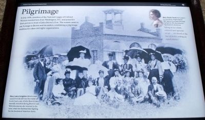
In July 1896, members of the National League of Colored Women traveled here from Washington, D.C. and posed for their picture in front of John Brown’s Fort. The women came to pay homage to Brown and his raiders, establishing a pilgrimage tradition for other civil rights organizations.
Mary Church Terrell, the League’s first president, helped lead its fight against lynchings and racial segregation. She described the organization’s mission as: “lifting as we climb, onward and upward we go…we knock at the bar of justice asking an equal chance.”
Erected by National Park Service, U.S. Department of the Interior.
Topics and series. This historical marker is listed in these topic lists: African Americans • Civil Rights • Forts and Castles • War, US Civil • Women. In addition, it is included in the Mary Church Terrell series list. A significant historical month for this entry is July 1896.
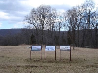
Location. 39° 18.482′ N, 77° 45.703′ W. Marker is near Bolivar, West Virginia, in Jefferson County. Marker can be reached from Murphy Road, on the right when traveling south. Located on the Murphy Farm trail in the Harpers Ferry National Historical Park. The Trail can be reached from the park's visitor center, located on Shoreline Drive south of Highway 340. Touch for map. Marker is in this post office area: Harpers Ferry WV 25425, United States of America. Touch for directions.
Other nearby markers. At least 8 other markers are within walking distance of this marker. Holy Ground (here, next to this marker); A Moving Symbol (here, next to this marker); The Murphy Farm (within shouting distance of this marker); Mountains, Men, and Maneuvers (about 400 feet away, measured in a direct line); Sheridan Dug In (about 800 feet away); The Fate of Harpers Ferry was sealed. (approx. 0.2 miles away); Struggle to the Heights (approx. ¼ mile away); From Civil War to Civil Rights / Battle of Harpers Ferry (approx. 0.3 miles away). Touch for a list and map of all markers in Bolivar.
More about this marker. The background of the marker is a photograph showing the old "fort" with a gathering of visitors in front, captioned: Mary Leary Langston (third woman seated from the left) was the widow of Lewis Leary, one of John Brown’s men mortally wounded during Brown’s raid. With this journey she returned to the town where her husband died fighting for the freedom of American slaves. In the upper left is a portrait of Mary Church Terrell.
Also see . . . John Brown's Fort. National Park Service page detailing the history of the fort. (Submitted on June 15, 2008, by Craig Swain of Leesburg, Virginia.)
Credits. This page was last revised on July 21, 2020. It was originally submitted on June 13, 2008. This page has been viewed 1,199 times since then and 18 times this year. Photos: 1, 2. submitted on June 13, 2008. • Craig Swain was the editor who published this page.

