Birmingham in Jefferson County, Alabama — The American South (East South Central)
East Birmingham
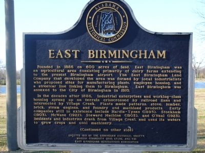
Founded in 1886 on 600 acres of land, East Birmingham was the agricultural area consisting primarily of dairy farms extending to the present Birmingham airport. The East Birmingham Land Company that developed the area was formed by local industrialists who proposed sites for manufacturing plants, employee housing, and a streetcar line linking them to Birmingham. East Birmingham was annexed to the city in 1910.
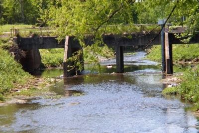
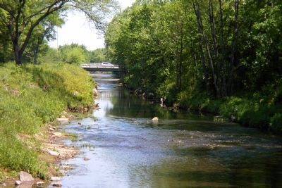
In the decades after 1886, industrial enterprises and working-class housing sprang up on terrain crisscrossed by railroad lines and intersected by Village Creek. Plants made patterns, stove, lumber, brick, steam engines, and foundry and machined products. Early companies still in existence include Hardy-Tynes (1895), Stockham (1903), McWane (1922), Stewart Machine (1905), and O'Neal (1923). Residents and industries drank from Village creek and used it's waters to grow crops and cool machinery.
Marker Reverse:
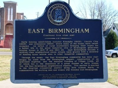
Early housing subdivisions included Klondyke (1902), Lincoln City (1903), and Greenwood (1903), where many of the homes were owner occupied. An influx of rural Southerners bringing their hopes for a better life to the great industrial city of Birmingham generated housing booms in 1913-15 and 1924-28. East Birmingham became a working-class neighborhood whose streets were graced with a diversity of housing types seldom seen in other industrial communities.
Through the years, the East Birmingham community has been challenged by noise from the Birmingham airport, construction of an interstate highway, and the seasonal flooding of Village Creek, all of which led to the demolition of a great number of early houses. Yet, the East Birmingham neighborhood remains. This marker is erected in the longtime commercial district along 10th Avenue North, to commemorate the working men and women who founded East Birmingham.
Erected 1991 by the Birmingham Historical Society, Wasson Community Drug Store, and the East Birmingham Neighborhood Association.
Topics. This historical marker is listed in these topic lists: African Americans • Agriculture • Civil Rights • Settlements & Settlers. A significant historical year for this entry is 1886.
Location. 33° 32.59′ N, 86° 46.864′ W. Marker is in Birmingham, Alabama, in Jefferson County. Marker can be reached from the intersection of 12th Avenue and Cahaba Street, on the left when traveling east. Marker is along a walking path in W. C. Patton Park. Touch for map. Marker is at or near this postal address: 3937 12th Avenue North, Birmingham AL 35234, United States of America. Touch for directions.
Other nearby markers. At least 8 other markers are within 2 miles of this marker, measured as the crow flies. ACMHR & the Second Revolution (approx. 1.3 miles away); Leaving Town, But Not the Battle (approx. 1.3 miles away); It Began at Bethel (approx. 1.3 miles away); Bethel's Pastor Leads the Leaders (approx. 1.3 miles away); ACMHR & the Student Activists (approx. 1.3 miles away); Rev. Fred Shuttlesworth Bethel Baptist Church (approx. 1.3 miles away); A New Organization is Born (approx. 1.3 miles away); A New Strategy: All-Out Attack (approx. 1.3 miles away). Touch for a list and map of all markers in Birmingham.
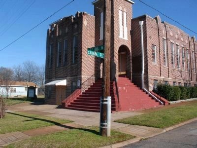
More about this marker. From downtown Birmingham take Richard Arrington Blvd. Drive east to Coosa Street, turn left , go two blocks north to park entrance. St. Luke AME Zion Church will be seen one block east at the intersection of Cahaba Street and 12th Ave North.
Additional commentary.
1. W. C. Patton Park
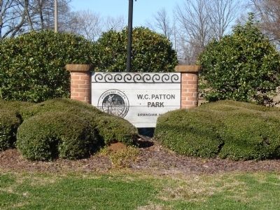
Named in honor of one of Birmingham's civil rights heroes, W.C. Patton Park was the first neighborhood park to be developed under the Village Creek Linear Park and Retention System Master Plan. It is a seven-acre park with a community arts and cultural center in the renovated Shields School. With multiple locations for picnics, an amphitheater, walking trail, lake, and the adjacent arts center, this park has become one of the most popular venues in the city. It also can be seen along the descending glide path to the Birmingham Airport and serves as visual gateway to the city. This project was the first phase in a series of parks along the Village Creek Floodway
— Submitted January 19, 2010, by Dodson M. Curry of Birmingham, Alabama.
Credits. This page was last revised on November 1, 2019. It was originally submitted on January 19, 2010, by Dodson M. Curry of Birmingham, Alabama. This page has been viewed 2,531 times since then and 70 times this year. Last updated on May 29, 2015, by J. Makali Bruton of Accra, Ghana. Photos: 1, 2, 3, 4, 5, 6. submitted on January 19, 2010, by Dodson M. Curry of Birmingham, Alabama. • Bill Pfingsten was the editor who published this page.
