Near New Straitsville in Perry County, Ohio — The American Midwest (Great Lakes)
Paynes Crossing
Historic Underground Railroad Site
Inscription.
Side 1
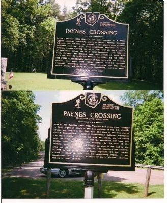
Payne Cemetery (1852-1945) is the only remnant of a freed African American community known as Paynes Crossing. Research indicates that the area was involved in the Underground Railroad Movement, and may have been established expressly for this purpose. Paynes Crossing was not a "town" per se, but a system of farmsteads spread out on a rural landscape. The Harpers, Letts, Normans and Stevens were free people of color who were the first to settle the area in the 1830s. By the 1850s, they owned a considerable amount of land here and the tax records indicate that some were rather wealthy ($1,000) personal property. According to the census records for this period, whites are living in black households, and vice versa.
Side 2
Most of the families came from Virginia and some even traveled to Ohio together. Some of the men enlisted in the U.S. Colored Troops and fought in the Civil War, and some of the men stayed behind (presumably to conduct Underground Railroad activities). The Payne family, for which the area was named, did not arrive until 1880, which suggests that the settlement may have had another name during the 19th century. By the turn of the century, coal companies had bought up most of the land in the area and the families moved on. The cemetery was restored in 1995 by the Wayne National Forest together
Erected 1995 by Wayne National Forest.
Topics. This historical marker is listed in these topic lists: Abolition & Underground RR • African Americans • Cemeteries & Burial Sites • War, US Civil. A significant historical year for this entry is 1880.
Location. 39° 33.71′ N, 82° 15.472′ W. Marker is near New Straitsville, Ohio, in Perry County. Marker is on Ohio Route 595, on the right when traveling south. Touch for map. Marker is in this post office area: New Straitsville OH 43766, United States of America. Touch for directions.
Other nearby markers. At least 8 other markers are within 4 miles of this marker, measured as the crow flies. Robinson’s Cave (approx. 1˝ miles away); New Straitsville Mine Fire and Rock Run Reclamation (approx. 2˝ miles away); World’s Greatest Mine Fire (approx. 2˝ miles away); A Little City in the Forest (approx. 3.8 miles away); Tecumseh Theater (approx. 3.8 miles away); Black Diamonds and Bricks (approx. 3.8 miles away); Shawnee (approx. 3.8 miles away); A Boom Town (approx. 3.8 miles away). Touch for a list and map of all markers in New Straitsville.
Credits. This page was last revised on October 18, 2020. It was originally submitted on July 25, 2015, by Geraldine M. Winfield of Columbus, Ohio. This page has been viewed 1,308 times since then and 119 times this year. Photo 1. submitted on July 25, 2015, by Geraldine M. Winfield of Columbus, Ohio. • Bill Pfingsten was the editor who published this page.
