Near Driftwood in Cameron County, Pennsylvania — The American Northeast (Mid-Atlantic)
Sinnemahoning Path
Photographed by Mike Wintermantel, September 7, 2015
1. Sinnemahoning Path Marker
Erected 1950 by Pennsylvania Historical and Museum Commission.
Topics and series. This historical marker is listed in these topic lists: Indigenous Peoples and Communities • Roads & Vehicles • Waterways & Vessels. In addition, it is included in the Pennsylvania Historical and Museum Commission (PHMC) series list.
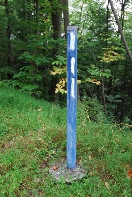
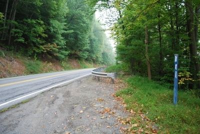
Location. Marker is missing. It was located near 41° 21.174′ N, 78° 7.472′ W. Marker was near Driftwood, Pennsylvania, in Cameron County. It could be reached from Bucktail Trail Highway (Pennsylvania Route 120) 1½ miles north of Chestnut Street ( Route 555), on the right when traveling south. Touch for map. Marker was in this post office area: Driftwood PA 15832, United States of America. Touch for directions.

Regionally, this marker was in the Pennsylvania Wilds. It was also in the American Northeast, in the Mid-Atlantic, in Appalachia, and specifically in Northern Appalachia. Globally, it was in North America, the Western Hemisphere, the Western World, and the Anglosphere. Historically, it found itself in what was once the Haudenosaunee (Iroquois) Confederacy and also one of the original Thirteen Colonies.
Other nearby markers. At least 8 other markers are within 12 miles of this location, measured as the crow flies: "The Bucktails" (approx. 1.1 miles away); Bucktails Monument (approx. 1.2 miles away); Pepper Hill Fire of 1938 (approx. 3 miles away); Tom Mix (approx. 3.4 miles away); a different marker also named Sinnemahoning Path (approx. 8.6 miles away); Simeon & Susannah Pfoutz (approx. 10.2 miles away);
this page online
More about this marker. Marker has been missing for some time, only the post remains.
Photographed by Mike Wintermantel, September 7, 2015
2. Sinnemahoning Path Marker
Credits. This page was last revised on June 16, 2016. It was originally submitted on September 7, 2015, by Mike Wintermantel of Pittsburgh, Pennsylvania. This page has been viewed 754 times since then and 57 times this year. Photos: 1, 2. submitted on September 7, 2015, by Mike Wintermantel of Pittsburgh, Pennsylvania.
