Fort Hunter in Montgomery County, New York — The American Northeast (Mid-Atlantic)
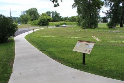
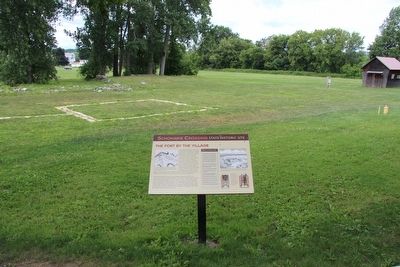
The Fort by the Village
Schoharie Crossing
— State Historic Site —
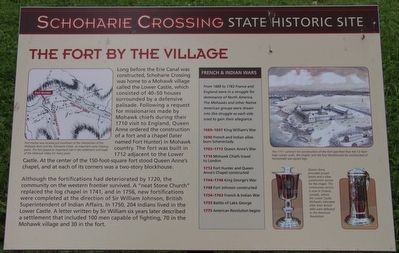
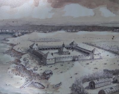
Long before the Erie Canal was constructed, Schoharie Crossing was home to a Mohawk village called the Lower Castle, which consisted of 40-50 houses surrounded by a defensive palisade. Following a request for missionaries made by Mohawk chiefs during their 1710 visit to England, Queen Anne ordered the construction of a fort and a chapel (later named Fort Hunter) in Mohawk country. The fort was built in 1712 adjacent the Lower Castle. At the center of the 150-foot-square fort stood Queen Anne's chapel, and at each of its corners was a two-story blockhouse.
Although the fortifications had deteriorated by 1720, the community on the western frontier survived. A "neat Stone Church" replaced the log chapel in 1741, and in 1756, new fortifications were completed at the direction of Sir William Johnson, British Superintendent of Indian Affairs. In 1750, 204 Indians lived in tthe Lower Castle. A letter written by Sir William six years later described a settlement that included 100 men capable of fighting, 70 in the Mohawk village and 30 in the fort.
From 1689 to 1763 France France and England were in a struggle for dominance of North America. The Mohawks and other Native American groups were drawn into this struggle as each side tried to gain their allegiance.
1689-1697 King William's War
1690 French and Indian allies burn Schenectady
1703-1713 Queen Anne's War
1710 Mohawk Chiefs travel to London
1712 Fort Hunter and Queen Anne's Chapel constructed
1744-1748 King George's War
1748 Fort Johnson constructed
1754-1763 French & Indian War
1755 Battle of Lake George
1775 American Revolution begins
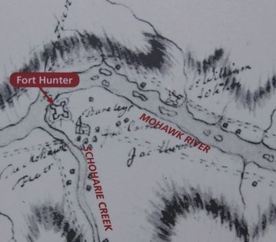
Fort Hunter was located just southeast of the intersection of the Mohawk River and the Schoharie Creek, an important early crossing point. The fort played an important role in the settlement and trade of the Mohawk Valley for many years
The 1711 contract for construction of the fort specified that the 12-foot-high curtain walls, the chapel, and the four blockhouses be constructed of horizontally laid square logs.
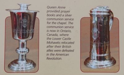
Queen Anne provided prayer books and a silver communion service for the chapel. The communion service is now in Ontario, Canada, where the Lower Castle Mohawks relocated after their British allies were defeated in the American Revolution.
Topics. This historical marker is listed in these topic lists: Churches & Religion • Colonial Era • Forts and Castles • Native Americans. A significant historical year for this entry is 1710.
Location.
42° 56.373′ N, 74° 16.929′ W. Marker is in Fort Hunter, New York, in Montgomery County. Marker is on Schoharie Street south of Main Street, on the left when traveling south. This marker is on the site of the grounds of the Schoharie Crossing, State Historic Site, just north of the State Historic Site Visitor Center, between the Visitor Center and the visitor's parking lot. Touch for map. Marker is in this post office area: Fort Hunter NY 12069, United States of America. Touch for directions.
Other nearby markers. At least 8 other markers are within walking distance of this marker. Building Block of the Erie Canal (a few steps from this marker); In the Wake of Hurricane Irene (a few steps from this marker); Site of Queen Anne Chapel (within shouting distance of this marker); Canal Dams (within shouting distance of this marker); Original Erie Canal (within shouting distance of this marker); East Guard Lock (within shouting distance of this marker); Site of Last Mohawk Indian Village (within shouting distance of this marker); Site of Old Fort Hunter (within shouting distance of this marker). Touch for a list and map of all markers in Fort Hunter.
Also see . . . Schoharie Crossing State Historic Site - National Park Service. Download National Register of Historic Places documentation (Submitted on March 24, 2024, by Anton Schwarzmueller of Wilson, New York.)
Credits. This page was last revised on March 24, 2024. It was originally submitted on September 11, 2015, by Dale K. Benington of Toledo, Ohio. This page has been viewed 456 times since then and 13 times this year. Photos: 1, 2, 3, 4, 5, 6, 7. submitted on September 12, 2015, by Dale K. Benington of Toledo, Ohio.
