Montgomery in Montgomery County, Alabama — The American South (East South Central)
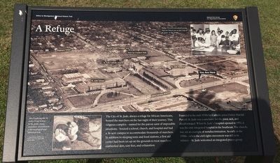
A Refuge
Selma to Montgomery National Historic Trail
| — | National Park Service, U.S. Department of the Interior | — |
Photographed by Mark Hilton, December 11, 2015
1. A Refuge Marker
The City of St Jude, always a refuge for African Americans, hosted the marchers on the last night of their journey. This religious complex—named for the patron saint of impossible situations—housed a school church and hospital and had a 36-acre campus to accommodate thousands of marchers. In addition to sleeping tents and food stations, a first aid center had been set up on the grounds to treat marchers’ sunburned skin, sore feet, and exhaustion.
Founded in the mid-1930s by Catholic priest Father Harold Purcell, St. Jude was a sanctuary for the poor, sick, and disadvantaged. When St. Jude's Hospital opened in 1951, it was the only integrated hospital in the Southeast. The church, too, set an example of nondiscrimination. As early as the 1950s—when the civil rights movement was still in its infancy—St. Jude welcomed an integrated prayer group.
Erected 2015 by National Park Service, U.S. Department of the Interior.
Topics. This historical marker is listed in these topic lists: African Americans • Civil Rights • Religion & Religious Structures • Science & Medicine. A significant historical year for this entry is 1951.
Location. 32° 21.103′ N,
this page online

Regionally, this marker is in Alabama’s Tri-Counties River Region. It is also in the American South, specifically in the Deep South, and in the Black Belt. Globally, it is in North America, a Gulf of Mexico state, the Western Hemisphere, the Western World, and the Anglosphere. Historically, it finds itself in what was once the territory of the Mississippian Culture, one of the Confederate States of America, and the Antebellum South.
Other nearby markers. At least 8 other markers are within walking distance of this marker: Heroes' Welcome (here, next to this marker); Campsite 4 (within shouting distance of this marker); Marching to Montgomery (within shouting distance of this marker); City of St. Jude / The Selma to Montgomery March (about 400 feet away,
Photographed by Mark Hilton, December 11, 2015
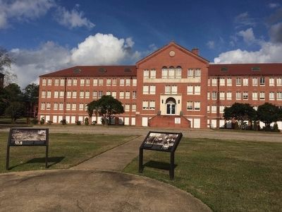
2. Former St. Jude's Catholic Hospital (closed 1985)
Also see . . . City of Saint Jude Story. (Submitted on December 11, 2015, by Mark Hilton of Montgomery, Alabama.)
Photographed by Mark Hilton, December 11, 2015
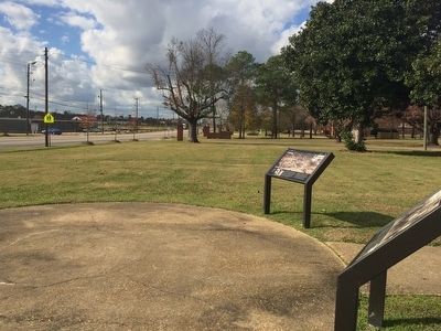
3. View down Fairview Avenue and the "City of St. Jude"
Credits. This page was last revised on September 8, 2026. It was originally submitted on December 11, 2015. This page has been viewed 1,251 times since then and 44 times this year. Last updated on September 5, 2026. Photos: 1, 2, 3. submitted on December 11, 2015, by Mark Hilton of Montgomery, Alabama. • Devry Becker Jones was the editor who published this page.
