El Asintal, Retalhuleu, Guatemala — Central America
Structure 11
Tak'alik Ab'aj National Archaeological Park
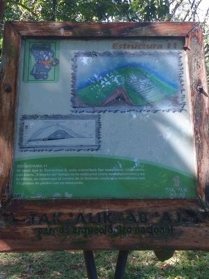
Estructura 11
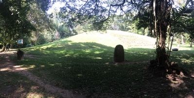
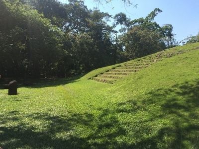
Al igual que la Estructura 5, esta estructura fue construida totalmente con barro. A través del tiempo se le realizaron cinco remodelaciones y en la última, se construye al centro de la fachada oeste una escalinata con 13 gradas de piedra con un descanso.
Pie de dibujo:
Etapas constructivas de la Estructura 11
Structure 11
Similiarly to Structure 5, this structure was constructed completely out of clay. Through the years five different updates were made to its construction, and in the last, a stairway with 13 stone steps with a resting area were constructed in the middle of the western face.
Caption:
Construction stages of Structure 11
Topics. This historical marker is listed in these topic lists: Anthropology & Archaeology • Man-Made Features • Native Americans.
Location. 14° 38.177′ N, 91° 44.038′ W. Marker is in El Asintal, Retalhuleu. Km. 199, Tak'alik Ab'aj Archaeological Park, Reserva Natural Privada Santa Margarita, Municipio El Asintal. Touch for map. Marker is in this post office area: El Asintal, Retalhuleu 11009, Guatemala. Touch for directions.
Other nearby markers. At least 6 other markers are within walking distance of this marker. Plaza Tukur Balam (within shouting distance of this marker); Sweat Lodge (within shouting distance of this marker); Guacalitos Station (about 210 meters away, measured in a direct line); Tanmi Tnam Plaza (about 210 meters away); Piecitos Station (approx. 0.3 kilometers away); Stela 18 Station (approx. 0.4 kilometers away).
Regarding Structure 11. Tak'alik Ab'aj is the oldest known Mayan site, dating from 900 BCE, and was continuously inhabited until ca. 1000. The site is unique in that it has many examples of Olmec influence on early Mayan culture.
Credits. This page was last revised on March 2, 2018. It was originally submitted on January 6, 2016, by J. Makali Bruton of Accra, Ghana. This page has been viewed 386 times since then and 2 times this year. Photos: 1, 2, 3, 4. submitted on January 6, 2016, by J. Makali Bruton of Accra, Ghana.


