Maumee in Lucas County, Ohio — The American Midwest (Great Lakes)
Alliances
Main Battle Line
Photographed by Dale K. Benington, November 5, 2015
1. Alliances Marker
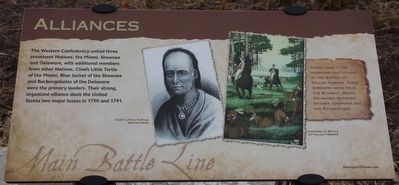
There were 1,100 warriors that fought at the Battle of Fallen Timbers. These warriors were from the Wyandot, Mingo, Delaware, Shawnee, Ottawa, Chippewa and the Potawatomie.
Erected by Metroparks of the Toledo Area.
Topics. This historical marker is listed in these topic lists: Indigenous Peoples and Communities • Wars, US Indian. A significant historical year for this entry is 1790.
Location. 41° 33.329′ N, 83° 41.58′ W. Marker is in Maumee, Ohio, in Lucas County. It can be reached from North Jerome Road south of Monclova Road, on the left when traveling south. This marker is located on the grounds of the Fallen Timbers Battlefield, Metropark, in a clearing near the northern border of the park, and is the fourteenth in a series of markers seen along the Fallen Timbers
this page online

Regionally, this marker is on the Lake Erie Shore and in the Toledo Metropolitan Area. It is also in the American Midwest and in the Corn Belt. Globally, it is in North America, on the Great Lakes, in the Western Hemisphere, in the Western World, and in the Anglosphere. Historically, it finds itself in what was once the Viceroyalty of New France, the Haudenosaunee (Iroquois) Confederacy, the territory of the Mississippian Culture, and the Northwest Territory.
Other nearby markers. At least 8 other markers are within walking distance of this marker: Fort Miamis Connection (here, next to this marker); American Faces (approx. 0.2 miles away); Aftermath of War (approx. 0.2 miles away); Treaty of Greenville (approx. 0.2 miles away); Archeology & Artifacts (approx. ¼ mile away); The Battle Begins (approx. ¼ mile away); Ready, Aim, Fire! (approx. ¼ mile away); The Battle Ends (approx. ¼ mile away). Touch for a list and map of all markers in Maumee.
More about this marker. This
Photographed by Dale K. Benington, November 5, 2015
2. Alliances Marker
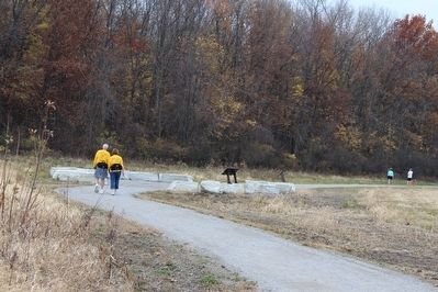
A distant view, looking southwest, of the "Meadow Node," where this marker is located.
Photographed by Dale K. Benington, November 5, 2015
3. Alliances Marker
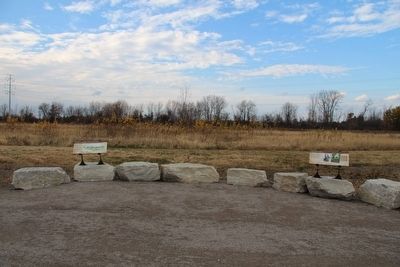
View of this marker, as one of the two markers (featured marker on the right) in the "Meadow Node."
Photographed by Dale K. Benington, November 5, 2015
4. Alliances Marker
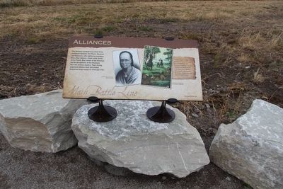
View of the marker.
Photographed by Dale K. Benington, November 5, 2015
5. Alliances Marker
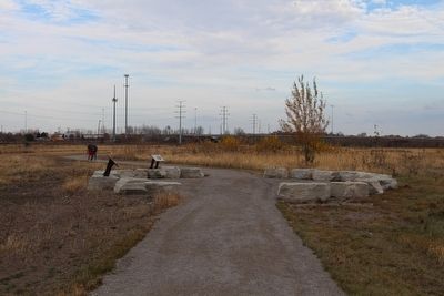
A distant view, looking northeast, of the "Meadow Node," where this marker is located.
Photographed by Dale K. Benington, November 5, 2015
6. Alliances Marker
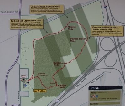
View of a map of the Fallen Timbers Battlefield park, showing the park's walking trail in red, and showing the "Meadow Node" (where this marker is located), near the top center of the map.
Credits. This page was last revised on June 16, 2016. It was originally submitted on March 17, 2016, by Dale K. Benington of Toledo, Ohio. This page has been viewed 573 times since then and 27 times this year. Photos: 1, 2. submitted on March 20, 2016, by Dale K. Benington of Toledo, Ohio. 3, 4, 5, 6. submitted on March 21, 2016, by Dale K. Benington of Toledo, Ohio.
