Suchitoto, Cuscatlán, El Salvador — Central America (West Coast)
Structure 1D1 or Southern Surveillance Point
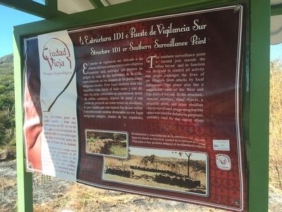
Estructura 1D1 o Puesto de Vigilancia Sur
Inscription.
La estructura posee un solo espacio y tiene una orientación de 20° en vez de 12°, que es la orientación de toda la villa, lo que indica que esta fue construida antes de hacer el trazo de la ciudad.
Pie de dibujo: Restauración y consolidación de la estructura 1D1. En este lugar era donde se ejercía el control de la zona sur de Ciudad Vieja para evitar posibles ataques el asentamiento español.
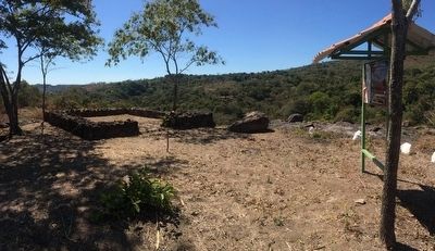
The southern surveillance point is located just outside the urban layout and its function was designed to control all activity that might endanger the lives of the villagers from attacks by local indigenous. This place also has a magnificent view of the West and East sides of the site. In this structure, charcoal, ceramics, metal objects, a projectile point, and other obsidian objects were found, suggesting that this space was used for defensive purposes, probably used by the native allies.
This structure has a single room that has an orientation of 20° instead of 12°, which is the orientation of the entire village, indicating that this building probably was constructed before establishing the grid of the city.
Caption: Restoration and consolidation of Structure 1D1. This was where control was exercised over the southern zone of Ciudad Vieja in order to avoid possible attacks against the Spanish settlement. (Marker Number 6.)
Topics. This historical marker is listed in these topic lists: Anthropology & Archaeology • Colonial Era • Man-Made Features.
Location. 13° 51.425′ N, 89° 1.988′ W. Marker is in Suchitoto, Cuscatlán. The marker is at the far southern end of the Ciudad Vieja Archaeological Site near Suchitoto, El Salvador. Touch for map. Marker is in this post office area: Suchitoto, Cuscatlán 01400, El Salvador. Touch for directions.
Other nearby markers. At least 8 other markers are within 10 kilometers of this marker, measured as the crow
flies. Streets of Ciudad Vieja (about 210 meters away, measured in a direct line); Structure 3D2 (about 210 meters away); Ciudad Vieja Archaeological Site (approx. 0.3 kilometers away); Structure 4D1 (approx. 0.3 kilometers away); Church Platform (approx. 0.3 kilometers away); Structure 4E1 or Cabildo (approx. 0.3 kilometers away); Historia de / History of Suchitoto (approx. 8.9 kilometers away); The Church of Santa Lucía (approx. 8.9 kilometers away). Touch for a list and map of all markers in Suchitoto.
Credits. This page was last revised on July 28, 2019. It was originally submitted on April 16, 2016, by J. Makali Bruton of Accra, Ghana. This page has been viewed 258 times since then and 7 times this year. Photos: 1, 2. submitted on April 16, 2016, by J. Makali Bruton of Accra, Ghana.

