Near Manassas in Prince William County, Virginia — The American South (Mid-Atlantic)
Opening Shots
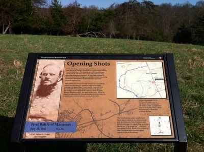
First Battle of Manassas
| — | July 21, 1861 6 a.m. | — |
Photographed by Shane Oliver, March 28, 2016
1. Opening Shots Marker
After two hours Evans became suspicious; no Federal attack had developed. Soon he received a timely message via signal flag: "Look out for your left! You are turned!" Leaving a detachment here to guard the bridge, Evans shifted the balance of his brigade towards Matthews Hill, one mile to the west. There he hoped to intercept the Union advance and buy time for Confederate reinforcements to reach the field.
Erected by Manassas National Battlefield Park, National Park Service, U.S. Department of the Interior.
Topics. This historical marker is listed in this topic list: War, US Civil. A significant historical date for this entry is July 21, 1861.
Location. 38° 49.406′ N, 77° 30.616′ W. Marker is near Manassas, Virginia, in Prince William
this page online

Regionally, this marker is in the Washington Metropolitan Area, in Northern Virginia, and in the Piedmont. It is also in the American South, specifically in the Upper South, in the Mid-Atlantic, and on the Eastern Seaboard. Globally, it is in the North Atlantic Region, North America, the Western Hemisphere, the Western World, and the Anglosphere. Historically, it finds itself in what was once the territory of the Mississippian Culture, one of the original Thirteen Colonies, one of the Confederate States of America, and the Antebellum South.
Other nearby markers. At least 8 other markers are within walking distance of this marker: A different marker also named Opening Shots (a few steps from this
Photographed by Shane Oliver, March 28, 2016
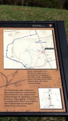
2. Close-up View of Map & Sketch on the "Opening Shots" Marker
Map Caption:
"Union commander Irvin McDowell's plan was to out-flank the Confederate left with a swift, coordinated attack via Sudley Ford, while maintaining a diversion at Stone Bridge.
Sketch Caption:
"The Confederate army established three signal stations to communicate over its defensive line. Soldiers sent coded messages via signal flag, a system known as "wig-wagging." Contrary to popular belief, there is no evidence that Confederates erected signal towers at these locations.
Other markers no longer nearby. Farm Ford (was approx. 0.3 miles away but has been replaced with another marker now near it); Stone Bridge (was approx. 0.4 miles away but has been confirmed missing).
Also see . . .
1. Manassas National Battlefield Park. National Park Service (Submitted on May 13, 2016.)
2. Old Marker at this Location. This marker replaced an older one at this location titled “Opening Shots" (Submitted on May 13, 2016.)
Photographed by Shane Oliver, March 28, 2016
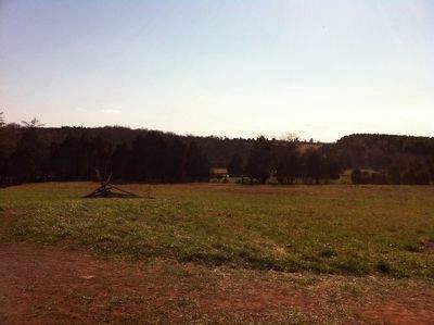
3. Open Field near the "Opening Shots" Marker
Photographed by Shane Oliver, March 28, 2016
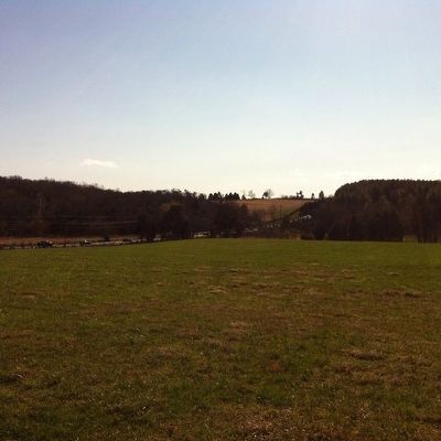
4. View of U.S. 29 (Lee Highway) from the "Opening Shots" Marker
Credits. This page was last revised on June 16, 2016. It was originally submitted on May 13, 2016, by Shane Oliver of Richmond, Virginia. This page has been viewed 866 times since then and 20 times this year. Photos: 1, 2, 3, 4. submitted on May 13, 2016, by Shane Oliver of Richmond, Virginia. • Bernard Fisher was the editor who published this page.
