Southside in San Antonio in Bexar County, Texas — The American South (West South Central)
Spanish and Mexican Land Grants
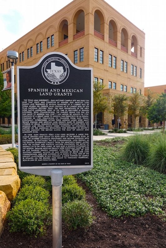
Photographed by Randi Berkovsky, September 22, 2016
1. Spanish and Mexican Land Grants Marker
In 1808, Juan Ignacio Perez (1761-1830) received a large five-league Spanish land grant on both sides of the Medina River. In 1781, he married Clemencia Hernandez and became involved with ranching. He purchased the Old Comandancia, later known as the Spanish Governor’s Palace, from the Menchaca family. Along with his military and political success following the Battle of Medina (1813) on these lands, he was also a leading cattleman of the region. Smaller Mexican grants were eventually made to Jose de los Angeles (Angel) Navarro (1784-1836), brother of Jose Antonio Navarro, alcalde of San Antonio de Bexar and land commissioner, and Jose Antonio de la Garza (b. 1776), one of the largest landowners in San Antonio. A large portion of campus is situated on the Spanish land grant to Fernando Rodriguez, son-in-law of Juan Ignacio Perez.
Erected 2016
this page online
Topics. This historical marker is listed in these topic lists: Agriculture • Education • Hispanic Americans • Indigenous Peoples and Communities • Settlements & Settlers. A significant historical year for this entry is 1731.
Location. 29° 18.235′ N, 98° 31.481′ W. Marker is in San Antonio, Texas, in Bexar County. It is in Southside. It can be reached from the intersection of University Way and Verano Parkway. Located on the Texas A&M University-San Antonio campus next to the President's Seal, in front of the Central Academic Building. Touch for map. Marker is at or near this postal address: One University Way, San Antonio TX 78224, United States of America. Touch for directions.

Regionally, this marker is in South Texas. It is also in the American South. Globally, it is in North America, a Gulf of Mexico state, the Western Hemisphere, the Western World, and the Anglosphere. Historically, it finds itself in what was once New Spain, the Republic of Texas, and one of the Confederate States of America.
Other nearby markers. At least 8 other markers are within 5 miles of this marker, measured as the crow flies: Kings Highway Camino Real — Old San Antonio Road (approx. 1.7 miles away); a different marker also named Kings Highway Camino Real — Old San Antonio Road (approx. 3½ miles away); Stinson Airport (approx. 4.2 miles away); Espada Aqueduct (approx. 4.3 miles away); Mission San Francisco de la Espada Dam, Ditch and Aqueduct (approx. 4.3 miles away); Bridging the Gulch (approx. 4.3 miles away); a different marker also named Kings Highway Camino Real — Old San Antonio Road (approx. 4.4 miles away); Defending the Faithful (approx. 4½ miles away). Touch for a list and map of all markers in San Antonio.
Credits. This page was last revised on February 2, 2023. It was originally submitted on September 27, 2016, by Nan Palmero of San Antonio, Texas. This page has been viewed 1,830 times since then and 136 times this year. Photo 1. submitted on September 27, 2016, by Nan Palmero of San Antonio, Texas. • Bernard Fisher was the editor who published this page.
