Valladolid, Yucatán, Mexico — The Southeast (Yucatan Peninsula)
Road of the Friars
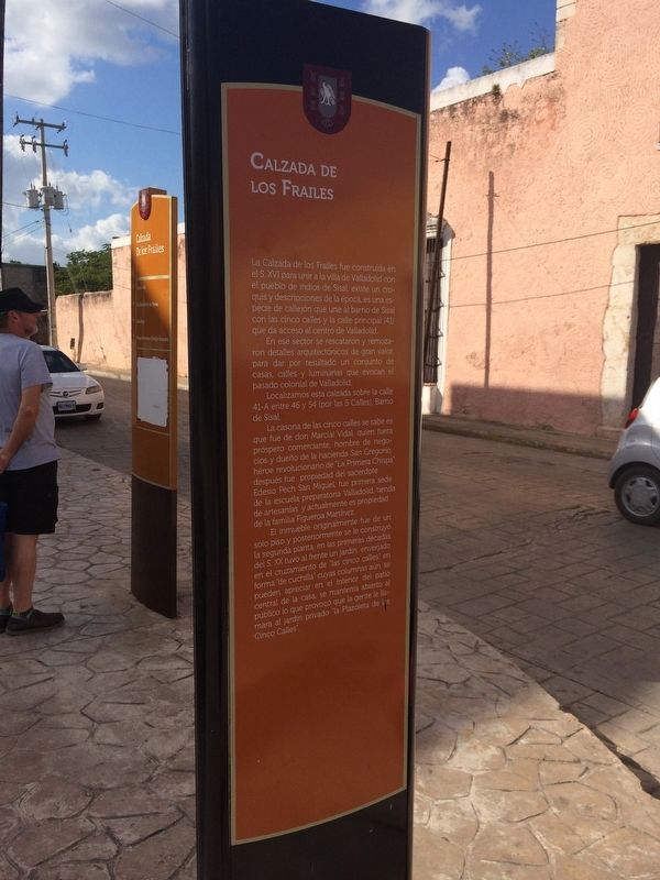
Calzada de los Frailes
La Calzada de los Frailes fue construida en el S. XVI para unir a la villa de Valladolid con el pueblo de indios de Sisal, existe un croquis y descripciones de la época, es una especie de callejón que une al barrio de Sisal con las cinco calles y la calle principal (41) que da acceso al centro de Vallodolid.
Localizamos esta calzada sobre la calle 41-A entre 46 y 54 (por las 5 Calles), Barrio de Sisal.
La casona de las cinco calles se sabe es que fue de don Marcial Vidal, quien fuera próspero comerciante, hombre de negocios y dueño de la hacienda San Gregorio, héroe revolucionario de “La Primera Chispa” después fue propiedad del sacerdote Edesio Pech San Miguel, fue primera sede de la escuela preparatoria Valladolid, tienda de artesanías y actualmente es propiedad de la familia Figueroa Martínez.
El inmueble originalmente fue de un solo piso y posteriormente se le construyó la segunda planta, en las primeras décadas del S. XX tuvo al frente un jardín enverjado en el cruzamiento de “las cinco calles” en forma “de cuchilla” cuyas columnas aún se pueden apreciar en el interior del patio central de la casa, se mantenía abierto al público lo que provocó que la gente le llamara al jardín privado “la Plazoleta de las Cinco Calles”.
English:
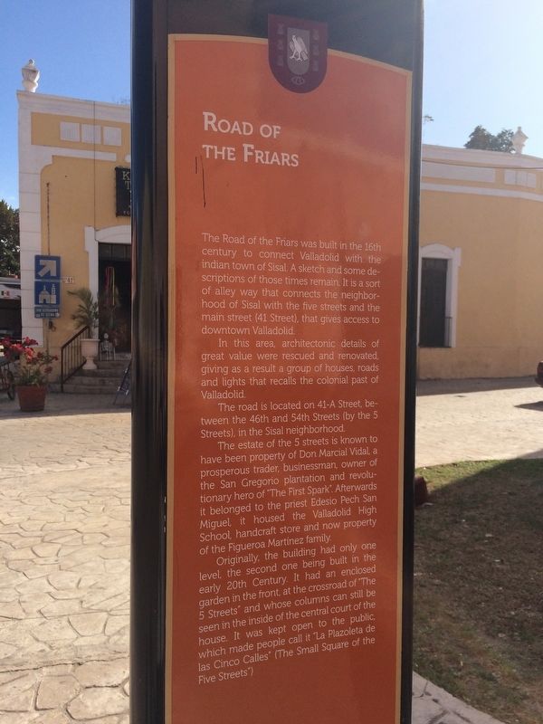
Road of the Friars
The Road of the Friars was built in the 16th century to connect Valladolid with the indian town of Sisal. A sketch and some descriptions of those times remain. It is a sort of alley way that connects the neighborhood of Sisal with the five streets and the main street (41 Street), that gives access to downtown Valladolid.
In this área, architectonic details of great value were rescued and renovated, giving as a result a group of houses, roads and lights that recalls the colonial past of Valladolid.
The road is located on 41-A Street, between the 46th and 54th Streets (by the 5 Streets), in the Sisal neighborhood.
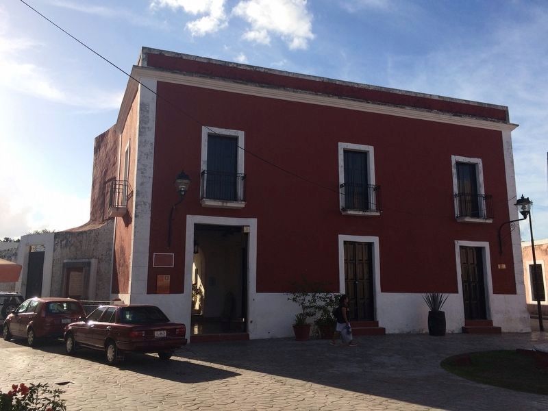
The estate of the 5 streets is known to have been property of Don Marcial Vidal, a prosperous trader, businessman, owner of the San Gregorio plantation and revolutionary hero of “The First Spark”. Afterwards it belonged to the priest Edesio Pech San Miguel, it housed the Valladolid High School, handcraft store and now property of the Figueroa Martínez family.
Originally, the building had only one level, the second one being built in the early 20th Century. It had an enclosed garden in the front, at the crossroad of “The 5 Streets” and whose columns can still be seen in the inside of the central court of the house. It was kept open to the public, which made people call it “La Plazoleta de las Cinco Calles” (The Small Square of the Five Streets”)
Topics. This historical marker is listed in these topic lists: Churches & Religion • Colonial Era • Man-Made Features • Native Americans.
Location. 20° 41.378′ N, 88° 12.298′ W. Marker is in Valladolid, Yucatán. Marker is at the intersection of Calle 41 and Calle 46, on the right when traveling east on Calle 41. Touch for map. Marker is in this post office area: Valladolid YU 97780, Mexico. Touch for directions.
Other nearby markers. At least 8 other markers are within walking distance of this marker. The Valladolid Artisans' Market (about 210 meters away, measured in a direct line); House of Governor Francisco Canton Rosado (approx. 0.3 kilometers away); The Crime of the Mayors (approx. 0.3 kilometers away); The Catholic Parsonage of Valladolid (approx. 0.3 kilometers away); Church of San Servacio (approx. 0.3 kilometers away); Birth House of Delio Moreno Cantón (approx. 0.4 kilometers away); Francisco Cantón Rosado Park (approx. 0.4 kilometers away); The Author of “Ojos Tristes” (Sad Eyes) (approx. 0.4 kilometers away). Touch for a list and map of all markers in Valladolid.
Photographed By J. Makali Bruton, January 16, 2017
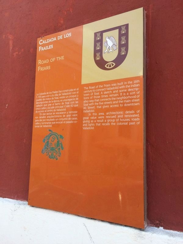
3. An additional Road of the Friars Marker on the left of the building facing the intersection.
This additional marker, which has slightly shorter text than that of the featured marker, reads:
Calzada de los Frailes
La Calzada de los Frailes fue construida en el S. XVI para unir a la villa de Valladolid con el pueblo de indios de Sisal, existe un croquis y descripciones de la época, es una especie de callejón que une al barrio de Sisal con las cinco calles y la calle principal (Calle 41) que da acceso al centro de Vallodolid.
En ese sector se rescataron y remozaron detalles arquitectónicos de gran valor, para dar por resultado un conjunto de casas, calles y luminarias que evocan el pasado colonial de Valladolid.
English:
Road of the Friars
The Road of the Friars was built in the 16th century to connect Valladolid with the indian town of Sisal. A sketch and some descriptions of those times remain. It is a sort of alley way that connects the neighborhood of Sisal with the five streets and the main street (41 Street), that gives access to downtown Valladolid.
In this area, architectonic details of great value were rescued and renovated, giving as a result a group of houses, roads and lights that recalls the colonial past of Valladolid.
Credits. This page was last revised on March 5, 2017. It was originally submitted on March 3, 2017, by J. Makali Bruton of Accra, Ghana. This page has been viewed 200 times since then and 16 times this year. Photos: 1, 2, 3. submitted on March 3, 2017, by J. Makali Bruton of Accra, Ghana. 4. submitted on March 5, 2017, by J. Makali Bruton of Accra, Ghana. 5. submitted on March 3, 2017, by J. Makali Bruton of Accra, Ghana. 6. submitted on March 5, 2017, by J. Makali Bruton of Accra, Ghana.
