Franklin in Williamson County, Tennessee — The American South (East South Central)
Battle of Franklin, Eastern Flank
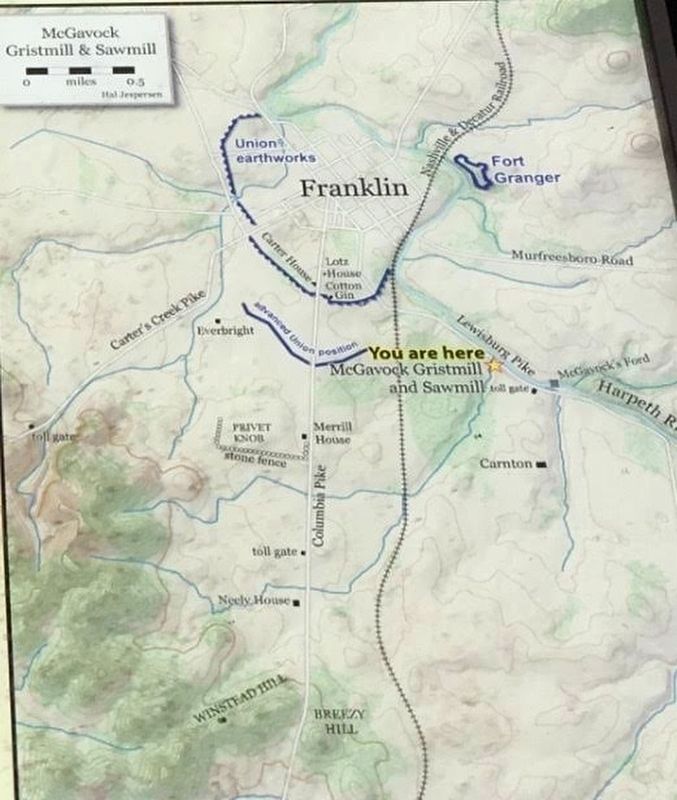
McGavock Gristmill and Sawmill
The mill reflected the modern age as well as the ancient world. Although the machinery ran on belts and gears turned by a steam engine, the foundational device of the Industrial Revolution, a male slave whom McGavock purchased for $2,500 operated the boiler and mill. This high price (twice as expensive as most adult male slave) was due to his rare skills—he was essentially an engineer.
The fates of the buildings and the slave are unknown. John McGavock likely sent the man southward early in the Civil War, as he did with most of his slaves, in an attempt to keep them from running away to freedom as Federal forces approached.
Erected by Tennessee Civil War Trails.
Topics and series. This historical marker is listed in these topic lists: Abolition & Underground RR • African Americans • Agriculture • War, US Civil. In addition, it is included in the Tennessee Civil War Trails series list.
Location. 35° 54.614′ N, 86° 51.611′ W. Marker is in Franklin, Tennessee, in Williamson County. Marker can be reached from Eastern Flank Circle south of Lewsburg Pike (Business U.S. 431), on the right when traveling north. Touch for map. Marker is at or near this postal address: 1368 Eastern Flank Cir, Franklin TN 37064, United States of America. Touch for directions.
Other nearby markers. At least 8 other markers are within walking distance of this marker. Advancing With Scott's Brigade (here, next to this marker); a different marker also named Battle of Franklin, Eastern Flank (about 400 feet away, measured in a direct line); Eastern Flank Battlefield Park (about 500 feet away); a different marker also named Advancing With Scott's Brigade (about 500 feet away); a different marker also named Battle of Franklin, Eastern Flank (approx. 0.2 miles away); a different marker also named Advancing With Scott's Brigade (approx. 0.2 miles away); a different marker also named Battle of Franklin, Eastern Flank (approx. 0.2 miles away); a different marker also named Battle of Franklin (approx. ¼ mile away). Touch for a list and map of all markers in Franklin.

Williamson County Archives
4. Gristmill and Sawmill
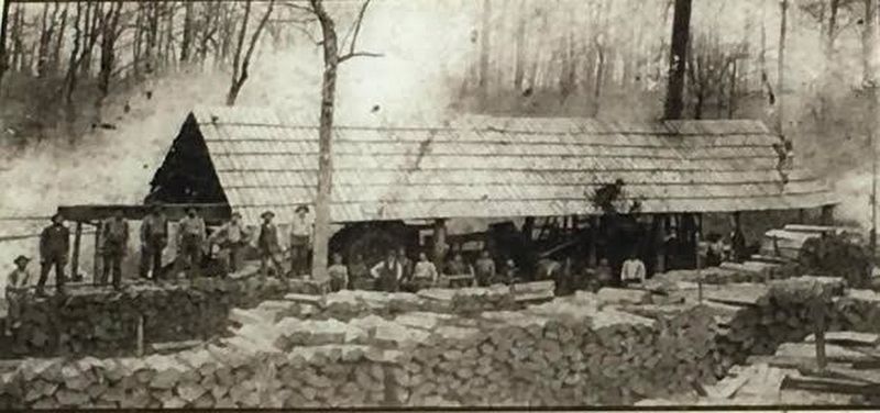
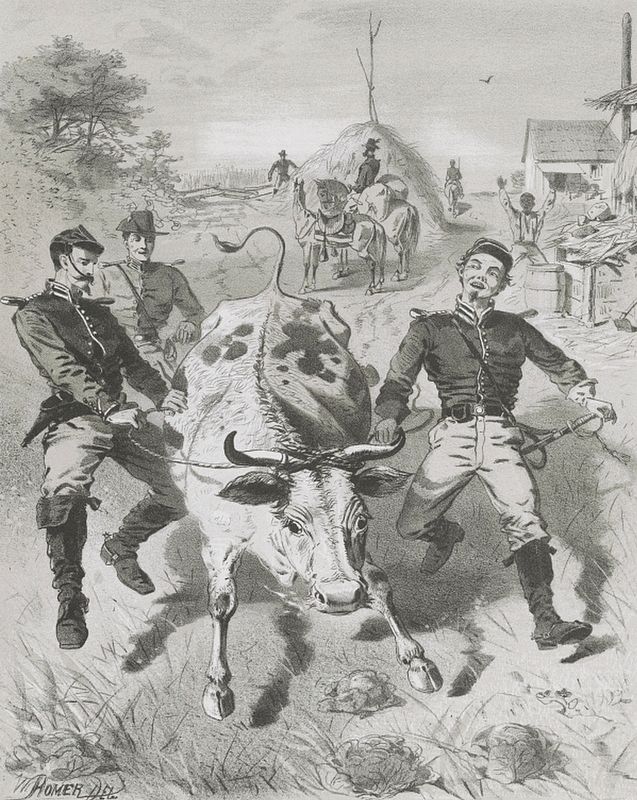
The McGavock gristmill and sawmill may have looked similar to this one. Before the Civil War, Williamson County produced large quantities of grain, livestock, and timber. From the spring of 1862 onward, Union and Confederate armies fighting for control of this area stripped this bounty to supply and feed their ranks.
Credits. This page was last revised on August 27, 2020. It was originally submitted on May 31, 2017, by Brandon Stahl of Fairfax, Virginia. This page has been viewed 301 times since then and 17 times this year. Photos: 1, 2, 3, 4, 5. submitted on May 31, 2017, by Brandon Stahl of Fairfax, Virginia. • Bernard Fisher was the editor who published this page.


