Thonotosassa in Hillsborough County, Florida — The American South (South Atlantic)
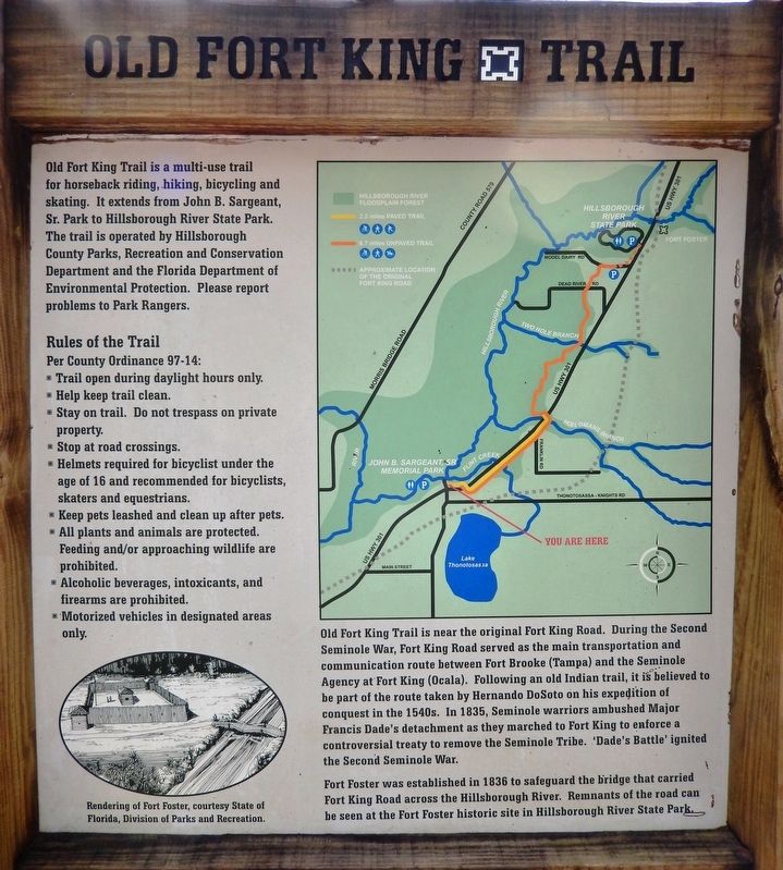
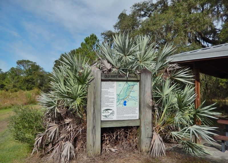
Old Fort King Trail
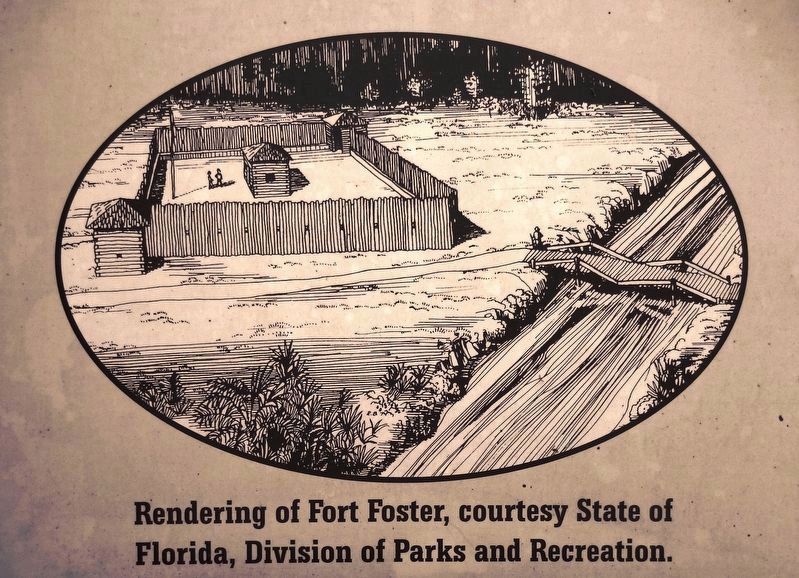
Fort Foster was established in 1836 to safeguard the bridge that carried Fort King Road across the Hillsborough River. Remnants of the road can be seen at the Fort Foster historic site in Hillsborough River State Park.
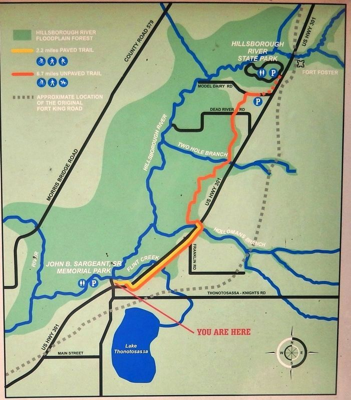
Old Fort King Trail is a multi-use trail for horseback riding, hiking, bicycling and skating. It extends from John B. Sargeant, Sr. Park to Hillsborough River State Park. The trail is operated by Hillsborough County Parks, Recreation and Conservation Department and the Florida Department of Environmental Protection. Please report problems to Park Rangers.
Topics. This historical marker is listed in these topic lists: Forts and Castles • Native Americans • Parks & Recreational Areas • Roads & Vehicles • Wars, US Indian.
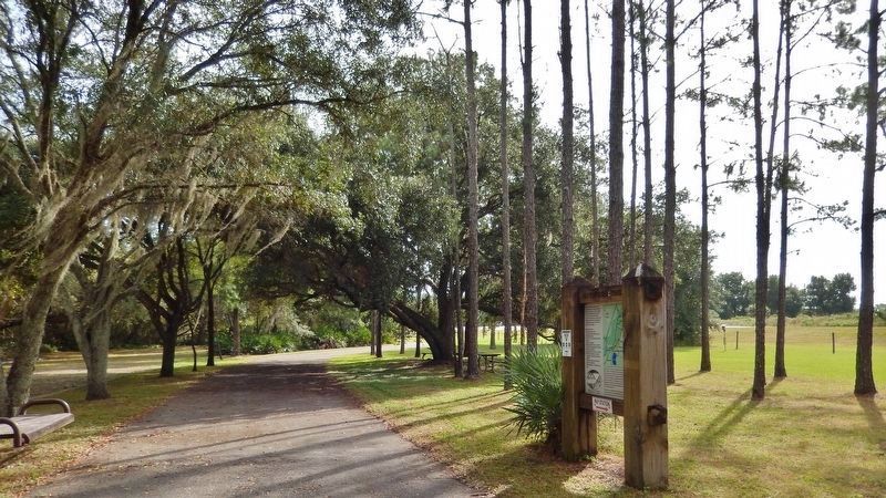
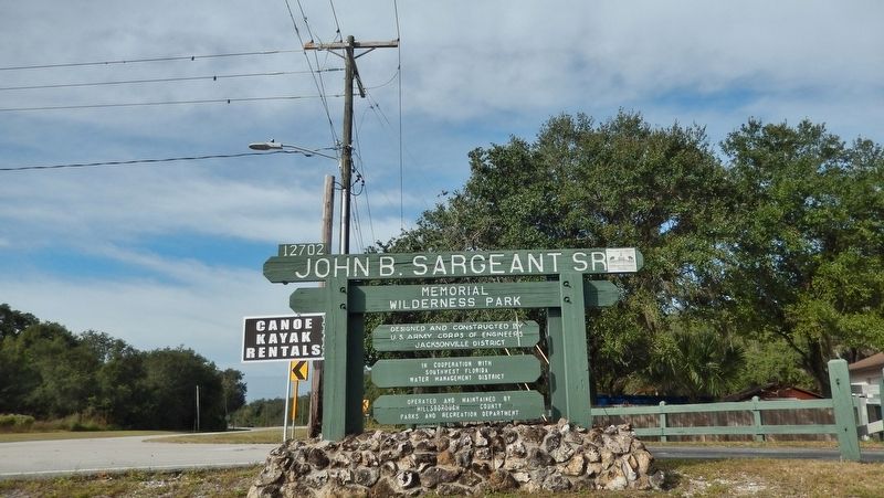
Location. 28° 4.797′ N, 82° 17.087′ W. Marker is in Thonotosassa, Florida, in Hillsborough County. Marker can be reached from the intersection of U.S. 301 and Stacy Road. Marker is located within the John B. Sargeant Sr, Memorial Wilderness Park, beside the Old Fort King Trailhead parking lot near the park entrance. Touch for map. Marker is at or near this postal address: 12702 US Highway 301, Thonotosassa FL 33592, United States of America. Touch for directions.
Other nearby markers. At least 8 other markers are within 7 miles of this marker, measured as the crow flies. John B. Sargeant, Sr. (about 400 feet away, measured in a direct line); Thonotosassa Chamber of Commerce (approx. 1.4 miles away); Military Road (approx. 2.6 miles away); Sunset Memory Gardens 9-11 Memorial (approx. 4.3 miles away); Capt. Nathaniel Wyche Hunter (approx. 4˝ miles away); The Largest Orange Grove in the World (approx. 6 miles away); Reverend Billy Graham (approx. 6.7 miles away); Temple Terraces Country Club Sutton Hall (approx. 6.7 miles away). Touch for a list and map of all markers in Thonotosassa.
More about this marker. Marker is a large painted
metal plaque mounted inside a heavy wooden timber kiosk. There are two duplicate instances of this marker: (1) at the south trailhead in John B. Sargeant Sr. Memorial Wilderness Park, and (2) at the north trailhead in Hillsborough River State Park.
Related markers. Click here for a list of markers that are related to this marker. Old Fort King Trail
Also see . . .
1. Fort Foster State Historic Site. During the Second Seminole War the purpose of Fort Foster was to defend the bridge crossing at the Hillsborough River and act as a resupply point for the soldiers in the field. The fort was garrisoned on and off from December, 1836 – April, 1838. Although the fort was attacked on several occasions, the worst attack occurred in February 1836, when a small group of Seminoles attempted to set fire to the bridge. The attempt was thwarted by aggressive musket and cannon fire from the fifty or so U.S. Navy sailors and the 20 artillery men within the fort. Fort Foster State Historic Site is part of Hillsborough River State Park, though located on the East Side of US 301 from the park. (Submitted on November 8, 2018, by Cosmos Mariner of Cape Canaveral, Florida.)
2. Walking the Fort King Military Road. In 1835, Maj. Francis Dade and 108 men marched from Fort Brooke in what is now Tampa to Fort King in present-day Ocala. The Seminoles, under the leadership of
chiefs Jumper, Micanopy and Alligator, waited patiently for their chance to strike. Three days after Christmas, when Dade and his band of cold, tired and hungry men reached this point in the trail, Chief Jumper emerged from the palmettos and let loose a war whoop. Upon hearing that call to action, 180 brightly painted warriors rose from their hiding places and fired. The first volley dropped Dade and more than half of his troops. Three men survived, but two of them later died of their wounds. Only one man, Ransom Clark, lived to tell the tale. For the next seven years, the old military road, which stretched roughly 100 miles through the wilderness, would be fought over more than once. Parts of it are still visible. You can get a glimpse of the past at one of three state parks that still preserve the old trail pretty much the way it looked when Dade and his men made their fateful journey. (Submitted on November 8, 2018, by Cosmos Mariner of Cape Canaveral, Florida.)
3. Fort King National Historic Landmark. The Fort King National Historic Landmark is located in Ocala, in Marion County, Florida. Fort King, originally built in 1827, was named for Colonel William King who commanded the Fourth Infantry before Brevet Brigadier General Duncan L. Clinch. (Submitted on November 8, 2018, by Cosmos Mariner of Cape Canaveral, Florida.)
Credits. This page was last revised on December 29, 2018. It was originally submitted on November 8, 2018, by Cosmos Mariner of Cape Canaveral, Florida. This page has been viewed 1,115 times since then and 174 times this year. Photos: 1, 2, 3, 4, 5, 6. submitted on November 8, 2018, by Cosmos Mariner of Cape Canaveral, Florida. • Andrew Ruppenstein was the editor who published this page.
