Seaholm District in Austin in Travis County, Texas — The American South (West South Central)
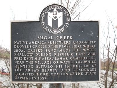
Shoal Creek
Native Americans, settlers and cattle drovers crossed the river here where Shoal Creek's sand made the water shallow. During Republic days Vice President Mirabeau Lamar camped here, near the village of Waterloo while hunting buffalo. His impression of the area's beauty and resources prompted the relocation of the state capital in 1839.
Topics. This historical marker is listed in these topic lists: Agriculture • Native Americans • Roads & Vehicles • Waterways & Vessels. A significant historical year for this entry is 1839.
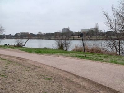
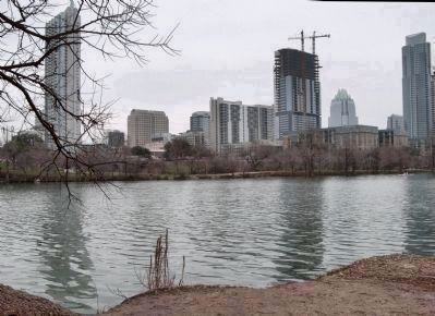
Location. 30° 15.88′ N, 97° 45.103′ W. Marker is in Austin, Texas, in Travis County. It is in the Seaholm District. Marker can be reached from West Cesar Chavez Street west of Nueces Street, on the right when traveling west. The marker is on a walking trail along the Colorado River, the Ann and Roy Butler Hike and Bike Trail. Touch for map. Marker is in this post office area: Austin TX 78701, United States of America. Touch for directions.
Other nearby markers. At least 8 other markers are within walking distance of this marker. Seaholm Power Plant (about 600 feet away, measured in a direct line); Margaret Moser Plaza (approx. 0.2 miles away); Michael Butler and Butler Brick Company (approx. 0.2 miles away); Town Lake Park Alliance (approx. 0.2 miles away); J.P. Schneider Store (approx. ¼ mile away); Austin City Limits (approx. 0.3 miles away); Michael Paggi House (approx. 0.3 miles away); Congress Avenue (approx. 0.4 miles away). Touch for a list and map of all markers in Austin.
Related markers. Click here for a list of markers that are related to this marker. To better understand the relationship, study each marker in the order shown.
Additional commentary.
1. A Trail North
Quoting Annals of Travis County and of the City of Austin, by Frank Brown, a primary source on early Austin: "From time out of mind there was a trail running north from the Rio Grande by way of the present towns of San Antonio, New Braunfels and San Marcos, crossing the Colorado at the ford near the mouth of Shoal Creek .. This trail was found here by the first white explorers that visited the site now occupied by the capital city .. Here, also, the buffalo crossed, going south to north, according to the season. The ford at the mouth of Shoal Creek has a rock bottom, is comparatively smooth and shallow; and could always be crossed with safety when the river was at all fordable. This crossing is at the foot of the mountains, on a direct course
north. The main line of travel from the Rio Grande to Red River, south to north, was by this route. The old trail went up the valley of Shoal Creek, passing out above and near the residence of the late Gov. Pease; thence on the nearly level plateau between the creek and the mountains, near the foot of the hills, almost one north to the Indian village at Waco and beyond.."
— Submitted February 23, 2014, by Richard Denney of Austin, Texas.
Credits. This page was last revised on February 1, 2023. It was originally submitted on February 7, 2010, by Richard Denney of Austin, Texas. This page has been viewed 1,532 times since then and 80 times this year. Photos: 1, 2, 3. submitted on February 7, 2010, by Richard Denney of Austin, Texas. • Kevin W. was the editor who published this page.


