Near Churchville in Augusta County, Virginia — The American South (Mid-Atlantic)
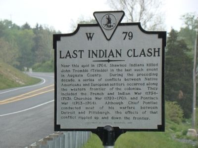
Last Indian Clash
Erected 1997 by Virginia Department of Historic Resources. (Marker Number W-79.)
Topics and series. This historical marker is listed in these topic lists: Colonial Era • Native Americans • War, French and Indian • Wars, US Indian. In addition, it is included in the Virginia Department of Historic Resources (DHR) series list. A significant historical year for this entry is 1764.
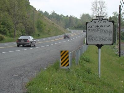
Location. 38° 12.75′ N, 79° 7.867′ W. Marker is near Churchville, Virginia, in Augusta County. Marker is on Churchville Road (U.S. 250) just west of Eagle Rock Lane (County Route 721), on the left when traveling west. Touch for map. Marker is in this post office area: Churchville VA 24421, United States of America. Touch for directions.
Other nearby markers. At least 8 other markers are within 5 miles of this marker, measured as the crow flies . James Edward Hanger (approx. 2 miles away); Mount Pleasant (approx. 3.3 miles away); Colonel George Moffett (approx. 3.3 miles away); West View (approx. 3.8 miles away); Project Dogwood: Staunton's Tradition Reborn (approx. 4.4 miles away); Lt. Col. Jacob Earl "Shorty" Manch (approx. 4½ miles away); 116th Infantry Regiment Memorial (approx. 4½ miles away); Augusta County Training School (approx. 4½ miles away). Touch for a list and map of all markers in Churchville.
More about this marker. This marker replaces a marker from the late 1920s with the same number titled “Last Indian Raid” which reads “Near this spot, in 1774, John Trimble was killed by Indians in the last raid in Augusta County.”
Credits. This page was last revised on January 27, 2022. It was originally submitted on May 8, 2010, by J. J. Prats of Powell, Ohio. This page has been viewed 12,866 times since then and 87 times this year. Photos: 1, 2. submitted on May 8, 2010, by J. J. Prats of Powell, Ohio.

