Wichita in Sedgwick County, Kansas — The American Midwest (Upper Plains)
Tipis
A Mobile World
— Plains Indians Life, Beliefs and Practices —
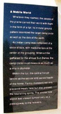
Wherever they roamed, the people of the praire carried their world with them in the form of a tipi. Its circular ground pattern resembled the larger camp circle as well as the disk of the earth.
An Indian camp was composed of a circle of tipis, with medicine tipis at the center of the grouping. When a tribe gathered for the annual Sun Dance, the camp circle could measure as much as a mile in diameter.
Within the tipi, the central fire-pit served as the secular and sacred hearth of the home. Family members not only prepared meals here but also praised the nourishing spirits. The smoke hole above was viewed symbolically as a passageway to the heavens.
Topics. This historical marker is listed in these topic lists: Anthropology & Archaeology • Environment • Native Americans • Science & Medicine.
Location. 37° 41.492′ N, 97° 20.999′ W. Marker is in Wichita, Kansas, in Sedgwick County. The marker is on the Keeper of the Plains plaza, at the confluence of the Big and Little Arkansas Rivers, about 500 feet ESE of the Mid-America All-Indian Center. Touch for map. Marker is at or near this postal address: 650 North Seneca Street, Wichita KS 67203, United States of America. Touch for directions.
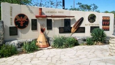
Other nearby markers. At least 8 other markers are within walking distance of this marker. Dream Animals (here, next to this marker); Ceremonial Pipes (here, next to this marker); Chiefs (here, next to this marker); Eagles (here, next to this marker); Way of the Horse (here, next to this marker); Ceremony (a few steps from this marker); Warriors (a few steps from this marker); Women (a few steps from this marker). Touch for a list and map of all markers in Wichita.
Also see . . .
1. Tipis. Encyclopedia of the Great Plains website entry (Submitted on February 5, 2022, by Larry Gertner of New York, New York.)
2. Keeper of the Plains Plaza. 360 Wichita website entry (Submitted on June 24, 2012, by William Fischer, Jr. of Scranton, Pennsylvania.)
3. Mid-American All-Indian Museum, Wichita. Museum website entry (Submitted on June 24, 2012, by William Fischer, Jr. of Scranton, Pennsylvania.)
Credits. This page was last revised on February 5, 2022. It was originally submitted on June 24, 2012, by William Fischer, Jr. of Scranton, Pennsylvania. This page has been viewed 483 times since then and 11 times this year. Photos: 1, 2. submitted on June 24, 2012, by William Fischer, Jr. of Scranton, Pennsylvania.

