Lucerne Valley in San Bernardino County, California — The American West (Pacific Coastal)
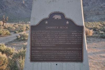
Chimney Rock
Photographed by Michael Kindig, April 24, 2010
1. Chimney Rock Marker
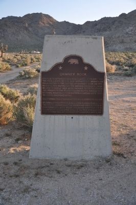
Erected 1986 by State Department of Parks and Recreation in cooperation with Billy Holcomb Chapter No. 1069, E Clampus Vitus, Lucerne Valley Museum Association, and Lucerne Valley Chamber of Commerce. (Marker Number 737.)
Topics and series. This historical marker is listed in these topic lists: Anthropology & Archaeology • Indigenous Peoples and Communities • Notable Events • Settlements & Settlers. In addition, it is included in the California Historical Landmarks, and the E Clampus Vitus series lists. A significant historical date for this entry is February 16, 1867.
Location. 34° 27.013′ N, 117° 0.235′ W. Marker is in Lucerne Valley, California, in San Bernardino County. It is at the intersection of Old Woman Springs Road (California Route 18) and Rabbit
this page online

Regionally, this marker is in Greater Los Angeles, in the Peninsular Ranges, and specifically in the Transverse Ranges. It is also in the American Southwest. Globally, it is in North America, on the Ring of Fire, on the Pacific Rim, in the Western Hemisphere, in the Western World, and in the Anglosphere. Historically, it finds itself in what was once New Spain and also Mexico’s Alta California.
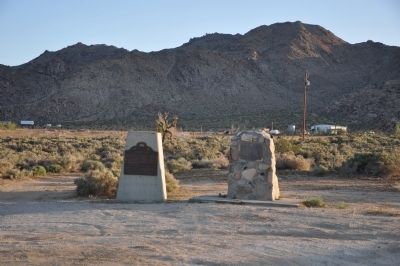
Other nearby markers. At least 8 other markers are within 15 miles of this marker, measured as the crow flies: The Last Indian Fight in Southern California (here, next to this marker); Peter Davidson (approx. 2.2 miles away); People Came and Left This Meadow (approx. 12.3 miles away); Bellevill Holcomb Valley (approx. 12.3 miles away); The Pigmy Cabin (approx. 12½ miles away); A National Hero, a Local Hero (approx. 13.6 miles away); Big Bear Solar Observatory (approx.
Photographed by Michael Kindig, April 24, 2010
2. Chimney Rock Marker
Another marker is no longer nearby. Holcomb Valley (was approx. 12.3 miles away but has been confirmed missing).
Regarding Chimney Rock. Preceding this battle of February 16, 1867 was an ambush of three young cowboys at the Dunlap Ranch (now the Las Flores Ranch) on March 25, 1866. Later, Indians who had resolved to expel the invaders from their land, fought in Little Bear Valley and were tracked to Chimney Rock by their footprints and trails of blood. The tracks were readily visible as it had recently snowed. SOURCE: Billy Holcomb Chapter 1069 35th Anniversary Plaque Book by Phillip Holdaway
Photographed by Michael Kindig, April 24, 2010
3. Chimney Rock and Last Indian Fight Markers
Photographed by Richard Hawkins, March 27, 2013
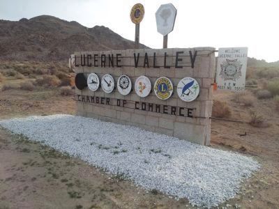
4. Lacerne Valley Sign
Credits. This page was last revised on September 4, 2024. It was originally submitted on December 18, 2011, by Michael Kindig of Elk Grove, California. This page has been viewed 2,363 times since then and 98 times this year. Last updated on March 29, 2013. Photos: 1. submitted on December 18, 2011, by Michael Kindig of Elk Grove, California. 2, 3. submitted on December 23, 2011, by Michael Kindig of Elk Grove, California. 4. submitted on March 27, 2013, by Richard Hawkins of Phelan, California. • Syd Whittle was the editor who published this page.
