Near Dickerson in Montgomery County, Maryland — The American Northeast (Mid-Atlantic)
White’s Ferry
Chesapeake and Ohio Canal National Historical Park
— National Park Service, U.S. Department of the Interior —
Inscription.
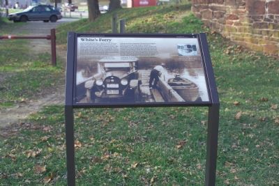
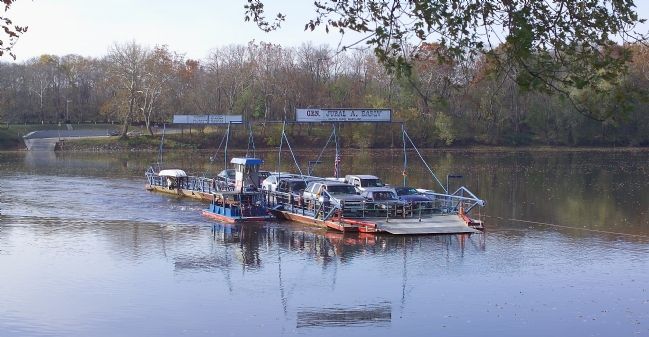
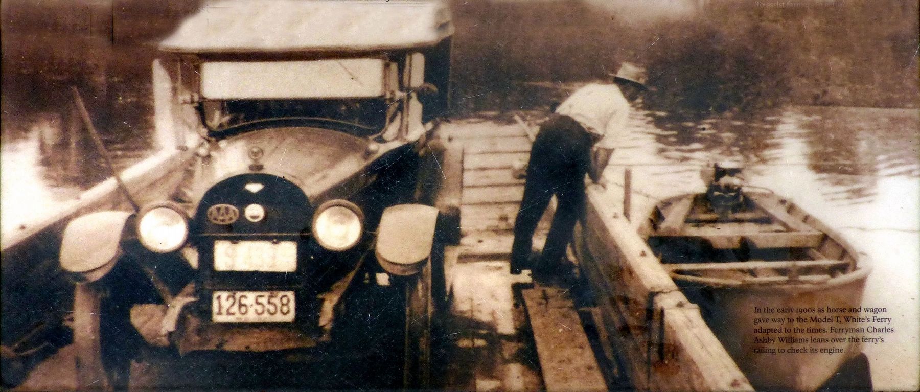
Before you is the last operating ferry on the Potomac River. Early settlers recognized these relatively still waters would provide an ideal location for a ferry. The first known ferry operation here was Conrad’s Ferry in 1817. After the Civil War, former Confederate soldier Elijah White purchased and made many improvements to the service. He named his ferry boat in honor of his former commander General Jubal Early.
More than a convenient river crossing, the ferry provided a place of commerce between the canal and surrounding community. Farmers from Virginia used the ferry to get their crops to market in Washington, D.C., and Maryland via the C&O Canal. In the days before modern refrigeration, a farmer's access to reliable transportation meant the difference between prosperity and watching a year's worth of work rot in storage. Together the canal and the ferry shortened the time it took farmers to get goods to market. Today White’s Ferry continues to serve the needs of its community by providing a safe river crossing and a living link to the past.
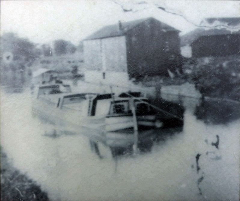
(Sidebar) To assist farmers in getting their crops to market, White built a granary along the canal to store grains until they could be loaded and shipped via the canal.
Erected by National Park Service, U.S. Department of the Interior.
Topics and series. This historical marker is listed in these topic lists: Agriculture • War, US Civil • Waterways & Vessels. In addition, it is included in the Chesapeake and Ohio (C&O) Canal series list. A significant historical year for this entry is 1817.
Location. 39° 9.284′ N, 77° 31.043′ W. Marker is near Dickerson, Maryland, in Montgomery County. Marker can be reached from the intersection of Whites Ferry Road (Maryland Route 107) and River Road. Marker is on the C&O Canal towpath at Mile 35.5, beneath the old bridge. Touch for map. Marker is in this post office area: Dickerson MD 20842, United States of America. Touch for directions.
Other nearby markers. At least 8 other markers are within 2 miles of this marker, measured as the crow flies. Chesapeake & Ohio Canal (within shouting distance of this marker); Gettysburg Campaign (about 300 feet away, measured in a direct line); a different marker also named White’s Ferry (about 300 feet away); 1862 Antietam Campaign (about 300 feet away); The History of White's Ferry (about 500 feet away); Sharpsburg (Antietam) Campaign (approx. 1.3 miles away in Virginia); Ball’s Bluff Overlook (approx. 1.6 miles away in Virginia); Union Artillery (approx. 1.6 miles away in Virginia). Touch for a list and map of all markers in Dickerson.
Regarding White’s Ferry. 2006 Fare for automobiles is $4 one way or $6 round trip. Pedestrians and bicyclists 50¢ each.
2017 Toll Ferry - Cash Only Cars One Way: $5.00 Cars Roundtrip: $8.00 Motorcycles: $3.00 Bicycle: $2.00 Pedestrian: $1.00 Trucks: Varies
Also see . . . Mutinous Ferry Roils the Waters. “Boat Owner Entangled in Licensing Dispute Ignores Coast Guard’s Order to Shut Down. ‘It’ll be a cold day in hell before they collect any money from me.’ ” 2006 Washington Post article by Frederick Kunkle. (Submitted on December 7, 2006.)
Additional commentary.
1. Heading West...
I was 23 years old in 1968, and heading west on my first cross-country motorcycle trip. I was riding a Suzuki T-500 twin, burdened with two army knapsacks for saddlebags and my backpacking gear on a tail rack.
I lived in Washington Grove, MD then, and remember hitting the Jubal A. Early ferry at about 7 AM. It was a cool morning and the water was warmer than the air, making a rising fog coming off the river. The ferry was smaller then, and would only hold about four or five vehicles. I
Photographed By Tom Fuchs, November 4, 2006
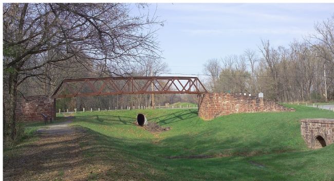
2. White's Ferry Road Crosses the C&O Canal
Sometime after the canal closed and was drained, Whites Ferry Road was rebuilt to cross the canal on a culvert, seen in this photo beyond the bridge that originally carried the road over the canal. The photographer is standing on the towpath. This marker faces the towpath just before the bridge.
But the magic that began the whole trip started with crossing the Potomac on the Jubal A, and I've never forgotten it. Glad to hear it's still crossing the river.
— Submitted August 21, 2008, by Tock Frantz of Lancaster, Massachusetts.
Photographed By J. J. Prats, November 4, 2006
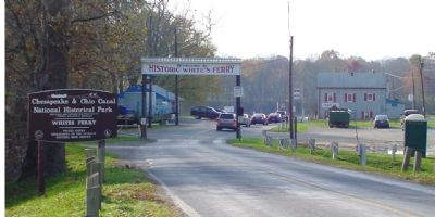
3. White's Ferry Terminal, Maryland
Cars line up for the ferry to Virginia. White's Ferry is privately owned and operated. Photographer is standing on White's Ferry Road, on the culvert over the C&O Canal. The old bridge over the canal is out of frame to the left. The gray building with the red shutters has a convenience store and restaurant on the ground level. Tree-shaded tables in a large picnic grove overlooking the river are available for a small fee.
Photographed By Craig Swain, November 3, 2007
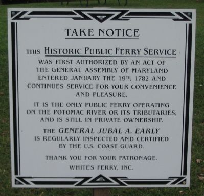
5. White's Ferry Signs
On the Maryland and Virginia sides of the ferry, these signs call notice to the historical aspects of the ferry while re-assuring travelers of safe operation:
Take Notice
This Historic Public Ferry Service
was first authorized by an act of
the general assembly of Maryland
entered January the 19th, 1782 and
continues service for your convenience
and pleasure.
It is the only public ferry operating
on the Potomac River or its tributaries
and is still in private ownership.
The General Jubal A. Early
is regularly inspected and certified
by the U.S. Coast Guard.
Thank you for your patronage.
White's Ferry, Inc.
Credits. This page was last revised on July 14, 2019. It was originally submitted on December 7, 2006, by Tom Fuchs of Greenbelt, Maryland. This page has been viewed 20,048 times since then and 309 times this year. Photos: 1, 2. submitted on December 7, 2006, by Tom Fuchs of Greenbelt, Maryland. 3. submitted on December 7, 2006, by J. J. Prats of Powell, Ohio. 4. submitted on December 7, 2006, by Tom Fuchs of Greenbelt, Maryland. 5, 6. submitted on December 5, 2007, by Craig Swain of Leesburg, Virginia. 7, 8, 9. submitted on June 16, 2018, by Allen C. Browne of Silver Spring, Maryland. • J. J. Prats was the editor who published this page.
