Victoria in Capital, British Columbia — Canada’s West Coast (North America)
Tlikwaynung
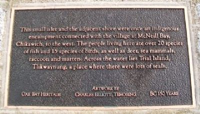
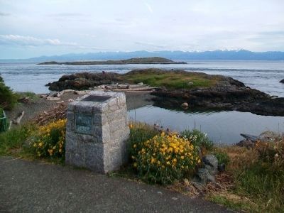
This small islet and the adjacent shore were once an indigenous encampment connected with the village at McNeill Bay, Chikawich, to the west. The people living here ate over 20 species of fish and 15 species of birds, as well as deer, sea mammals, raccoon and marten. Across the water lies Trial Island, Tlikwaynung, a place where there were lots of seals.
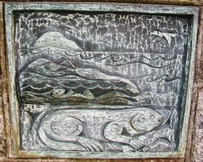
Artwork by Charles Elliott, Temoseng
BC 150 Years
Erected 2008 by Oak Bay Heritage.
Topics. This historical marker is listed in these topic lists: Anthropology & Archaeology • Environment • Native Americans • Waterways & Vessels.
Location. 48° 24.674′ N, 123° 18.43′ W. Marker is in Victoria, British Columbia, in Capital. Marker is on Beach Drive, 0.4 kilometers west of Newport Avenue, on the left when traveling west. Touch for map. Marker is at or near this postal address: 568 Beach Drive, Victoria BC V8S 2M5, Canada. Touch for directions.
Other nearby markers. At least 8 other markers are within 3 kilometers of this marker, measured as the crow flies. European exploration in the Strait of Juan de Fuca (approx. one kilometer away); Sahsima (approx. 1.2 kilometers away); Chinese Cemetery (approx. 1.3 kilometers away); a different marker also named Chinese Cemetery (approx. 1.3 kilometers away); Spewhung (approx. 1.3 kilometers away); Abkhazi Garden (approx. 1.5 kilometers away); Abkhazi Garden House (approx. 1.5 kilometers away); Oak Bay Grocery (approx. 1.8 kilometers away). Touch for a list and map of all markers in Victoria.
Credits. This page was last revised on June 16, 2016. It was originally submitted on July 14, 2014, by William Fischer, Jr. of Scranton, Pennsylvania. This page has been viewed 455 times since then and 11 times this year. Photos: 1, 2, 3, 4. submitted on July 14, 2014, by William Fischer, Jr. of Scranton, Pennsylvania.


