Marker Logo HMdb.org THE HISTORICAL
MARKER DATABASE
“Bite-Size Bits of Local, National, and Global History”
Frankfort in Franklin County, Kentucky — The American South (East South Central)
 

Daniel Boone's Grave


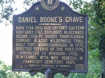
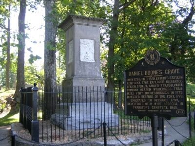
Daniel Boone's Grave Marker image. Click for full size.
Photographed By Christopher Light, July 17, 2008
1. Daniel Boone's Grave Marker
Inscription. Born 1734; died 1820. Entered Eastern Kentucky, 1767; explored Bluegrass Region, 1769-71; guided Transylvania Company, blazed Wilderness Trail, built Fort Boonesborough in 1775; directed defense of the fort, 1778; emigrated to Missouri, 1799; reinterred, with wife Rebecca, in Frankfort Cemetery, 1845.
 
Erected by Kentucky Department of Highways. (Marker Number 113.)
 
Topics and series. This historical marker is listed in these topic lists: Cemeteries & Burial SitesColonial EraForts and CastlesRoads & VehiclesSettlements & SettlersWar, US Revolutionary. In addition, it is included in the Kentucky Historical Society series list. A significant historical year for this entry is 1734.
 
Location. 38° 11.627′ N, 84° 51.968′ W. Marker is in Frankfort, Kentucky, in Franklin County. Marker can be reached from East Main (U.S. 460 / 6) near Glenn's Creek Road. Touch for map. Marker is in this post office area: Frankfort KY 40601, United States of America. Touch for directions.
 
Other nearby markers. At least 8 other markers are within walking distance of this marker. The Trabue Family Vault (within shouting distance of this marker); Kentucky's State Mound (about 300 feet away, measured in a direct line); Our Confederate Dead (about 300 feet away); Lt. Presley N. O'Bannon, USMC
Paid Advertisement
Click on the ad for more information.
Please report objectionable advertising to the Editor.
Click or scan to see
this page online
(about 300 feet away); Kentucky War Memorial (about 400 feet away); Vietnam Conflict (about 400 feet away); Korean Conflict (about 400 feet away); World War I (about 400 feet away). Touch for a list and map of all markers in Frankfort.
 
More about this marker. The entrance to the Frankfort Cemetery is at the corner of East Main (US 60 & 460) at Glenns Creek Road. Follow the cemetery road, staying to the right. You'll see a sign at the 1st intersection. After the 2nd intersection, the grave and marker are off to the right and slightly down in a wooded area.
 
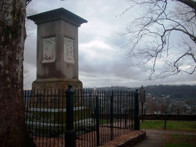
Daniel Boone's Grave Marker and Memorial image. Click for full size.
Photographed By Christopher Light, July 17, 2008
2. Daniel Boone's Grave Marker and Memorial
Daniel Boone's Grave Memorial and Marker image. Click for full size.
Photographed By John Desaulniers, Jr.
3. Daniel Boone's Grave Memorial and Marker
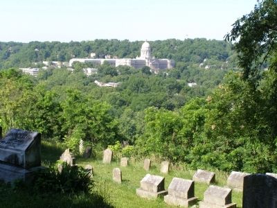
Daniel Boone's grave is in the foreground, historical marker to right, and in the background is the Kentucky State Capitol building.
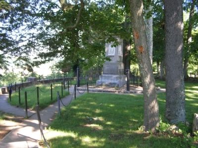
Daniel Boone's Grave from the road/parking area. image. Click for full size.
Photographed By Christopher Light, July 17, 2008
4. Daniel Boone's Grave from the road/parking area.
West face of Daniel Boone's Gravestone image. Click for full size.
Photographed By Christopher Light, July 17, 2008
5. West face of Daniel Boone's Gravestone
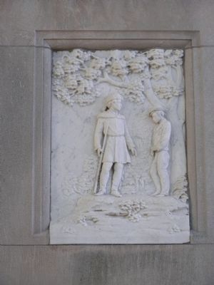
North face of Daniel Boone's Gravestone image. Click for full size.
Photographed By Christopher Light, July 17, 2008
6. North face of Daniel Boone's Gravestone
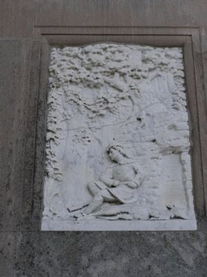
East face of Daniel Boone's Gravestone image. Click for full size.
Photographed By Christopher Light, July 17, 2008
7. East face of Daniel Boone's Gravestone
Tribute to Rebecca Boone who is also buried here.
South face of Daniel Boone's Gravestone image. Click for full size.
Photographed By John Desaulniers, Jr.
8. South face of Daniel Boone's Gravestone
View from Daniel Boone's Grave image. Click for full size.
Photographed By Christopher Light, July 17, 2008
9. View from Daniel Boone's Grave
The Kentucky State Capitol stands on a rise above the Kentucky River.
 
 
Credits. This page was last revised on November 20, 2019. It was originally submitted on July 30, 2008, by Christopher Light of Valparaiso, Indiana. This page has been viewed 8,739 times since then and 54 times this year. Photos:   1, 2. submitted on July 30, 2008, by Christopher Light of Valparaiso, Indiana.   3. submitted on May 6, 2010, by John Desaulniers, Jr. of Mingo, Iowa.   4, 5, 6, 7. submitted on July 30, 2008, by Christopher Light of Valparaiso, Indiana.   8. submitted on May 6, 2010, by John Desaulniers, Jr. of Mingo, Iowa.   9. submitted on July 30, 2008, by Christopher Light of Valparaiso, Indiana. • Kevin W. was the editor who published this page.
Share this page.  
Share on Tumblr
m=9728

CeraNet Cloud Computing sponsors the Historical Marker Database.
This website earns income from purchases you make after using our links to Amazon.com. We appreciate your support.
Paid Advertisement
Apr. 17, 2024