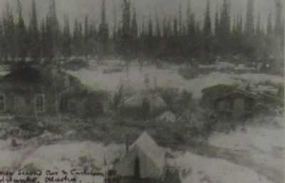
“Instead of row after row of empty houses (Dawson), they are building new stores. The place is alive and busy-a little too crowded when we got there.” – a tourist in Fairbanks, 1928 — — Map (db m47406) HM
On Front Street at Water Street, on the right when traveling south on Front Street.
At the turn of the century, Ketchikan's pioneer townsite sprouted up from the base of a rugged, uncleared rocky mountainside where it meets deep tidewater. The downtown business district was literally built upon pilings and planked decking, with . . . — — Map (db m181910) HM
On Front Street at Water Street, on the right when traveling south on Front Street.
Shipments of iced halibut from Ketchikan to outside markets was pioneered by F.J. Hunt and H.C. Strong, following similar successful methods with salmon, and a thriving business was built through the construction of two large cold storage . . . — — Map (db m181914) HM
On South Knik-Goose Bay Rd, on the right when traveling north.
Dedicated to the indomitable spirit of the
sled dogs of the Iditarod Trail Sled Dog Race.
“The Last Great Race on Earth”
Endurance • Fidelity • Intelligence
Dedicated the first Saturday of March, 2012
Historic replica of . . . — — Map (db m80411) HM
On Knik-Goose Bay Road, on the right when traveling north.
Joe Redington, Sr.
Born in Oklahoma, February 1, 1917 • Died in Alaska, June 24, 1999
Joe was an accomplished man; homesteader, big-game guide, bush pilot,
commercial fisherman, boat builder, fish-plant manager, and mountain . . . — — Map (db m80410) HM
In loving memory of
Dean H. Christopherson
1916-1992
Made possible by a generous
contribution from
Mrs. Elaine G. Christopherson
in memory of her husband
The cabin is similar to the cabin at Rohn
the eighth checkpoint on the . . . — — Map (db m80413) HM
On Alaska Highway (at milepost 1,422) at Richardson Highway, on the left when traveling north on Alaska Highway.
This highway was constructed during World War II as a military supply route for interior Alaska Military and Airfields in 1942. 7 Army regiments and 42 Contractors and Public Roads Administrators working from Delta Junction South and Dawson Creek . . . — — Map (db m59840) HM
On Taylor Highway (Alaska Route 6) at Alaska Highway (Alaska Highway 2) on Taylor Highway.
The Taylor Highway leads through some of the earliest and richest gold mining country in Alaska to the City of Eagle on the Yukon River. Gold was discovered by Franklin in 1886 and the old town of Forty Mile was located on the Yukon River at the . . . — — Map (db m49596) HM
On Richardson Highway (Alaska Route 4 at milepost 13.9).
The U.S. Army arrived at Valdez during the Gold Rush to build a trail into the interior. They found the Valdez Glacier impassable much of the year. To bypass the glacier, they cut a narrow trail along the walls of rugged Keystone Canyon. The . . . — — Map (db m49611) HM
On Richardson Highway (Alaska Route 4 at milepost 15.3).
On the far side, just above the water are the remains of the old sled trail, used in the early days. It was cut out of the rock, just wide enough for 2 horses abreast. 200 ft. above can be seen the old goat trail. This road was used till 1945. — — Map (db m49610) HM