John Hunt Morgan’s Raid - Jefferson County, Ohio Historical Markers
In 1913, the citizens of Jefferson County erected 14 bronze tablets to commemorate the 50th anniversary of Confederate Gen. John Hunt Morgan’s passage through that eastern-Ohio county on the last two days of his ill-fated Indiana-Ohio cavalry raid. Of the fourteen markers, one tablet was stolen in 2008 (#6) and another (#13) has been missing -- concrete base included -- for decades.
Near County Route 49, 0.1 miles west of Ohio Route 164, on the left when traveling west.
Gen. John H. Morgan in command of Confederate Troops passed here July 26, 1863: Burned a County bridge and proceeded northward via Nebo (now Bergholz) pursued by Gen. James M. Shackleford commanding 14th Ill. Cav., First Ky. Cav., 9th Mich. Cav., . . . — — Map (db m37439) HM
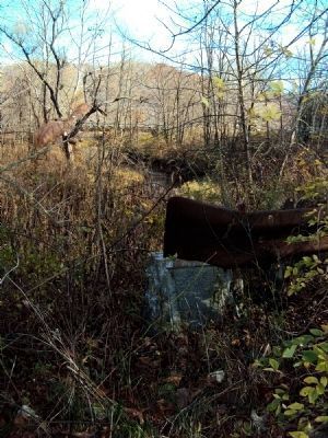
On Ohio Route 164 south of Local Road 263, on the left when traveling north.
The bronze tablet on this marker (#13) reads:
Gen. John H. Morgan in command of Confederate Troops passed here July 26, 1863: Burned a County bridge and proceeded northward via Nebo (now Bergholz) pursued by Gen. James M. Shackleford . . . — — Map (db m37759) HM
On Ohio Route 150, 0.1 miles west of Main Street, on the right when traveling east.
Gen. John H. Morgan in command of Confederate Troops on July 25, 1863, passed Updegraff's Mills then located here; proceeded northward via "Dry Fork Valley" and Smithfield; pursued by Gen. James M. Shackleford commanding 14th Ill. Cav., First Ky. . . . — — Map (db m37753) HM
On Dry Fork Road (County Highway 8) at State Route 150, on the right when traveling north on Dry Fork Road.
Gen. John H. Morgan in command of Confederate Troops passed here July 25, 1863; proceeded northward via “Dry Fork Valley” present site of Bradley and Smithfield, pursued by Gen. James M. Shackelford commanding 14th Ill. Cav., 1st Ky. Cav., 9th Mich. . . . — — Map (db m37147) HM
On Ohio Route 43 at Mill Street, on the left when traveling east on State Route 43.
Gen. John H. Morgan in command of Confederate Troops passed through this village July 26, 1863; proceeded northward via Circle Green and Nebo (now Bergholz) pursued by Gen. James M. Shackelford, commanding 14th Ill. Cav., First Ky. Cav., 9th Mich. . . . — — Map (db m37758) HM
On Green Street at East Main Street (U.S. 250), on the right when traveling east on Green Street.
General John H. Morgan in command of Confederate Troops entered Jefferson County here July 25, 1863; proceeded northward via Short Creek Valley, Smithfield and other Villages, pursued, under orders of Gen. Ambrose E. Burnside, by Gen. James M. . . . — — Map (db m37146) HM
On Ohio Route 164 at County Road 55, on the left when traveling east on State Route 164.
Gen. John H. Morgan in command of Confederate Troops passed through this village July 26, 1863; proceeded northward toward Salineville pursued by Gen. James M. Shackelford, commanding 14th Ill. Cav., First Ky. Cav., 9th Mich. Cav., 11th Mich. Bat'y, . . . — — Map (db m37760) HM
On New Alexandria Road (Ohio Route 151) at Chappel Hill Road (Local Highway 184), on the right when traveling west on New Alexandria Road.
Gen. John H. Morgan in command of Confederate Troops passed through this village July 25, 1863; proceeded northward via McIntire and Cross Creek Valleys and Wintersville, pursued by Gen. James M. Shackelford, commanding 14th Ill. Cav., First Ky. . . . — — Map (db m37752) HM
On County Highway 74 at Local Highway 166, on the left when traveling east on County Highway 74. Reported missing.
(Plaque missing; text from 1913 Steubenville Herald)
Gen. John H. Morgan in command of Confederate Troops passed here July 25, 1863; proceeded northward up Cross Creek valley, via Wintersville, pursued by Gen. James M. Shackelford . . . — — Map (db m36217) HM
On Local Highway 166, 0.5 miles north of County Highway 74, on the left when traveling north.
Gen. John H. Morgan in command of Confederate Troops passed here July 25, 1863; burned a bridge of the Steubenville and Indiana R.R. proceeded northward via Ekey Church, "Dry Fork Valley" and Wintersville, pursued by Gen. James M. Shackelford, . . . — — Map (db m36222) HM
On East Main Street (Ohio Route 43) at Ohio Route 152, on the left when traveling east on East Main Street.
Gen. John H. Morgan in command of Confederate Troops passed through this village July 26, 1863: proceeded northward via Circle Green and Nebo (now Bergholz) pursued by Gen. James M. Shackelford, commanding 14th Ill. Cav., First Ky. Cav., 9th Mich. . . . — — Map (db m37757) HM
On Main Street (Ohio Route 152) 0.2 miles south of Ohio Route 151, on the left when traveling north.
Gen. John H. Morgan in command of Confederate Troops passed through this village July 25, 1863; proceeded northward via New Alexandria, pursued by Gen. James M. Shackelford, commanding 14th Ill. Cav., First Ky. Cav., 9th Mich. Cav., 11th Mich. . . . — — Map (db m36213) HM
On Main Street (Ohio Route 43) at Fernwood Road, on the right when traveling east on Main Street.
Gen. John H. Morgan in command of Confederate Troops passed here July 25, 1863; proceeded northward via Richmond pursued by Gen. James M. Shackelford, commanding 14th Ill. Cav., First Ky. Cav., 9th Mich. Cav., 11th Mich. Bat'y, 86th Ohio Mounted . . . — — Map (db m35779) HM
On Canton Road (Ohio Route 43) 0.2 miles north of U.S. 22, on the right when traveling south.
Gen. John H. Morgan in command of Confederate Troops passed here “Two Ridges Church” July 25, 1863; proceeded northward via Richmond pursued by Gen. James M. Shackelford, commanding 14th Ill. Cav., First Ky. Cav., 9th Mich. Cav., 11th . . . — — Map (db m37754) HM