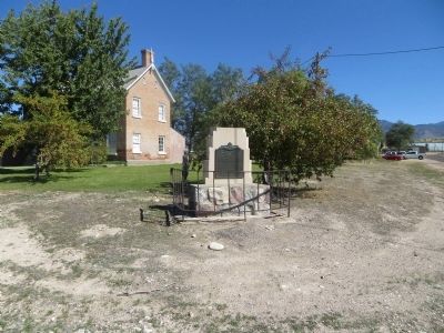
Erected 1855-56, was 150 feet long north and south by 75 feet wide. Facing each other and standing 30 feet apart were two rows of adobe houses. The gateways were in the north and south walls.
Richard Johnson and William Stevens, Sr. and families . . . — — Map (db m69575) HM
In 1853, Captain John W. Gunnison was selected to lead an expedition to find a trans-continental railroad route. He followed the Old Spanish Trail through Salina Canyon, over the mountains to Pahvant Valley, and upon reaching Fillmore, visited . . . — — Map (db m69536) HM
This pioneer cabin was built in December 1907 by Henry J. McCullough and was the second house in the town of Melville. One month later January 18, 1908, the first Post Office was established and the name changed to Burtner. Adjoining this cabin, on . . . — — Map (db m69546) HM
This marks the Southwest corner of the Fort, built in October and November 1851 as protection from Indians, by first 17 families under direction of Anson Call, Jesse W. Fox, surveyor. About 2 city blocks in size, the front wall 8 to 10 feet high was . . . — — Map (db m69583) HM
These stones, quarried in Chalk Creek and hauled by oxen in 1854, were used in the foundation of the two-storied 30 x 40 adobe church building located in the Pioneer Fort one half block east of Main Street. Remodeled into one 30 x 60 hall with oval . . . — — Map (db m69580) HM
In 1849, after a peace treaty was signed between Mexico and the United States, Congress was petitioned to admit the State of Desert to the Union. However, this petition was denied and the Organic Act of September 9, 1850, created the Utah Territory. . . . — — Map (db m69578) HM
It all began in the small community of Circleville, Utah, back in the summer of 1988. Two lifelong friends were sitting on a pick up tail gate, enjoying a Coke, and speculating about the recent closure of Hwy 53 to OHV's. With this closure, they . . . — — Map (db m272244) HM
Creating Fillmore City and Millard County the Territorial Legislature of Utah selected Pahvant Valley, as Capitol site October 29, 1851. This spot was selected by Governor Brigham Young. Construction work began in 1852. Truman O. Angell, architect . . . — — Map (db m1277) HM
Thin black lines indicate changes in relevance. Between each pair of lines entries are ordered geographically but all have the same relevance.
* Inflectional forms of words are their plurals, singulars, and possessives as well as gramatical tenses and similar variations.