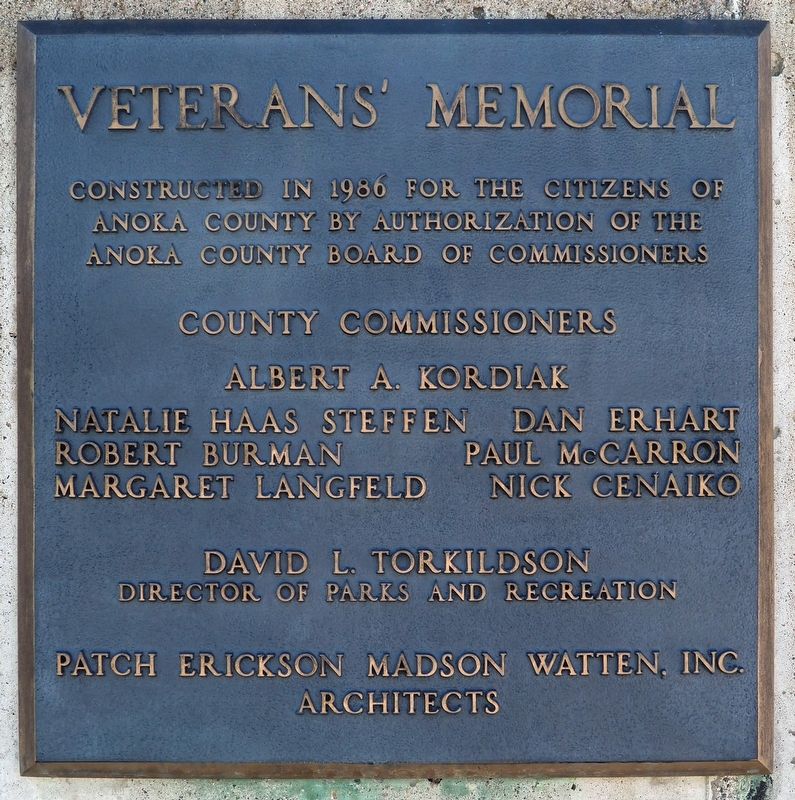
Constructed in 1986 for the citizens of Anoka County by authorization of the Anoka County Board of Commissioners
County Commissioners
Albert A. Kordiak • Natalie Haas Steffen • Dan Erhart • Robert Burman • Paul McCarron • Margaret . . . — — Map (db m280514) WM
Logs were cut in the winter and stacked on the riverbank until they could be floated down river in the spring. Many rivers carried logs from more than one logging camp, so it was important to know which logs came from which camps. Before . . . — — Map (db m248813) HM
Throughout history, the Mississippi River has been the artery of life for the Minneapolis St. Paul metropolitan area and the State of Minnesota. In the late 19th and early 20th centuries, the Mississippi powered flour mills and industries. . . . — — Map (db m294456) HM
The Rum River, a 148 mile river of gradual grade, is rich in history. The French explored it. The Chippewa and Sioux fought along it, and the pine logs that helped build the cities of the Midwest were floated down it during the lumber boom of the . . . — — Map (db m94721) HM
Itasca grew up around an Indian trading post which was established 800 feet east of here in 1849 by Thomas A. Holmes and James Beatty. At the suggestion of Territorial Governor Alexander Ramsey, the settlement was named in honor of Lake Itasca, the . . . — — Map (db m69908) HM
On this spot on September 16, 1958, a U.S. Air force B-52D bomber crashed while on a Cold War training mission originating from Loring Air Force Base, Limestone, Maine. Seven crewmen gave their lives for their country. They were:
Captain Wm. . . . — — Map (db m230711) HM
The original dam was built in 1913 and had 28 steel gates. The gates moved up and down to allow different amounts of water to flow under them. The current dam was completed in 1997 and is fitted with five crest gates. These gates maintain . . . — — Map (db m74833) HM
Map from the book, The Red River Trails by Gilman, Gilman, and Stultz. Minnesota Historical Society Pres, 1979.
Transportation is the key to the development of any community. The Rum and Mississippi Rivers were the . . . — — Map (db m249485) HM
Logging on the Rum River stretched from Mille Lacs to Anoka. This crew included J.W. Freeburg in 1894. Courtesy of the Anoka County Historical Society.
The last log drive on the Rum River occurred in the 1890's when the . . . — — Map (db m249652) HM
Built in 1872 by W.D. Washburn & Co., the mill had an annual production of 16 million board feet of lumber. Combined with the planing mills, dry kilns, etc., the mill employed about 125 men. For 17 years logs from the headwaters of the Rum . . . — — Map (db m242327) HM
The Mississippi River forms a unique and complex ecosystem spanning 2000 miles. From its origin at Lake Itasca in Northern Minnesota to its outlet in the Gulf of Mexico the river encompasses a diversity of life found only in a very few places . . . — — Map (db m70908) HM
1880 – Albin Riedel immigrated from Germany to New York City. He accepted a job offer to work on a farm in Minnesota. After earning enough money, he purchased land in Fridley and built this large farmhouse.
1889 – Swedish immigrant, . . . — — Map (db m248740) HM
Three stone houses were built during the 1920's by Thaddeus P. Giddings (1969-1954). Giddings was the Supervisor of Music for the Minneapolis Schools and founder of the National Music Camp in Interlachen, Michigan. The stone houses were part . . . — — Map (db m70825) HM
Washburn Saw Mill Chimney
On July 13, 1907, in front of a crowd of 3,000 onlookers, the iconic 90-foot Washburn Saw Mill chimney was razed. The chimney was constructed of approximately 125,000 Kelsey bricks; a high-quality . . . — — Map (db m248997) HM
Twenty thousand years ago, a great sheet of ice, the Superior lobe, covered this
area. At its farthest advance, it formed the St. Croix moraine, a series of high hills to the
west, south, and east. When it melted, it left behind vast . . . — — Map (db m70297) HM
Why Settle Here? Looking for Work
Timber was a resource that drew many west and in 1847, surveyor Daniel Stanchfield noted, "Seventy mills in seventy years couldn't exhaust the white pine I have seen on the Rum River". The rivers . . . — — Map (db m70982) HM
Thin black lines indicate changes in relevance. Between each pair of lines entries are ordered geographically but all have the same relevance.
* Inflectional forms of words are their plurals, singulars, and possessives as well as gramatical tenses and similar variations.