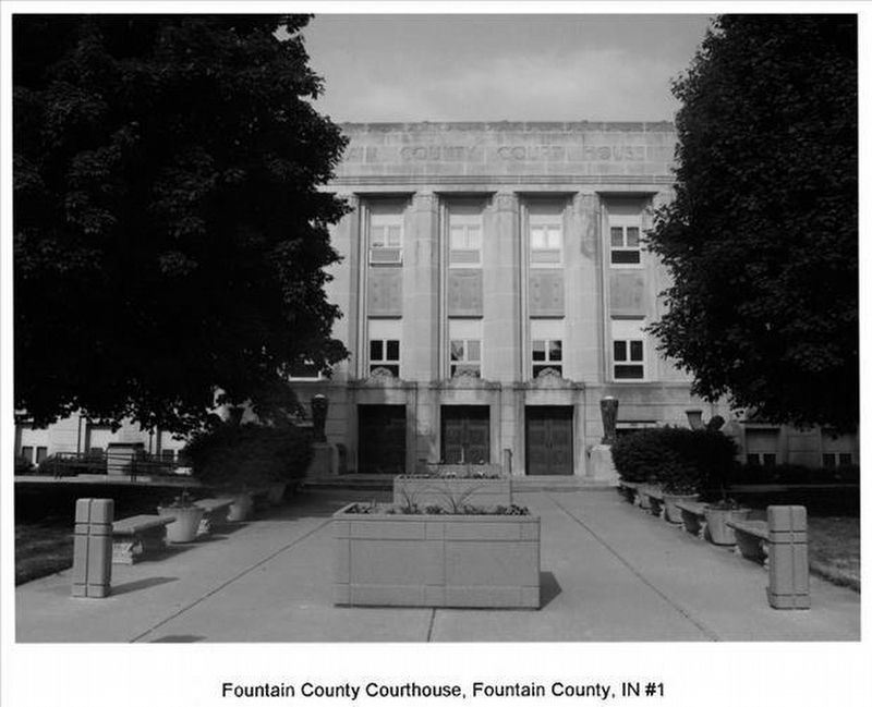
On 4th Street north of Liberty Street, on the left when traveling north.
Fountain County Court House
1937
has been placed on the
National Register of Historic Places
by the United States Department
of the Interior — — Map (db m37241) HM
On West Washington Street, on the right when traveling west.
In fall 1846, residents of Covington and Attica skirmished at Lock 35 over lack of water to Covington. Heavy rains eventually resolved the problem. Competition among canal towns over water control was often intense. First boat reached Attica 1846 . . . — — Map (db m305785) HM
On U.S. 41 south of East Stone Bluff Road, on the right when traveling south.
Birch - Colvert Cemetery
Also Known As
Stone Bluff Cemetery
Beneath this hallowed ground rests the souls of many long-forgotten loved ones. Their gravestones destroyed by the hand of man: and the physical boundaries of . . . — — Map (db m77583) HM
On West Washington Street east of South Market Street, on the right when traveling west.
Construction began on the Wabash and Erie Canal in 1832 to connect Lake Erie to the Ohio River, making travel and trade easier and cheaper. Towns along the route prospered as increased commerce fostered urban and agricultural growth. By 1846, the . . . — — Map (db m305786) HM
On Ravine Park Boulevard near East Jackson Street, on the right when traveling north.
American Indians frequented this area, rich in natural resources. The ravine provided water from natural springs, marl for lime, and clay for bricks for nineteenth-century residents of Attica, platted 1825. City became owner of ravine 1906 when . . . — — Map (db m3311) HM
On Main Street at West First Street, on the left when traveling south on Main Street.
(Engraved near the top are the Seals of the United States Army, United States Navy, United States Army Air Corps, United States Marine Corps, and United States Coast Guard) — — Map (db m7804) WM
On North Portland Arch Road west of County Road W400N, on the left when traveling west.
Shawnee Township
Wabash - Erie Canal
1846 - 1875
The Canal extended from Toledo, Ohio to Evansville, Indiana. Construction on the 376 mile section in Indiana began in 1832 and completed through Fountain County in 1846.
One to six horses in . . . — — Map (db m20364) HM
On U.S. 41 at County Road E 100 N, on the right when traveling north on U.S. 41.
Famous orator - Representative in Congress, 1861-66, 1869-73; U.S. Senator, 1877–1897; chief promoter of the building of the Library of Congress. — — Map (db m3232) HM
Historic Landmarks of Fountain County
Award Presented to Fountain County Art Council
for Restoration and Preservation of
Fountain County Clerk's Building Built 1842. — — Map (db m21155) HM
On Business State Road 55 near Business State Road 341, on the left when traveling east.
Richland Township
Site of National Corn Husking Contest in 1935.
4 Blocks West - - -
Cobb Farms and L.K. Mitchell and Family Hosts.
Lawrence Pitzer of Fountain County Represented Indiana and later became National Champion in 1939. . . . — — Map (db m3405) HM
On State Road 25 north of County Road 1125 N, on the right when traveling north.
The first horse thief detective association organized in the U.S.A. was founded at this place June 1845 and incorporated February 1848.
* * * Incorporators * * *
James Meharry, William Cosseboon, Absolom Kirkpatrick, Jesse MeHarry, . . . — — Map (db m36199) HM
On Wabana Common near Gable Drive, on the left when traveling south.
Henry Curtner arrived in Washington Township in 1852. A native of Fountain County, Indiana, Curtner became a prominent farmer, businessman, and philanthropist in the Warm Springs Area. Curtner’s ranch compromised several thousand acres and . . . — — Map (db m219704) HM
On U.S. 136 at South Layton Station Road, on the left when traveling west on U.S. 136.
Peter and James Layton, half brothers, came from New York, 1853. Here was the train stop for the residents of the area of the Plank Road ½ mile south. There a blacksmith shop, grocery, the stage stop, “Halfway House” were located. — — Map (db m3466) HM
Thin black lines indicate changes in relevance. Between each pair of lines entries are ordered geographically but all have the same relevance.
* Inflectional forms of words are their plurals, singulars, and possessives as well as gramatical tenses and similar variations.