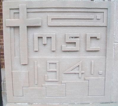
These 32 acres and buildings were purchased by the Kane County Board and the Forest Preserve Commission in October 1972 A.D. from The Society of the Missionaries of the Sacred Heart. — — Map (db m94262) HM
Near The Illinois Prairie Path near South 1st Avenue (Illinois Route 171), on the left when traveling west.
Praire Insects
This native garden is only a small fraction of the prairie that was once here. However, the bright colors and nectar of the forbs (wide-leaved flowering plants) and the shelter and food that the grasses provide, attract many . . . — — Map (db m235083) HM
On Lincolnway Street at Airport Road, on the right when traveling south on Lincolnway Street.
In 1914 Kane County's first paved portion of the Lincoln Highway was comparable to a seedling mile. This stretch of concrete road was 18 feet in width, three-quarters of a mile in length, and constructed on the Lincoln Highway by the Loyal Order of . . . — — Map (db m299074) HM
On Riverside Avenue at Main Street (Illinois Route 64), on the right when traveling north on Riverside Avenue.
The Lincoln Highway provided travelers easy access to vacation getaways along its route and corridor. Eye-catching roadside advertising directed motorists to the cultural activities of St. Charles and the scenic beauty and recreational opportunities . . . — — Map (db m258124) HM
On South Main Street just south of 1st Street, on the right when traveling south.
The 1838 Greek Revival Peleg Young Bliss House is an example of post and beam construction, which utilizes large wooden timbers joined together with wooden pegs. While this construction technique was commonly used in homes, churches, barns and . . . — — Map (db m235370) HM
On State Street (U.S. 89) at Muddy Creek Road, on the left when traveling north on State Street.
Settlement of Long Valley and Mt. Carmel
The first written account of the exploration of Long Valley was given by John D. Lee in 1852. Coming from Parowan, the explorers were under the direction of Bishop John R. Smith. James Lewis kept the . . . — — Map (db m40584) HM
Near Winfield Road (County Route 13) near Butterfield Road (Illinois Route 56).
While visiting St. James Farm during weekends, Chauncey and Marion McCormick indulged their passion for equine sport by riding horses. Although all three of the McCormicks' sons learned to ride while young, it was Brooks' love for his Shetland pony . . . — — Map (db m288788) HM
On Main Street (Illinois Route 64) west of 3rd Avenue.
This bell was cast at the William Kaye foundry in Louisville, Kentucky, and was then mounted on the "Frank Pargoud," a steamboat built in 1868 for Capt. John Tobin and named for Confederate Civil War General, J.F. Pargoud. The Pargoud operated for . . . — — Map (db m257935) HM
Near West Holmes Street (Illinois Route 3) south of Bridge Bypass Road.
Elias Kent Kane, architect of the state's first constitution was born in New York in 1794. Kane studied law and began his practice in Tennessee. In 1814 he moved to Kaskaskia, where he was appointed a judge of the Illinois Territory. Active in . . . — — Map (db m161382) HM
On Niles Center Road at Galitz Street, on the left when traveling north on Niles Center Road.
Father Arthur R. Sauer has spent 34 years as a civic leader in Skokie, tenaciously working to make the village a better place to live.
As pastor of St. Peter's Parish, he developed exceptional school programs which won national awards. As a . . . — — Map (db m242974) HM
Major Campaigns and Deaths
San Juan Heights/El Caney, Cuba (6/98-7/98) 1,475
Cuba Campaign (6/98-8/98) 350
Battle of February 4th, Philippines (2/99) 60
Balangiga Massacre, Philippines (9/01) 48
Manila, Philippines . . . — — Map (db m94845) WM
Major Campaigns and Deaths
Meuse-Argonne, France (9/18-11/18) 26,277
Aisne-Marne, France (7/18-8/18) 6,992
Somme, France (8/18-11/18) 3,221
Oise-Aisne, France (8/18-11/18) 1,919
St. Mihiel, France (9/18) 1,799 . . . — — Map (db m94883) HM WM
Thin black lines indicate changes in relevance. Between each pair of lines entries are ordered geographically but all have the same relevance.
* Inflectional forms of words are their plurals, singulars, and possessives as well as gramatical tenses and similar variations.