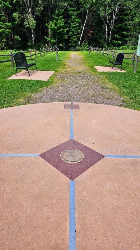
Latitude
Latitude is the angular distance on Earth measured North or South of the equator (0° latitude) in degrees, minutes, and seconds. The equator is considered the longest latitude line on Earth measuring 24,901.55 miles. You . . . — — Map (db m268758) HM
Near Scott Street (State Highway 52) near Washington Street.
The earliest American settlers were drawn to Big Bull Falls for the timber business, but other businesses soon sprouted. Lumbermen and their families needed supplies and services. Soon after George Stevens built the first sawmill Wausau began to . . . — — Map (db m44645) HM
Near Mcindoe Street, on the right when traveling north.
The Wisconsin Workmen's Compensation Act of 1911 assured victims of work-related accidents or illnesses just compensation regardless of fault. With this law, enacted on May 3, 1911, Wisconsin became the first state to have a constitutional system . . . — — Map (db m17859) HM
This trail was originally a railway built between Eland and Wausau by the Milwaukee, Lake Shore and Western Railway.
In 1996, the Friends of Mountain-Bay State Trail, the Wisconsin State Parks System and Marathon County Parks worked together . . . — — Map (db m138807) HM
On Norrie Road west of Bradley Street, on the left when traveling west.
On the shore of this peaceful lake was once the busy little town of Norrie. Norrie was originally part of Hatley, but during the 1880 Prohibition this part of town was named after Gordon Norrie.
It was said that one of the largest stands of . . . — — Map (db m138940) HM
In the 1800's, Callon was a busy stop for trains transporting lumber, potatoes and pickles from local farmers. The power of the Eau Claire River inspired the construction of many sawmills, including the portable mill operated by William Callon. . . . — — Map (db m138865) HM
Snowmobiling is a very popular winter activity for many outdoor enthusiasts. The Mountain-Bay State Trail is a major link in the more than 22,000 miles of Wisconsin snowmobile trails. Snowmobiles can travel over 70 miles from Weston to . . . — — Map (db m138862) HM
On Berlin Lane at Naugart Drive, on the right when traveling south on Berlin Lane.
In the 1850s, in the midst of Wisconsin's lumber boom, a large migration of Germans helped settle Marathon County. This group hailed from Pomerania, a former Prussian province in present-day northern Germany and Poland. Immigration continued for the . . . — — Map (db m86951) HM
Near Scott Street (State Highway 52) near Washington Street.
In the early 1800s, timber supplies were coming to an end in the eastern United States. The Westward Expansion—the settlement of the prairies and mountainous regions west of the Mississippi—was driving the hunger for more timber with which to . . . — — Map (db m44309) HM
Near Scott Street (State Highway 52) near Washington Street.
If you were a French voyageur in the 1600s or arrived with George Stevens in 1838, you would have heard and seen large rapids churning and bubbling here in front of you. Without dams, the river was much shallower than it is now. It swirled and . . . — — Map (db m44343) HM
On South Main Street at Iola Street, on the right when traveling south on South Main Street.
Side 1 The Central Wisconsin Electric Cooperative celebrated its 75th anniversary in 2012. It dates to Peter M. Johnson, Ed A. Leer, William Selmer, and Erick Solberg – all of rural Iola – and K. M. Sannes of rural Scandinavia . . . — — Map (db m123206) HM
On West Stewart Avenue (State Highway 52) at South 8th Avenue, on the right when traveling east on West Stewart Avenue.
Rural Teacher Training needs became apparent in Marathon County before the turn of the century. John F. Lamont, Marathon County School Superintendent, investigated the problem and urged Senator A. L. Kruetzer to introduce legislation in the 1887 . . . — — Map (db m87007) HM
Near River Drive 0.1 miles south of Washington Street (Wisconsin Highway 52), on the right when traveling south.
Clean drinking water has always been important, but in 1885, Wausau Water Works was built for a different reason — to supply water for fighting fires. 1885 was an especially bad fire year in Wausau. There were 23 alarm fires, including a . . . — — Map (db m48064) HM
Near Park Road 2.2 miles west of County Highway N, on the right when traveling west.
From the 1840's to 1920's, logging overshadowed all other industries in Wisconsin. The state's northern pine forests became "pineries," providing logs to meet the nation's increasing demand for building materials.
Timber cut from these pineries . . . — — Map (db m74237) HM
Thin black lines indicate changes in relevance. Between each pair of lines entries are ordered geographically but all have the same relevance.
* Inflectional forms of words are their plurals, singulars, and possessives as well as gramatical tenses and similar variations.