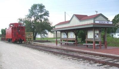
On Thompson Avenue at 4th Street, on the left when traveling south on Thompson Avenue.
1860...
Vision of Prosperity
Welcome to Sedalia, Pettis County seat and home of the Missouri State Fair. Sedalia, originally named Sedville, began as a vision in the mind and on the farm of George R. Smith. "Sed" was the nickname of . . . — — Map (db m85305) HM
On Ohio Avenue (Missouri Route 750) south of 4th Street, on the left when traveling south.
Block of ground donated
by Gen. Geo. R. Smith
Building erected 1924
County Court
Presiding Judge J. L. McCurdy
Associate Judges G. W. Teeter
S. M. Williams
A. R. Barnes, Supt
-------------
Corner Stone Laid
Feb. 7, 1924 • A. L. . . . — — Map (db m85193) HM
On 2nd Street at Roe Street, on the right when traveling east on 2nd Street.
The Katy Railroad was not the first to use this route from Boonville to Sedalia. Founders named this place Pilot Grove in 1820 because a local grove of trees "piloted" travelers along the divide between the Lamine River and Petite Saline Creek. . . . — — Map (db m247229) HM
Near Katy Trail 0.3 miles west of Oxline Road, on the right when traveling west.
You may not have noticed, but at 955 feet above sea level, you have reached the "summit" of Katy Trail State Park. You are standing on the Osage Plains, named after the Osage people who were once the dominant tribe in western Missouri. At . . . — — Map (db m272490) HM
On Thompson Avenue at 4th Street, on the left when traveling south on Thompson Avenue.
Green Ridge, the next trail head west, is 12.1 miles from here. The grade between these two trail heads remains fairly level, with a slight decline beyond the Missouri State Fair. The grade increases past Campbell Siding and decreases again to . . . — — Map (db m85315) HM
Near East McCarty Street just west of Locust Street, on the left when traveling west.
Civil War Jefferson City
In spring 1861, Missouri was a slave state divided over the issue of secession. An uneasy peace existed between pro-Confederate state government militia and Union forces headquartered in St. Louis. On June 11, 1861, . . . — — Map (db m169364) HM
Near Katy Trail west of County Highway BB, on the right when traveling west.
1830…
Mill on the Lamine River
Although Clifton City is a railroad town, the Lamine River is the original reason for the town's location. George Cranmer of Paris, Ky., settled on the Lamine in 1832, at what later became the Missouri, . . . — — Map (db m272505) HM
On Thompson Avenue at 4th Street, on the left when traveling south on Thompson Avenue.
Clifton City, the next trail head east, is 11.7 miles by way of the old rail corridor. Due to an undeveloped section of trail immediately east of here, some travel over city streets is required, adding slightly to that distance. The grade is . . . — — Map (db m85314) HM
Thin black lines indicate changes in relevance. Between each pair of lines entries are ordered geographically but all have the same relevance.
* Inflectional forms of words are their plurals, singulars, and possessives as well as gramatical tenses and similar variations.