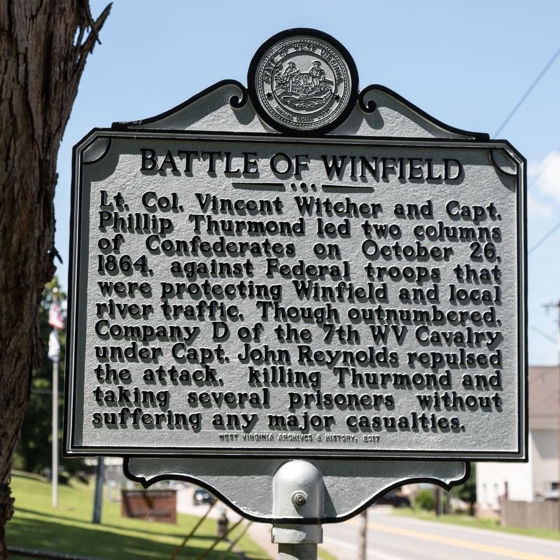
On Winfield Road (West Virginia Route 817) just north of Courthouse Drive, on the right when traveling south.
Sited on land owned by Charles
Brown, who started a ferry here in
1818, the town was named for Gen.
Winfield Scott, Mexican-American
War hero. Putnam County’s seat,
it was incorporated in 1868. Its
location along the Kanawha made
it an . . . — — Map (db m137350) HM
On Courthouse Drive at Emergency Lane / Sabre Street, on the right when traveling south on Courthouse Drive.
A Microcosm
Historians use the word microcosm as shorthand to show that a piece is
representative of the whole. “A house divided against itself,” Putnam
County sent approximately 10% of its population to war, nearly half to . . . — — Map (db m137355) HM
On Kanawha Boulevard at Morris Street, on the left when traveling south on Kanawha Boulevard.
Born in Kanawha County on 19 September 1892. Began work as a miner at age ten, and served as field organizer, UMWA. Noted as leader of 1921 Armed March. Indicted for treason but later acquitted. President of District 17 and vice-president of West . . . — — Map (db m23011) HM
On Courthouse Drive at Emergency Lane / Sabre Street, on the right when traveling south on Courthouse Drive.
Planting Roots in Putnam County
James William Hoge was born on April 9, 1830 in Staunton, Augusta County, Virginia to Reverend Peter C. and
Sallie Kerr Hoge. He studied law and was admitted to the bar at age 20 in 1850, later moving to . . . — — Map (db m247236) HM
Near Main Street north of Rices Landing Road (County Route 1010), on the left when traveling north.
Coal Seam
The Pittsburgh Coal Seam is the thickest and most extensive coal bed in the Appalachian Basin. The Upper Pennsylvanian Pittsburgh coal bed extends over 11,000 square miles through 63 counties. It extends from Allegany County, . . . — — Map (db m182022) HM
On Mate Street (West Virginia Route 49) at Bridge Street, on the left when traveling south on Mate Street.
John W. English. “We had an idea. Build trails for riders from all over the country to come here to enjoy the
beautiful mountains and to interact with the people of West Virginia.
Build the trails on private property with the cooperation of . . . — — Map (db m178367) HM
On Lafayette Street (West Virginia Route 62) at High Street, on the right when traveling north on Lafayette Street.
Chartered in 1837, the town of Buffalo predates the formation of Putnam County in 1848. Possibly named
after the nearby Big Buffalo Creek, the town was from its beginnings inextricably tied to river trade and
to agriculture. In its early days, . . . — — Map (db m137327) HM
Near Winfield Road (West Virginia Route 817) north of Ventroux Road, on the right when traveling north. Reported unreadable.
The 1861 Kanawha Valley Campaign
Union and Confederate leaders both wanted control of the Kanawha Valley, an approach to the Confederate capital at Richmond, Virginia, filled with such important resources as salt and soldiers, whose loyalty . . . — — Map (db m268902) HM
On Charleston Road (U.S. 119) south of River Road (Local Route 34), on the left when traveling north.
The Pocatalico River keeps alive the Indian word which meant “Plenty of Fat Doe.” Here early hunters and trappers brought their furs and by canoe made their way down this stream to Great Kanawha River and markets. — — Map (db m137923) HM
Thin black lines indicate changes in relevance. Between each pair of lines entries are ordered geographically but all have the same relevance.
* Inflectional forms of words are their plurals, singulars, and possessives as well as gramatical tenses and similar variations.