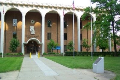
On Park Avenue East, on the right when traveling east.
Civil War
CPT David L. Cockley Georgia 1864
CPT Joseph S. Hedges Tennessee 1864
CPL Smith Larimer Virginia 1865
PVT John Henry Ricksecker Tennessee 1864
SGT James Wiley Pennsylvania 1863
Indian Campaigns
COL Ret. Walter Matthias Day . . . — — Map (db m20860) HM
On Marietta Road (Ohio Route 821) just north of Route 339, on the right when traveling south.
In memory of John Chapman, famous “Johnny Appleseed.” Born in Leominster, Mass., Sept. 26, 1774, died in Fort Wayne, Ind. March 18, 1845.
Without a hope of recompense, / Without a thought of pride, / John Chapman planted apple trees, / and . . . — — Map (db m121825) HM
On Brinkerhoff Avenue at Summit Street, on the right when traveling south on Brinkerhoff Avenue.
John Chapman - better known as “Johnny Appleseed” - Pioneer Apple Nurseryman - lived in & around Mansfield for 20 years - 1810 to 1830. — — Map (db m20705) HM
On Monticello Highway (State Highway 11) south of Jackson Road, on the right when traveling north.
Sunshine Church II, built in 1880 and dedicated in 1883 by Rev. Sam Jones, replaced old Sunshine Church, two miles south of here, which General Sherman’s troops burned in 1864. A wounded northern prisoner, B.F. Morris, Shelby, Ohio, cared for by . . . — — Map (db m8897) HM
On Pleasant Valley Road (Ohio Route 303) west of Route 603, on the right when traveling west.
In 1819, David Schrack immigrated from Pennsylvania to Richland County. Ohio where he and his wife Elizabeth established a farm, a mill, and a family of fourteen children. To accommodate their growing family, the Schracks constructed this large . . . — — Map (db m269829) HM
On South High Street at Church Street, on the right when traveling north on South High Street.
On December 30, 1847, six educators met at the Summit County Courthouse to organize the first convention of the Ohio State Teachers' Association, now known as the Ohio Education Association (OEA). The organizers Josiah Hurty (Richland County), . . . — — Map (db m299758) HM
On Wood Street at West First Street, on the right when traveling north on Wood Street.
The Barker Family Home. Generations of the Barker family lived in the house that stood at 89 Wood Street from 1875 to 1973. George W. Barker (1836-1913) was born enslaved in Virginia, emancipated age 13, and settled in Mansfield by 1870. He . . . — — Map (db m309437) HM
On Park Avenue West (Ohio Route 430), on the right when traveling west.
On April 27, 1865 the Sultana, a 260 foot, wooden-hulled, steamboat exploded, burned, and sank on the Mississippi River near Memphis, Tennessee. Approximately 2400 people were on board, six times the ship's legal limit. More than 1700 lives were . . . — — Map (db m20888) HM
On Park Avenue East, on the right when traveling east.
The purpose of the Mansfield Ohio Gold Star Families Memorial Monument is to honor Gold
Star Families, preserve the memory of the fallen, and stand as a stark reminder that freedom is not free. This stunning black granite monument features two . . . — — Map (db m181455) WM
Near Ohio Route 46 east of County Road 29, on the left when traveling east.
The Missionaries of the Precious Blood established in Italy in 1815, and the Sisters of the Precious Blood established in Switzerland in 1834, began their American ministry in 1844 in Peru, Ohio. In 1845 Swiss born Father Francis de Sales . . . — — Map (db m221330) HM
On O D N R Mohican Road 51 at Park Road, on the right when traveling north on O D N R Mohican Road 51.
While the Mohican area is recognized for its abundance of natural beauty, another natural resource lies below the surface of the landscape - natural gas.
Mohican Memorial State Forest covers a massive geologic formation of porous rock about . . . — — Map (db m269911) HM
On North Ballard Road (County Route 6), on the left when traveling south.
In 1883, James E. Brown built this seven-panel Howe truss bridge over the North Branch of Caesar Creek, near the site of Lyman Ballard’s grist mill and on the property of William C. Dean. At the time it was built, iron, concrete, and steel . . . — — Map (db m106267) HM
On Bunkerhill North Road 0.5 miles south of Butler Newville Road, on the right when traveling north.
Hemlock Falls
Hemlock Falls is located nearby. Two small streams cascade down the face of the massive sandstone cliff in the shade of tall hemlock trees. One of the falls drops about 60 feet and the other about 100 feet. The rock is Black . . . — — Map (db m225396) HM
On West 6th Street (U.S. 14) at North Orange Street (U.S. 14) on West 6th Street.
This park was dedicated by A · H · Krouskop · Oct·8·1925 · to the public for its pleasure and recreation ~
Born July 13 · 1840 at Bellefontaine · Ohio ·· Moved to Richland County · 1851 · where he lived until his death · Apr · 2 1930 ·· A . . . — — Map (db m18786) HM
On Park Avenue East, on the right when traveling east.
This memorial was donated by M.D. Harter, Treasurer and General Manager of the Aultman-Taylor Company. It was dedicated November 10, 1881. The inscription on the original plaque read:
“To the memory of Richland County's honored dead who . . . — — Map (db m20743) WM
Thin black lines indicate changes in relevance. Between each pair of lines entries are ordered geographically but all have the same relevance.
* Inflectional forms of words are their plurals, singulars, and possessives as well as gramatical tenses and similar variations.