7 entries match your criteria.
Related Historical Markers
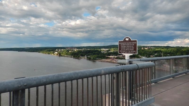
Poughkeepsie-Highland Railroad Bridge
By Cosmos Mariner, June 30, 2019
Poughkeepsie Railroad Bridge Marker
(view looking northeast across Hudson River)
SHOWN IN SOURCE-SPECIFIED ORDER
| Near North Water Street, 0.3 miles north of Main Street, on the left when traveling north. |
| | has been placed on the National Register of Historical Places in 1979 by The United States Department of the InteriorWilliam G. Pomeroy Foundation 2019 • 201 — — Map (db m136100) HM |
| Near Parker Avenue (New York State Route 9G) 0.2 miles east of Washington Street (New York State Route 9G), on the left when traveling east. |
| | First opened in 1889, the Poughkeepsie-Highland Railroad Bridge was the longest cantilevered and truss span bridge in the world. Reborn in 2009, Walkway Over the Hudson State Historic Park is the longest elevated pedestrian bridge in the world. . . . — — Map (db m142776) HM |
| Near Parker Avenue (New York State Route 9G) 0.2 miles east of Washington Street (New York State Route 9G), on the left when traveling east. |
| | Conceived in the 1860s, the Poughkeepsie-Highland Railroad Bridge created the only Hudson River crossing between New York City and Albany. Political and financial difficulties prevented the project from getting underway for several years. In 1886, . . . — — Map (db m142777) HM |
| Near Parker Avenue (New York State Route 9G) 0.2 miles east of Washington Street (New York State Route 9G), on the left when traveling east. |
| | When the bridge opened, it was connected to an extensive, nationwide railway network. The bridge provided a direct route for transporting raw materials, such as coal from Pennsylvania and grain from the Midwest, across the Hudson to the Northeast, . . . — — Map (db m142778) HM |
| Near Parker Avenue (New York State Route 9G) 0.2 miles east of Washington Street (New York State Route 9G), on the left when traveling east. |
| | In 1992, Walkway Over the Hudson was established to preserve the Poughkeepsie-Highland Railroad Bridge, transform it into a linear park and trailway and provide long-term stewardship. With public and private support, the bridge-to-park . . . — — Map (db m142779) HM |
| Near Parker Avenue (New York State Route 9G) 0.2 miles east of Washington Street (New York State Route 9G), on the left when traveling east. |
| | Although the river dates back some 60 million years, the river we see today was shaped during the last Ice Age. About 16,000 years ago, a massive ice field gouged the riverbed to a depth below sea level, thus allowing water from the Atlantic Ocean . . . — — Map (db m142780) HM |
| | The Poughkeepsie-Highland Bridge is the oldest surviving steel cantilever bridge in the world, and when built, had the longest truss and cantilever spans. The bridge provided the first, and only, all-rail route across the Husdon River south of . . . — — Map (db m35483) HM |
Jun. 17, 2024