THE HISTORICAL
MARKER DATABASE
“Bite-Size Bits of Local, National, and Global History”


7 entries match your criteria.  


Related Historical Markers

 
By Andrew Ruppenstein, June 17, 2017
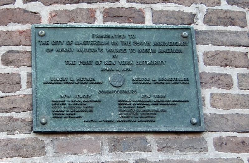
350th Anniversary Plaque from the Port of New York Authority
SHOWN IN SOURCE-SPECIFIED ORDER
1 ► Netherlands, Noord-Holland, Amsterdam, Amsterdam-Centrum — Henry Hudson —
On Prins Hendrikkade, on the left when traveling west.
From this ancient "Tower of Tears" erected 1482 A.D. Henry Hudson set sail April 4th.' 1609 A.D. on the vessel "Half Moon" on that voyage of discovery destined to bring him to the harbor of New York and the Hudson River . . . — — Map (db m116691) HM
2 ► New York, Albany County, Albany, Downtown — Henry Hudson —
On Broadway (New York State Route 5) north of Hudson Avenue, on the right when traveling north.
Explorer, here ended the voyage of the Half Moon in quest of the Indies September, 1609 — — Map (db m116689) HM
3 ► New York, Columbia County, Stuyvesant — Henry Hudson —
On New York State Route 9J, on the left when traveling north.
Landed here Sept. 19, 1609 and was entertained by Indians who encamped here called Kinderhook. — — Map (db m116690) HM
4 ► New York, Saratoga County, Waterford — Henry Hudson — September 22, 1609 —
On Hudson River Road (U.S. 4) just north of Lock One Road, on the right when traveling north.
Stopped near here by shallow water in Hudson River in search for Northwest Passage — — Map (db m129183) HM
5 ► New York, Greene County, Catskill — Wanatonka Island —
Near Main Street.
Henry Hudson and his ship the Half Moon, stopped here in 1609 — — Map (db m130547) HM
6 ► New Jersey, Monmouth County, Atlantic Highlands — Henry Hudson Springs —
On Bayside Drive near Prospect Road.
In 1609, Henry Hudson drew water from this spring. Before the White Man's arrival, Lenni Lenape Indians obtained water from this site. Packet ships continued to use the spring into the 1800's. — — Map (db m5678) HM
7 ► New York, Albany County, Selkirk, Cedar Hill — Henry Hudson Park at Cedar Hill —
On Lyons Road 1 mile east of River Road ( Route 144), on the left when traveling south.
Commemorating the arrival of Halfmoon September 18, 19, 1609 — — Map (db m305286) HM
 
 
CeraNet Cloud Computing sponsors the Historical Marker Database.
This website earns income from purchases you make after using our links to Amazon.com. We appreciate your support.
Paid Advertisement
Nov. 11, 2026
